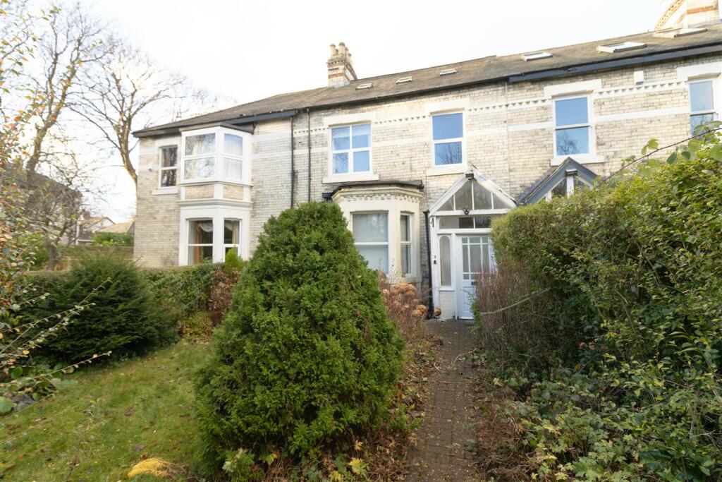
Property Information Report
19 Hailsham Avenue
Newcastle Upon Tyne, NE12 8HJ
Estimated Value - £219,000
Estimated Rental Value - £975 PCM
Last Sold - Dec, 2022


Key Facts
Properties To Let in the Area
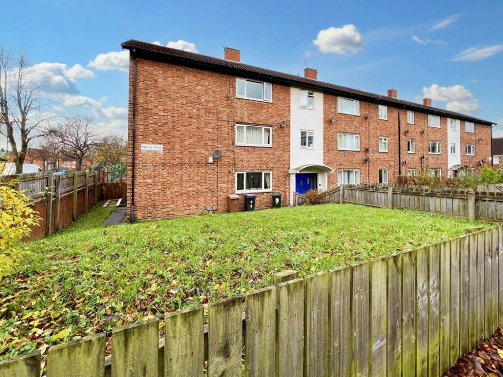
Bowes Walk
60 metres away
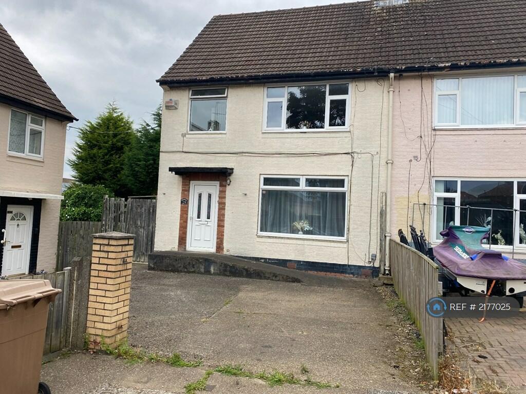
The Roundway
0.27 km away
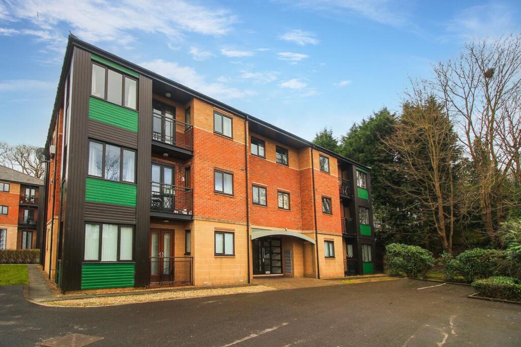
Williams Park
0.40 km away
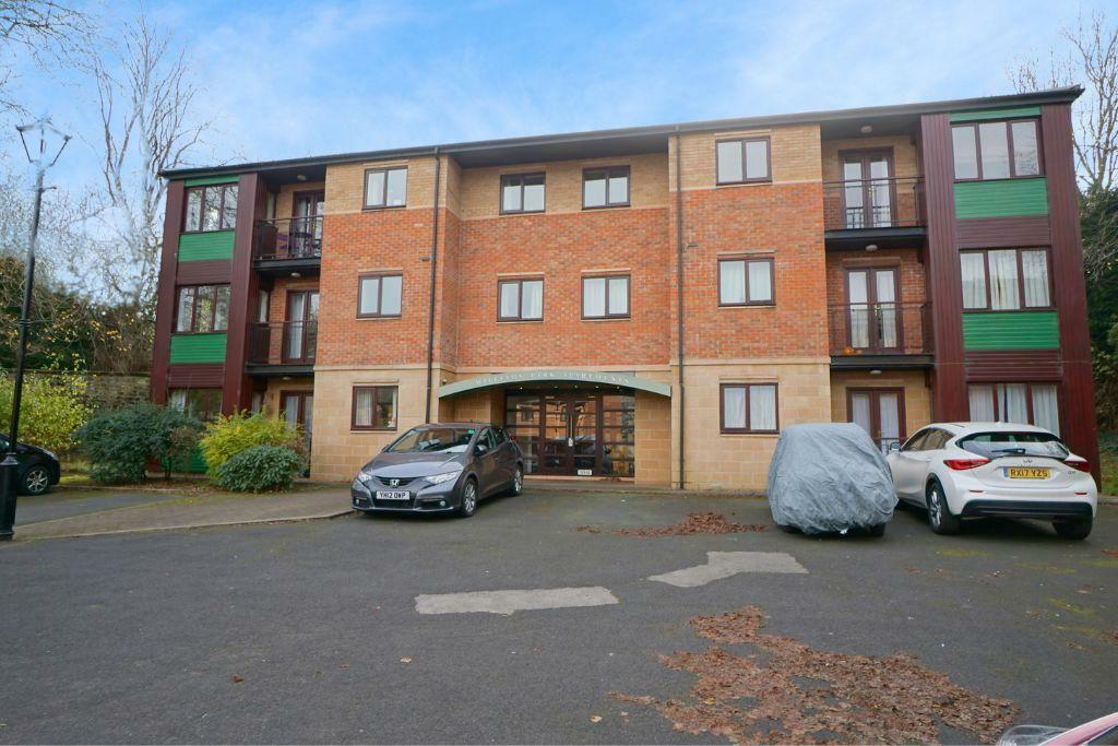
Williams Park
0.43 km away
Station Approach
0.52 km away
Coach Lane
0.56 km away
Title Plan
Title Information
Details provided by the Land Registry
- Title Number
- TY142814
- Plot Size
- 0.08 acres (315 sq metres)
Street View
House Prices in North Tyneside
Last 12 months
-
Average Price Change
£12,313
Increased by 7%
-
Semi-Detached Price Change
£14,263
Increased by 7%
Average House Prices
Last 12 months for all property types.
Since Last Sale - 20th December 2022
-
Average Price Change
£8,244
Increased by 4%
-
Semi-Detached Price Change
£10,188
Increased by 5%
Average House Prices
Since last sale in 2022 for all property types
EPC
Properties For Sale in the Area
 We couldn’t find properties for sale in the area for this property.
Recently Sold Properties in the Area
| Address | Property Type | Distance | Price | Completed |
|---|---|---|---|---|
|
6 Marlow Place Newcastle Upon Tyne, NE12 8HR |
Semi-Detached | 67 metres away | £154,500 | 8 months ago |
|
2 Marlow Place Newcastle Upon Tyne, NE12 8HR |
Semi-Detached | 83 metres away | £120,000 | 10 months ago |
|
41 Goathland Avenue Newcastle Upon Tyne, NE12 8HB |
Semi-Detached | 0.17 km away | £120,000 | 8 months ago |
|
79 Goathland Avenue Newcastle Upon Tyne, NE12 8HE |
Semi-Detached | 0.17 km away | £175,000 | 6 months ago |
|
5 Tetford Place Newcastle Upon Tyne, NE12 8DS |
Semi-Detached | 0.21 km away | £178,000 | 5 months ago |
|
6 Radstock Place Newcastle Upon Tyne, NE12 8DD |
Semi-Detached | 0.24 km away | £182,500 | 10 months ago |
|
6 Radstock Place Newcastle Upon Tyne, NE12 8DD |
Semi-Detached | 0.24 km away | £182,500 | 10 months ago |
|
32 Elmsford Grove Newcastle Upon Tyne, NE12 8HU |
Terraced | 0.25 km away | £150,000 | 6 months ago |
|
31 Elmsford Grove Newcastle Upon Tyne, NE12 8HU |
Terraced | 0.25 km away | £142,000 | 7 months ago |
|
64 Sandringham Avenue Newcastle Upon Tyne, NE12 8JX |
Semi-Detached | 0.26 km away | £175,000 | 7 months ago |
Schools
| Name | Type | Postcode | Distance | Rating |
|---|---|---|---|---|
| St Bartholomew's Church of England Primary School (Aided) | Nursery, Primary | NE12 8FA | 0.17 km | Good |
| St Stephen's Catholic Primary School, Newcastle | Nursery, Primary | NE12 8FA | 0.17 km | Not rated |
| St Stephens Roman Catholic Primary School Aided | Nursery, Primary | NE12 8FA | 0.18 km | Good |
| Longbenton High School | Secondary, Post 16 | NE12 8ER | 0.45 km | Good |
| Percy Hedley Hedleys College | Special | NE12 8YY | 0.52 km | Good |
Transport
Bus Stops & Stations
Details provided by Department for Transport
| Name | Distance |
|---|---|
| Hailsham Avenue | 65 metres |
| Goathland Avenue-Lambourn Avenue | 0.13 km |
| Goathland Avenue-Skelder Avenue | 0.33 km |
| Benton Estate, Hailsham Avenue | 0.34 km |
| Ashleigh Grove-Cemetery, Ashleigh Grove | 0.34 km |
Train Stations
Details provided by Department for Transport
| Name | Distance |
|---|---|
| Railway Station | 4.08 km |
Nearest Motorway
Details provided by Department for Transport
| Name | Distance |
|---|---|
| A194(M) | 8.59 km |
Tram and Metro Stations
Details provided by Department for Transport
| Name | Distance |
|---|---|
| Benton (Tyne And Wear Metro Station) | 0.49 km |
| Four Lane Ends (Tyne And Wear Metro Station) | 0.56 km |
| Longbenton (Tyne And Wear Metro Station) | 1.23 km |
Coverage
- Average Broadband Speed:
-
8mb Basic
-
74mb Superfast
-
1800mb Ultrafast
-
1800mb Overall
- Mobile Coverage:
-
EEOkay
-
O2Good
-
ThreeGood
-
VodafoneOkay
Important Notice - This report is intended for general informational purposes only and should act only as a guide. The report is produced automatically on behalf of Northwood Incoporating Bowes Mitchell - Northwood Incoporating Bowes Mitchell by Street Insights, a product of Street Systems Ltd. Street Systems maintains and aggregates data from multiple public data sources and whilst every effort is made to keep information up to date and accurate, we make no representations or warranties of any kind about the accuracy, reliability or completeness of the information contained within this report for any purpose. Any reliance you place on the data contained within this report is strictly at your own risk. In no event will Northwood Incoporating Bowes Mitchell - Northwood Incoporating Bowes Mitchell or Street Systems Ltd be liable for any loss or damage including without limitation, indirect or consequential loss or damage, or any loss or damage whatsoever arising from loss of data or profits arising out of, or in connection with, the use of this report.
This report contains public sector information licensed under the Open Government License v3.0
Transaction data and HPI data is produced by HM Land Registry. Crown copyright and database rights 2025