Property Information Report
Beech Avenue
Kearsley, Bolton, BL4
Last Sold - Sep, 2024
Description
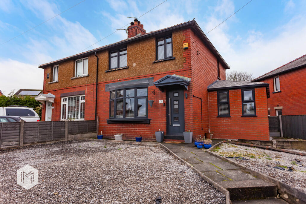
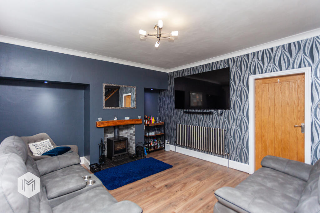
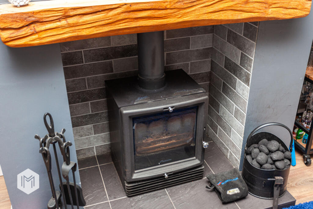
* A BEAUTIFULLY PRESENTED FAMILY HOME * EXTENDED TO THE SIDE & benefitting from a significant amount of modernisation in recent years, this FABULOUS HOME features 3 GENEROUS BEDROOMS and a MODERN FAMILY BATHROOM to the first floor, whilst the SPACIOUS GROUND FLOOR comprises of a family lounge, STUNNING MODERN KITCHEN with high quality fixtures & fittings, and an EXTENDED DINING AREA to the side. UPVC DOUBLE GLAZED & ‘COMBI’ GAS CENTRAL HEATED, the property also features a LOG-BURNING FIREPLACE, well maintained gardens, and OFF-ROAD PARKING. Ideally located close to many local amenities & excellent transport links, COULD THIS BE THE ONE FOR YOU? CALL US NOW TO BOOK A VIEWING!
Key Facts
About Us

About Us
Passionate about what we do. Here to serve the people of Salford and Greater Manchester and dedicated to helping you find your perfect home. Meet the multi-award winning team of property professionals at Hills.
Generate a full report on your own property including an instant estimated valuation.
Title Plan
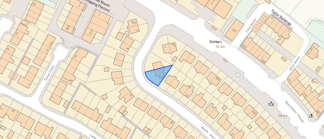 Contains OS data © Crown copyright 2025
Title Information
Details provided by the Land Registry
- Title Number
- GM746665
- Plot Size
- 0.05 acres (194 sq metres)
Street View
EPC
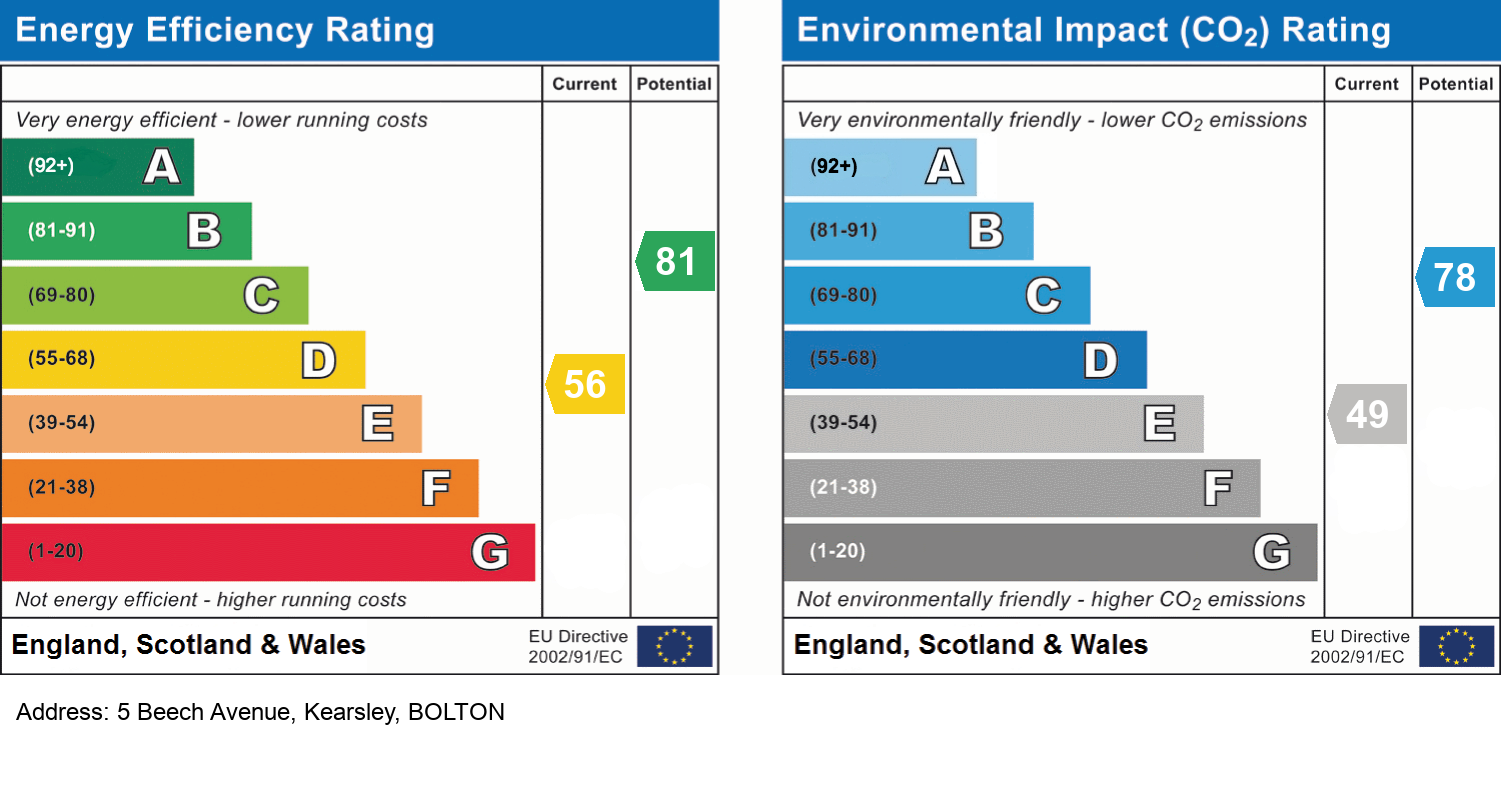
EPC Information
Details taken from the EPC register
- Date
- 2016-06-20
- Valid Until
- 2026-06-19
- Energy Efficiency - Current
- 56
- Energy Efficiency - Potential
- 81
- Environmental Impact - Current
- 49
- Environmental Impact - Potential
- 78
Hills Salfords Estate Agents
Schools
| Name | Type | Postcode | Distance | Rating |
|---|---|---|---|---|
| Spindle Point Primary School | Nursery, Primary | BL4 8SE | 0.32 km | Good |
| St Stephen's CofE Primary School | Primary | BL4 8PB | 0.46 km | Good |
| St Saviour CofE Primary School, Ringley | Primary | M26 1EU | 0.92 km | Good |
| Woodbridge College | Special | BL4 8LB | 1.07 km | Not rated |
| Kearsley Academy | Secondary | BL4 8HY | 1.36 km | Good |
Transport
Bus Stops & Stations
Details provided by Department for Transport
| Name | Distance |
|---|---|
| Beech Avenue | 52 metres |
| Moss Lane | 0.25 km |
| Blair Street | 0.32 km |
| Springfield Road | 0.61 km |
| Unity Brook, Manchester Road | 0.63 km |
Train Stations
Details provided by Department for Transport
| Name | Distance |
|---|---|
| Kearsley Rail Station | 1.00 km |
| Farnworth Rail Station | 2.08 km |
| Moorside Rail Station | 2.43 km |
| Walkden Rail Station | 2.72 km |
| Swinton (Manchester) Rail Station | 3.05 km |
Nearest Motorway
Details provided by Department for Transport
| Name | Distance |
|---|---|
| M61 | 0.95 km |
Coverage
- Average Broadband Speed:
-
5mb Basic
-
40mb Superfast
-
1000mb Ultrafast
-
1000mb Overall
- Mobile Coverage:
-
EEOkay
-
O2Good
-
ThreeOkay
-
VodafoneOkay
Important Notice - This report is intended for general informational purposes only and should act only as a guide. The report is produced automatically on behalf of Hills - Hills by Street Insights, a product of Street Systems Ltd. Street Systems maintains and aggregates data from multiple public data sources and whilst every effort is made to keep information up to date and accurate, we make no representations or warranties of any kind about the accuracy, reliability or completeness of the information contained within this report for any purpose. Any reliance you place on the data contained within this report is strictly at your own risk. In no event will Hills - Hills or Street Systems Ltd be liable for any loss or damage including without limitation, indirect or consequential loss or damage, or any loss or damage whatsoever arising from loss of data or profits arising out of, or in connection with, the use of this report.
This report contains public sector information licensed under the Open Government License v3.0
Transaction data and HPI data is produced by HM Land Registry. Crown copyright and database rights 2025