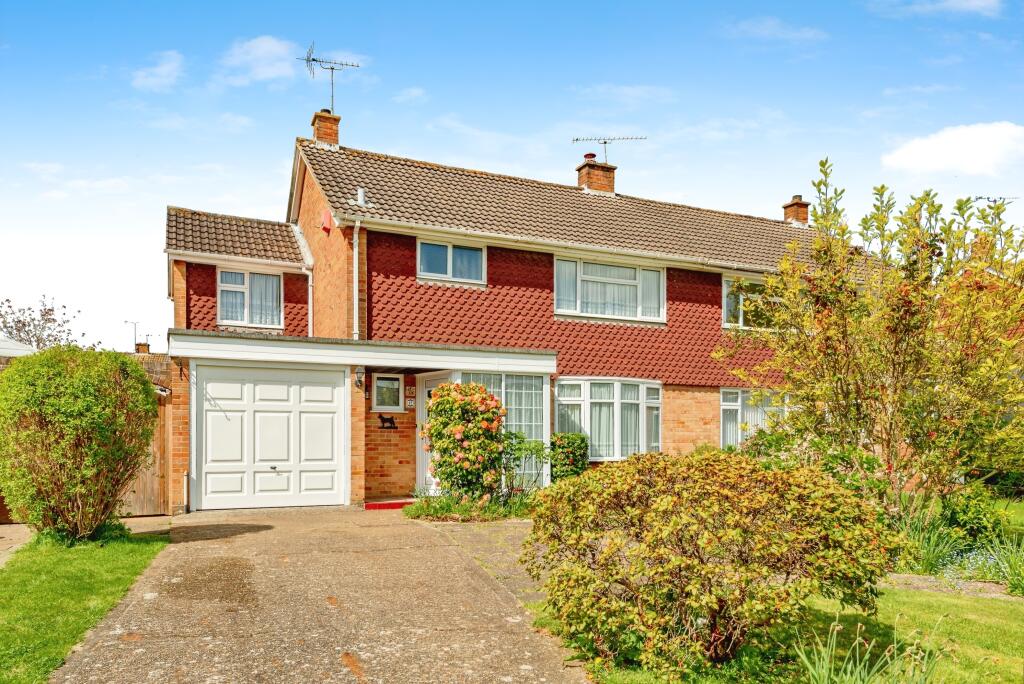
Property Information Report

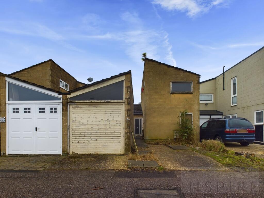
8 Linden Close
Crawley, RH10 6PA

Key Facts
About Us

Let us Inspire you
Are you considering selling or letting in Crawley or the surrounding areas? Would you like to deal with property professionals, who have lived and worked in the area for many years?
If you are, we guarantee you will be impressed with our service. We are so confident that you will love our honest and pro-active approach that we don't need to tie you into restrictive sole agency agreements!
Find out more at our website
Title Plan
 Contains OS data © Crown copyright 2025
Title Information
Details provided by the Land Registry
- Title Number
- SX92270
- Plot Size
- 0.05 acres (207 sq metres)
Street View
House Prices in Crawley
Last 12 months
-
Average Price Change
£22,546
Increased by 7%
-
Terraced Price Change
£24,999
Increased by 8%
Average House Prices
Last 12 months for all property types.
Since - February 2020
-
Average Price Change
£52,086
Increased by 19%
-
Terraced Price Change
£60,103
Increased by 22%
Average House Prices
Since 2020 for all property types
EPC
 No EPC data available for this property.
Properties For Sale in the Area
Linden Close
33 metres away
23 Bateman Court
0.16 km away
Forestfield
0.17 km away
Furnace Farm Road
0.19 km away
Furnace Farm Road
0.19 km away
Weirbrook
0.19 km away
Recently Sold Properties in the Area
| Address | Property Type | Distance | Price | Completed |
|---|---|---|---|---|
|
10 Linden Close Crawley, RH10 6PA |
Terraced | 12 metres away | £450,000 | 2 months ago |
|
12 Sharon Close Crawley, RH10 6QD |
Terraced | 61 metres away | £440,000 | 10 months ago |
|
13 Sharon Close Crawley, RH10 6QD |
Terraced | 63 metres away | £390,000 | 8 months ago |
|
178 Weald Drive Crawley, RH10 6NN |
Semi-Detached | 89 metres away | £400,000 | 9 months ago |
|
32 Furnace Farm Road Crawley, RH10 6QA |
Semi-Detached | 0.13 km away | £507,750 | 7 months ago |
|
41 Newmarket Road Crawley, RH10 6ND |
Detached | 0.15 km away | £500,000 | 11 months ago |
|
11 Weirbrook Crawley, RH10 6PE |
Flats/Maisonettes | 0.19 km away | £205,000 | 9 months ago |
|
19 Charleston Court Forestfield Crawley, RH10 6PT |
Semi-Detached | 0.22 km away | £277,500 | 7 months ago |
|
8 Doncaster Walk Crawley, RH10 6LY |
Terraced | 0.27 km away | £410,000 | 9 months ago |
|
11 Newmarket Road Crawley, RH10 6ND |
Semi-Detached | 0.29 km away | £377,500 | 5 months ago |
Schools
| Name | Type | Postcode | Distance | Rating |
|---|---|---|---|---|
| St Andrew's CofE Primary School | Primary | RH10 6NU | 0.46 km | Good |
| The Oaks Primary School & Nursery | Primary | RH10 5DP | 0.57 km | Good |
| Oriel High School | Secondary, Post 16 | RH10 7XW | 0.72 km | Good |
| Brook Infant School and Nursery | Nursery, Primary | RH10 7JE | 0.94 km | Good |
| St Francis of Assisi Catholic Primary School, Crawley | Primary | RH10 6HD | 1.20 km | Good |
Transport
Bus Stops & Stations
Details provided by Department for Transport
| Name | Distance |
|---|---|
| Weirbrook, Weald Drive | 0.19 km |
| The Charcoal Burner, Weald Drive | 0.31 km |
| The Charcoal Burner, Furnace Drive | 0.35 km |
| Brantridge Road | 0.48 km |
| Oriel High School, Maidenbower Lane | 0.65 km |
Train Stations
Details provided by Department for Transport
| Name | Distance |
|---|---|
| Crawley Rail Station | 1.56 km |
| Three Bridges Rail Station | 1.59 km |
| Ifield Rail Station | 3.50 km |
Nearest Motorway
Details provided by Department for Transport
| Name | Distance |
|---|---|
| M23 | 1.73 km |
Coverage
- Average Broadband Speed:
-
5mb Basic
-
45mb Superfast
-
1000mb Ultrafast
-
1000mb Overall
- Mobile Coverage:
-
EEOkay
-
O2Good
-
ThreeOkay
-
VodafoneOkay
Important Notice - This report is intended for general informational purposes only and should act only as a guide. The report is produced automatically on behalf of Inspire Estate Agents - Crawley by Street Insights, a product of Street Systems Ltd. Street Systems maintains and aggregates data from multiple public data sources and whilst every effort is made to keep information up to date and accurate, we make no representations or warranties of any kind about the accuracy, reliability or completeness of the information contained within this report for any purpose. Any reliance you place on the data contained within this report is strictly at your own risk. In no event will Inspire Estate Agents - Crawley or Street Systems Ltd be liable for any loss or damage including without limitation, indirect or consequential loss or damage, or any loss or damage whatsoever arising from loss of data or profits arising out of, or in connection with, the use of this report.
This report contains public sector information licensed under the Open Government License v3.0
Transaction data and HPI data is produced by HM Land Registry. Crown copyright and database rights 2025