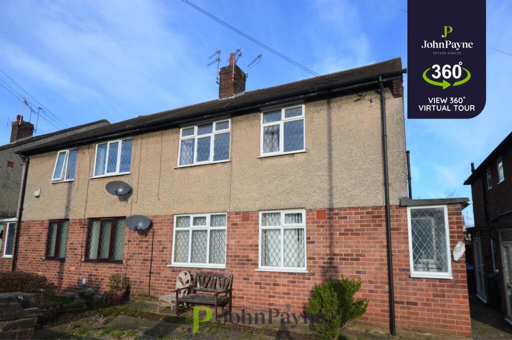
Property Information Report
Michaelmas Road
Coventry, CV3
Last Sold - Jul, 1997

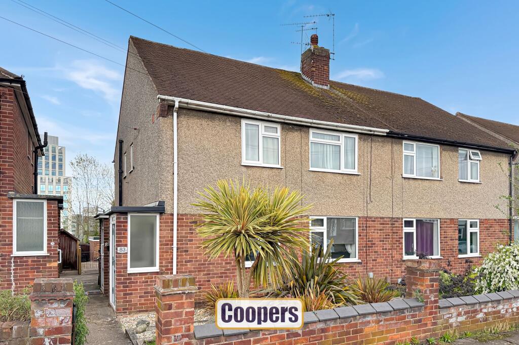
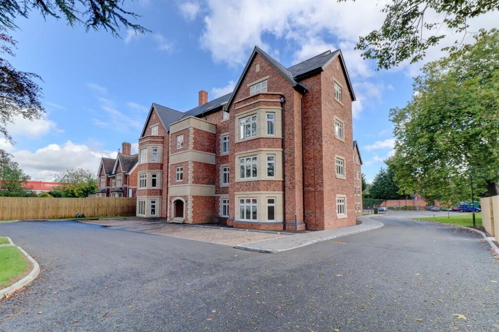
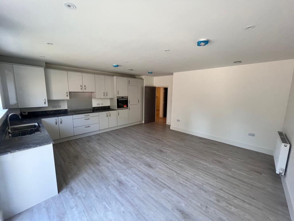
Description
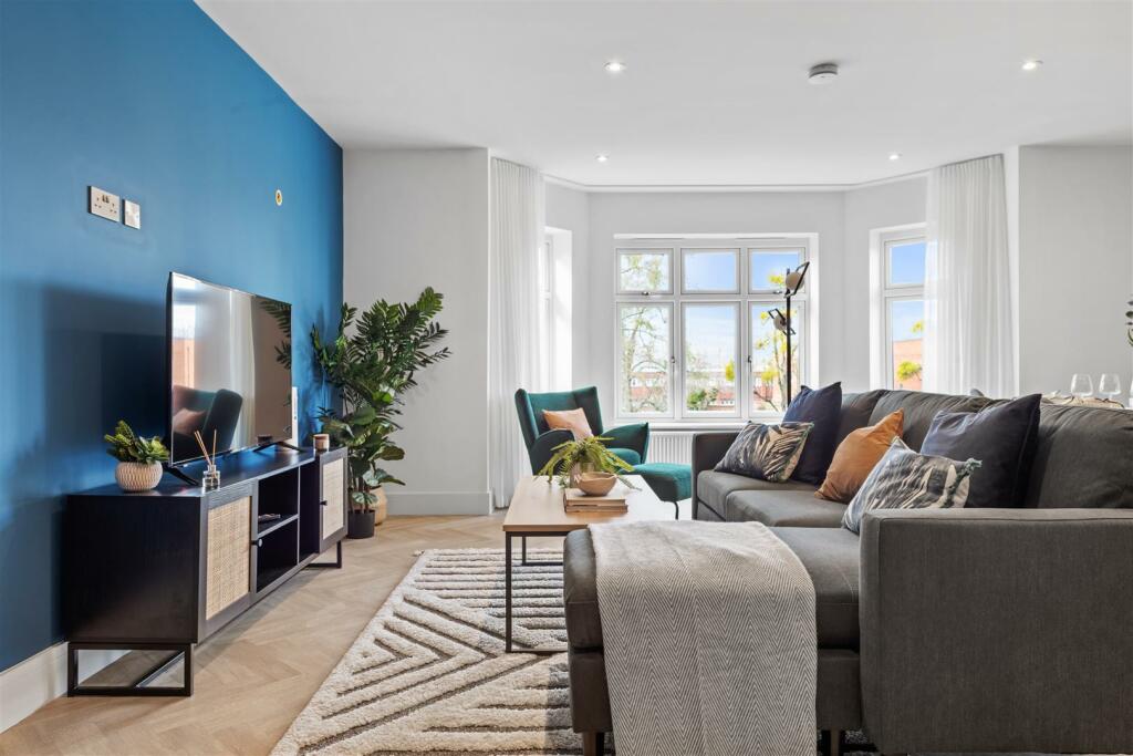
Beautifully presented, improved and refitted first floor maisonette in prime convenient location close to the City Centre, Railway Station and access to the road network.
The maisonette has the particular advantage of its own detached brick garage and private rear garden. This property has modern part triple and part double glazing. There is a luxuriously fitted kitchen and bathroom, two bedrooms and living room.
Key Facts
Title Plan
 Contains OS data © Crown copyright 2025
Title Information
Details provided by the Land Registry
- Title Number
- WM659866
- Plot Size
- 0.07 acres (278 sq metres)
Street View

House Prices in Coventry
Last 12 months
-
Average Price Change
£13,169
Increased by 6%
-
Flats/Maisonettes Price Change
£6,374
Increased by 5%
Average House Prices
Last 12 months for all property types.
Since - April 2020
-
Average Price Change
£42,873
Increased by 24%
-
Flats/Maisonettes Price Change
£22,776
Increased by 21%
Average House Prices
Since 2020 for all property types
EPC

EPC Information
Details taken from the EPC register
- Date
- 2025-05-08
- Valid Until
- 2035-05-07
- Energy Efficiency - Current
- 70
- Energy Efficiency - Potential
- 74
- Environmental Impact - Current
- 52
- Environmental Impact - Potential
- 76
Properties For Sale in the Area
Michaelmas Road
Asthill Grove
0.13 km away
Stoney Road
0.13 km away
Michaelmas Road
0.15 km away
Apt 1
0.19 km away

Apt 11 Rodborough House
0.19 km away
Michaelmas Road
Asthill Grove
0.13 km away
Stoney Road
0.13 km away
Michaelmas Road
0.15 km away
Apt 1
0.19 km away
Apt 11 Rodborough House
0.19 km away
Properties To Let in the Area
Michaelmas Road
43 metres away
Michaelmas Road
43 metres away
Michaelmas Road
0.12 km away
Warwick Road
0.19 km away
Warwick Road
0.19 km away
Seymour House Tudor Court Warwick Road Coventry
0.22 km away
Michaelmas Road
43 metres away
Michaelmas Road
43 metres away
Michaelmas Road
0.12 km away
Warwick Road
0.19 km away
Warwick Road
0.19 km away
Seymour House Tudor Court Warwick Road Coventry
0.22 km away
Schools
| Name | Type | Postcode | Distance | Rating |
|---|---|---|---|---|
| King Henry VIII School | Independent, Nursery, Primary, Post 16 | CV3 6AQ | 0.29 km | Not rated |
| Frederick Bird Primary School | Nursery, Primary | CV2 4QQ | 0.61 km | Not rated |
| Coventry Youth Offending Service | Primary | CV1 2GY | 0.69 km | Not rated |
| Manor Park Primary School | Nursery, Primary | CV3 5EZ | 1.01 km | Good |
| Coventry University | University | CV1 5FB | 1.06 km | Not rated |
Transport
Train Stations
Details provided by Department for Transport
| Name | Distance |
|---|---|
| Coventry Rail Station | 80 metres |
| Canley Rail Station | 2.34 km |
Nearest Motorway
Details provided by Department for Transport
| Name | Distance |
|---|---|
| M6 | 7.12 km |
Airports
Details provided by Department for Transport
| Name | Distance |
|---|---|
| Coventry Airport | 4.43 km |
| Birmingham International Airport | 15.92 km |
| East Midlands Airport | 48.99 km |
| London Oxford Airport | 64.68 km |
| Gloucestershire Airport | 71.87 km |
Coverage
- Average Broadband Speed:
-
13mb Basic
-
46mb Superfast
-
1800mb Ultrafast
-
1800mb Overall
- Mobile Coverage:
-
EEOkay
-
O2Good
-
ThreeGood
-
VodafoneGood
Recently Sold Properties in the Area
| Address | Property Type | Distance | Price | Completed |
|---|---|---|---|---|
|
81 Michaelmas Road Coventry, CV3 6HF |
Terraced | away | £145,000 | 5 months ago |
|
63 Michaelmas Road Coventry, CV3 6HF |
Flats/Maisonettes | 42 metres away | £145,000 | 1 month ago |
|
10 Asthill Grove Coventry, CV3 6HP |
Semi-Detached | 0.13 km away | £615,000 | 6 months ago |
|
Apartment 12, Rodborough House, 145 Warwick Road Coventry, CV3 6AG |
Flats/Maisonettes | 0.19 km away | £395,000 | 8 months ago |
|
Apartment 6, Rodborough House, 145 Warwick Road Coventry, CV3 6AG |
Flats/Maisonettes | 0.19 km away | £380,000 | 5 months ago |
|
Apartment 17, Rodborough House, 145 Warwick Road Coventry, CV3 6AG |
Flats/Maisonettes | 0.19 km away | £232,500 | 8 months ago |
|
Flat 21, Seymour House, Warwick Road Coventry, CV3 6TY |
Flats/Maisonettes | 0.22 km away | £273,000 | 4 months ago |
|
90 Stoney Road Coventry, CV3 6HY |
Semi-Detached | 0.27 km away | £425,000 | 3 months ago |
|
35 Wrigsham Street Coventry, CV3 5FU |
Semi-Detached | 0.33 km away | £280,000 | 7 months ago |
|
44 Asthill Grove Coventry, CV3 6HP |
Semi-Detached | 0.34 km away | £615,000 | 11 months ago |
Important Notice - This report is intended for general informational purposes only and should act only as a guide. The report is produced automatically on behalf of Coopers Estate Agents - Coventry by Street Insights, a product of Street Systems Ltd. Street Systems maintains and aggregates data from multiple public data sources and whilst every effort is made to keep information up to date and accurate, we make no representations or warranties of any kind about the accuracy, reliability or completeness of the information contained within this report for any purpose. Any reliance you place on the data contained within this report is strictly at your own risk. In no event will Coopers Estate Agents - Coventry or Street Systems Ltd be liable for any loss or damage including without limitation, indirect or consequential loss or damage, or any loss or damage whatsoever arising from loss of data or profits arising out of, or in connection with, the use of this report.
This report contains public sector information licensed under the Open Government License v3.0
Transaction data and HPI data is produced by HM Land Registry. Crown copyright and database rights 2025