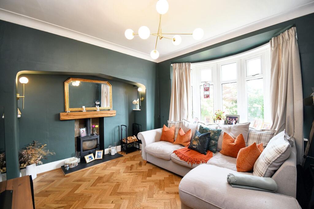
Property Information Report
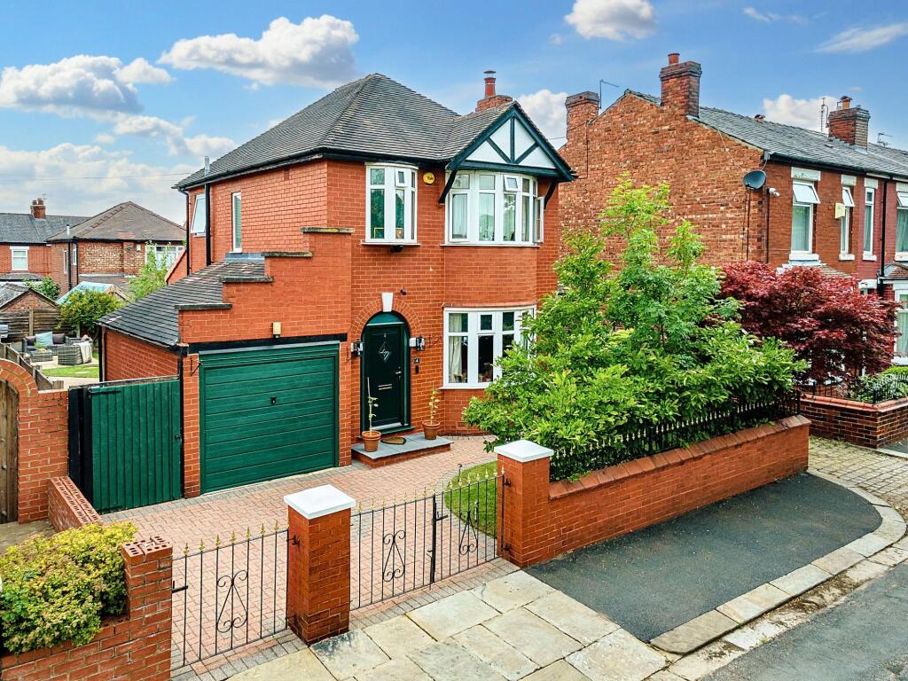
Stanley Road
Eccles, Manchester, M30
Last Sold - Apr, 2017

Key Facts
About Us

About Us
Passionate about what we do. Here to serve the people of Salford and Greater Manchester and dedicated to helping you find your perfect home. Meet the multi-award winning team of property professionals at Hills.
Generate a full report on your own property including an instant estimated valuation.
Title Plan
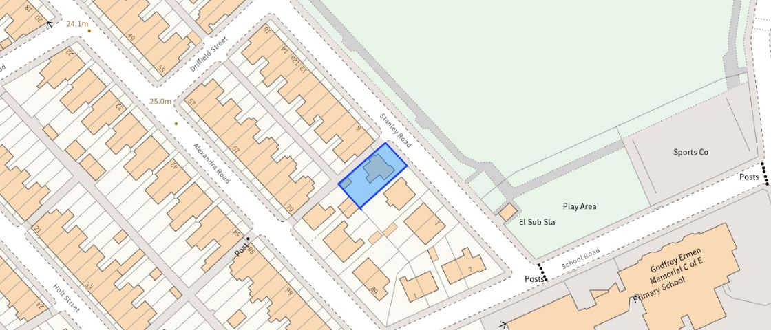 Contains OS data © Crown copyright 2025
Title Information
Details provided by the Land Registry
- Title Number
- GM810590
- Plot Size
- 0.06 acres (260 sq metres)
Street View
EPC
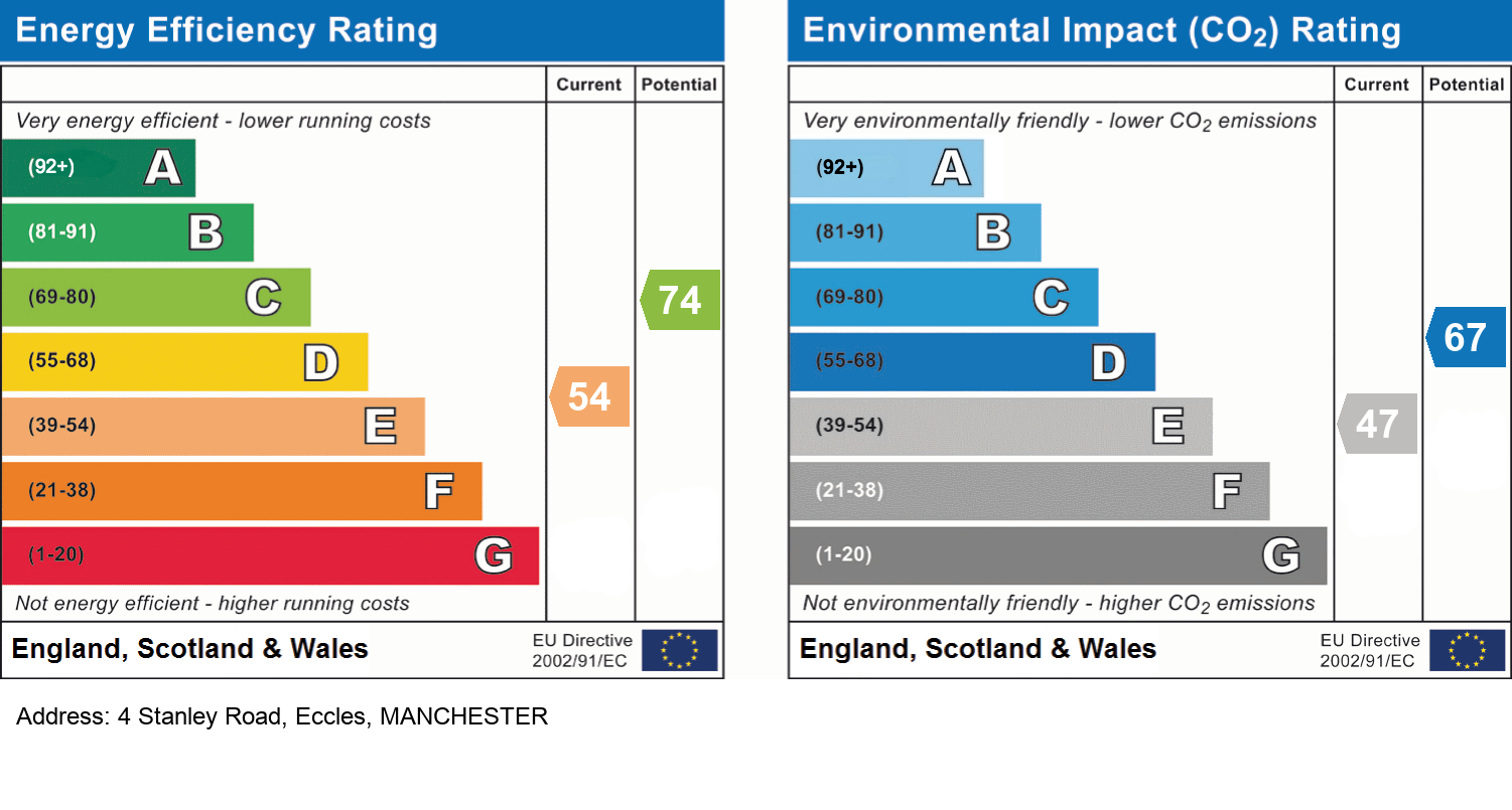
EPC Information
Details taken from the EPC register
- Date
- 2016-10-07
- Valid Until
- 2026-10-06
- Energy Efficiency - Current
- 54
- Energy Efficiency - Potential
- 74
- Environmental Impact - Current
- 47
- Environmental Impact - Potential
- 67
Hills Salfords Estate Agents
Schools
| Name | Type | Postcode | Distance | Rating |
|---|---|---|---|---|
| Godfrey Ermen Memorial CofE Primary School | Nursery, Primary | M30 7BJ | 77 metres | Not rated |
| Beech Street Community Primary School | Nursery, Primary | M30 8GB | 0.37 km | Good |
| Holy Cross and All Saints RC Primary School | Nursery, Primary | M30 0JA | 0.50 km | Good |
| Lewis Street Primary School | Special, Nursery | M30 0PU | 0.60 km | Good |
| St Patrick's RC High School | Secondary | M30 7JJ | 0.67 km | Good |
Transport
Bus Stops & Stations
Details provided by Department for Transport
| Name | Distance |
|---|---|
| Alexandra House, Liverpool Road | 0.27 km |
| Kirkman Avenue | 0.28 km |
| Patricroft Bridge, Liverpool Road | 0.30 km |
| Patricroft Bridge, Barton Road | 0.30 km |
| Grapes Hotel, Liverpool Road | 0.32 km |
Train Stations
Details provided by Department for Transport
| Name | Distance |
|---|---|
| Patricroft Rail Station | 0.81 km |
| Eccles Rail Station | 1.93 km |
| Urmston Rail Station | 3.31 km |
| Humphrey Park Rail Station | 3.54 km |
| Chassen Road Rail Station | 3.58 km |
Nearest Motorway
Details provided by Department for Transport
| Name | Distance |
|---|---|
| M60 | 0.87 km |
Tram and Metro Stations
Details provided by Department for Transport
| Name | Distance |
|---|---|
| The Trafford Centre (Manchester Metrolink) | 1.34 km |
Coverage
- Average Broadband Speed:
-
5mb Basic
-
32mb Superfast
-
1800mb Ultrafast
-
1800mb Overall
- Mobile Coverage:
-
EEOkay
-
O2Good
-
ThreeOkay
-
VodafoneGood
Important Notice - This report is intended for general informational purposes only and should act only as a guide. The report is produced automatically on behalf of Hills - Hills by Street Insights, a product of Street Systems Ltd. Street Systems maintains and aggregates data from multiple public data sources and whilst every effort is made to keep information up to date and accurate, we make no representations or warranties of any kind about the accuracy, reliability or completeness of the information contained within this report for any purpose. Any reliance you place on the data contained within this report is strictly at your own risk. In no event will Hills - Hills or Street Systems Ltd be liable for any loss or damage including without limitation, indirect or consequential loss or damage, or any loss or damage whatsoever arising from loss of data or profits arising out of, or in connection with, the use of this report.
This report contains public sector information licensed under the Open Government License v3.0
Transaction data and HPI data is produced by HM Land Registry. Crown copyright and database rights 2025