Property Information Report
Eccles New Road
Salford, M5
Last Sold - Dec, 2024

Description
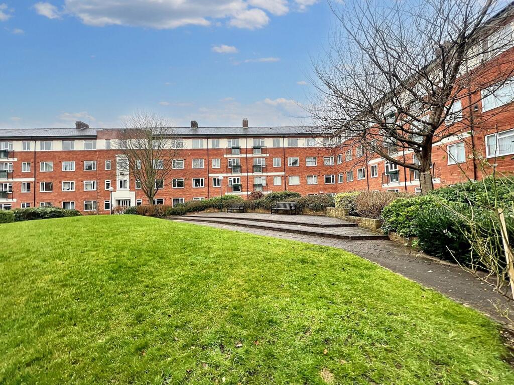
Large Corner One Bedroom Apartment on a Popular Development Within Walking Distance of Salford Quays & Media City!
This property is a fantastic opportunity to live within easy access of Salford Quays & Media City at a great price. It’s within easy access of a fine array of amenities, including bars, shops and restaurants.
It is also just a short walk from Langworthy tram stop - which provides direct access into Manchester City Centre!
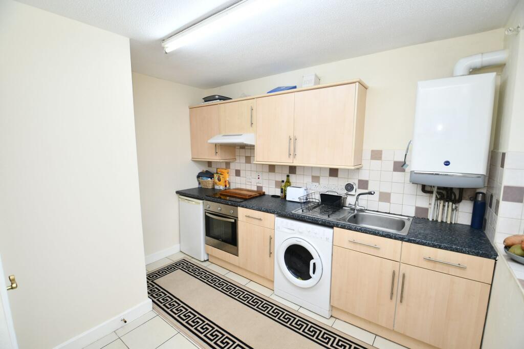
As you enter the property you head into the welcoming entrance hallways, which provides access to the large lounge diner, spacious double bedroom, fitted kitchen and the bright three-piece bathroom.
Externally, the development boasts beautifully maintained communal gardens, an allocated parking space and secure access through intercom, fob and electric gates.
Viewing is highly recommended - get in touch to secure your viewing today!
Key Facts
About Us

About Us
Passionate about what we do. Here to serve the people of Salford and Greater Manchester and dedicated to helping you find your perfect home. Meet the multi-award winning team of property professionals at Hills.
Generate a full report on your own property including an instant estimated valuation.
Title Plan
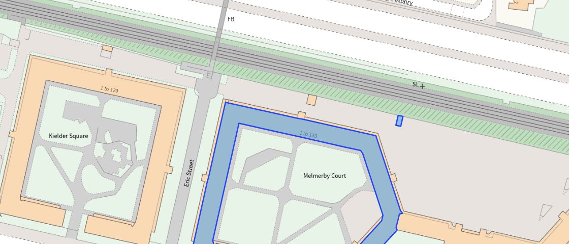 Contains OS data © Crown copyright 2025
Title Information
Details provided by the Land Registry
- Title Number
- MAN449176
- Plot Size
- 0.59 acres (2401 sq metres)
Street View
EPC
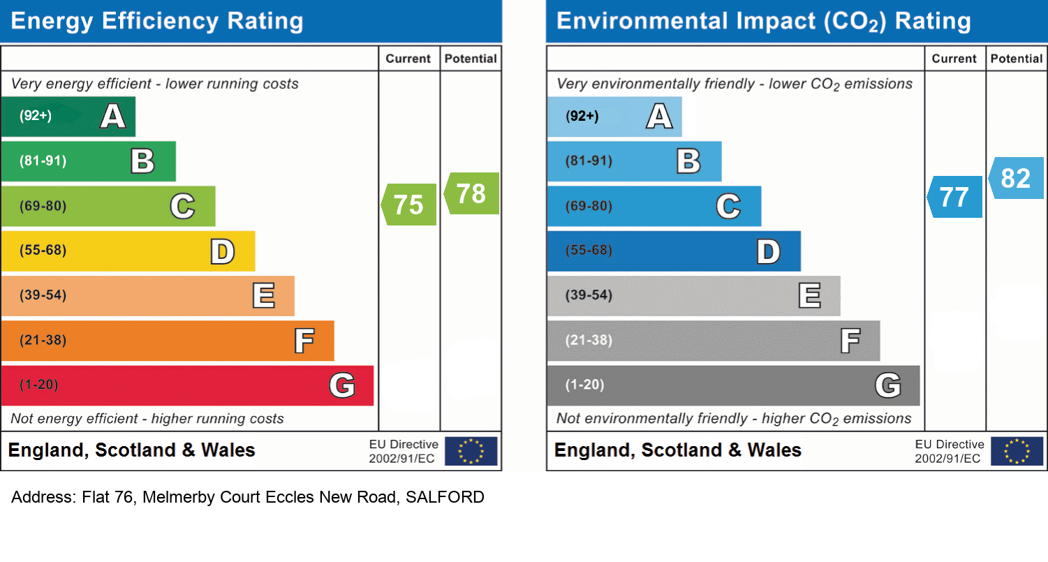
EPC Information
Details taken from the EPC register
- Date
- 2018-10-16
- Valid Until
- 2028-10-15
- Energy Efficiency - Current
- 75
- Energy Efficiency - Potential
- 78
- Environmental Impact - Current
- 77
- Environmental Impact - Potential
- 82
Hills Salfords Estate Agents
Schools
| Name | Type | Postcode | Distance | Rating |
|---|---|---|---|---|
| Lark Hill Community Primary School | Nursery, Primary | M5 4BJ | 0.36 km | Good |
| Willow Tree Primary School | Nursery, Primary | M6 5TJ | 0.70 km | Good |
| St Paul's CofE Primary School | Nursery, Primary | M5 4AL | 0.73 km | Good |
| AldridgeUTC@MediaCityUK | Secondary, Post 16 | M50 2UW | 0.74 km | Good |
| St Joseph's RC Primary School | Nursery, Primary | M5 3JP | 0.84 km | Good |
Transport
Bus Stops & Stations
Details provided by Department for Transport
| Name | Distance |
|---|---|
| Thurlow Street | 0.14 km |
| Kielder Square, Eccles New Road | 0.17 km |
| Scanlon Lane | 0.25 km |
| Howard Street | 0.28 km |
| South Langworthy Road | 0.29 km |
Train Stations
Details provided by Department for Transport
| Name | Distance |
|---|---|
| Salford Crescent Rail Station | 1.09 km |
| Manchester United Rail Station | 2.03 km |
| Manchester United Fc Rail Station | 2.06 km |
| Salford Central Rail Station | 2.30 km |
| Deansgate Rail Station | 2.62 km |
Nearest Motorway
Details provided by Department for Transport
| Name | Distance |
|---|---|
| M602 | 0.41 km |
Tram and Metro Stations
Details provided by Department for Transport
| Name | Distance |
|---|---|
| Langworthy (Manchester Metrolink) | 0.41 km |
| Anchorage (Manchester Metrolink) | 0.72 km |
| Broadway (Manchester Metrolink) | 0.72 km |
| Harbour City (Manchester Metrolink) | 0.73 km |
| Mediacityuk | 1.06 km |
Coverage
- Average Broadband Speed:
-
12mb Basic
-
55mb Superfast
-
1000mb Ultrafast
-
1000mb Overall
- Mobile Coverage:
-
EEOkay
-
O2Good
-
ThreeOkay
-
VodafoneGood
Important Notice - This report is intended for general informational purposes only and should act only as a guide. The report is produced automatically on behalf of Hills - Hills by Street Insights, a product of Street Systems Ltd. Street Systems maintains and aggregates data from multiple public data sources and whilst every effort is made to keep information up to date and accurate, we make no representations or warranties of any kind about the accuracy, reliability or completeness of the information contained within this report for any purpose. Any reliance you place on the data contained within this report is strictly at your own risk. In no event will Hills - Hills or Street Systems Ltd be liable for any loss or damage including without limitation, indirect or consequential loss or damage, or any loss or damage whatsoever arising from loss of data or profits arising out of, or in connection with, the use of this report.
This report contains public sector information licensed under the Open Government License v3.0
Transaction data and HPI data is produced by HM Land Registry. Crown copyright and database rights 2025