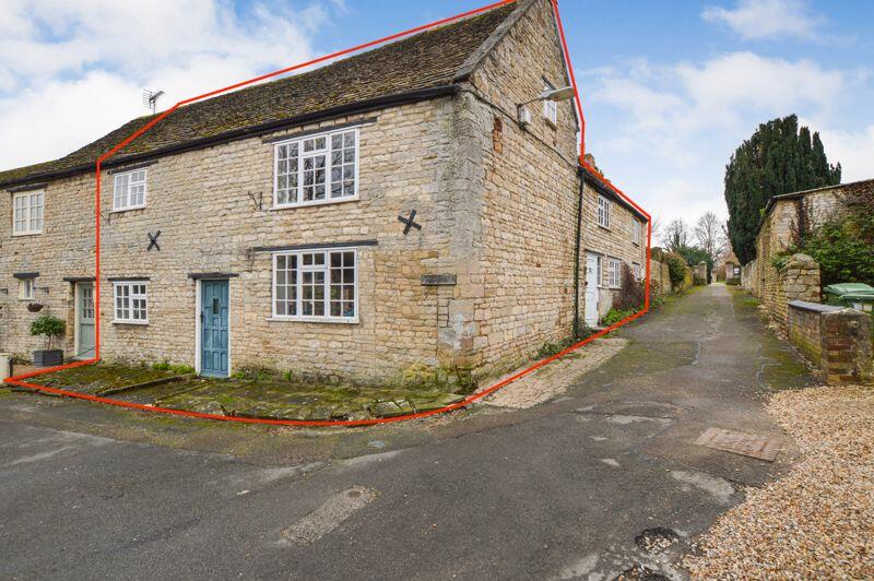
Property Research
St. Johns Close
Ryhall, Stamford, PE9
Last Sold - Aug, 2024
Key Facts
About Us

Estate agency services, delivered differently.
As distinguished estate agents in Stamford and Rutland, we help our clients sell their beautiful homes, whether modern, historic, contemporary or full of unique charm and character. Our bespoke estate agency services are carefully crafted to combine traditional local property expertise with digital innovation, maximising property exposure and helping our clients achieve the best price for their property by connecting them with suitable buyers.
Whether you want to sell your home or simply determine its value, we are here as your reliable and trustworthy property partner.
Is your property value lower than expected? DON'T PANIC! This automated system uses publicly available data to generate an estimated value. You shouldn't rely on this amount if you are planning to move or use the estimated price for anything that requires a valuation, such as taking out finance.
To determine your home's true value, contact us to book an in-person valuation.
Find out more at www.eastaway.co.uk
Title Plan
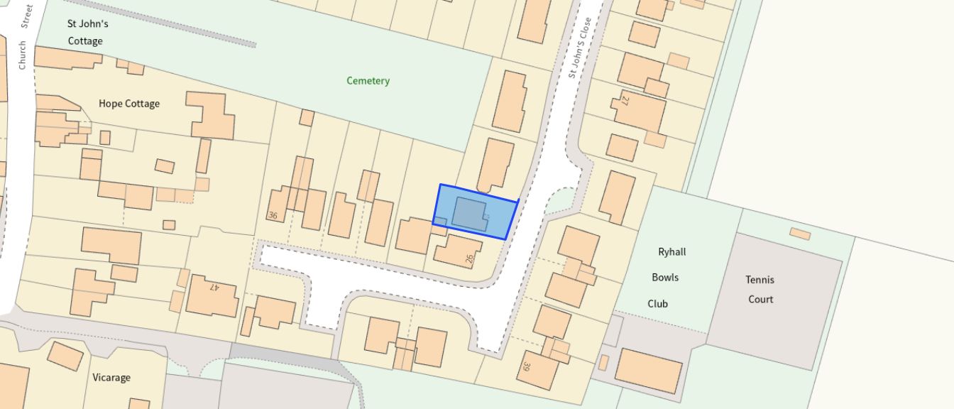 Contains OS data © Crown copyright 2025
Title Information
Details provided by the Land Registry
- Title Number
- LT244480
- Plot Size
- 0.06 acres (258 sq metres)
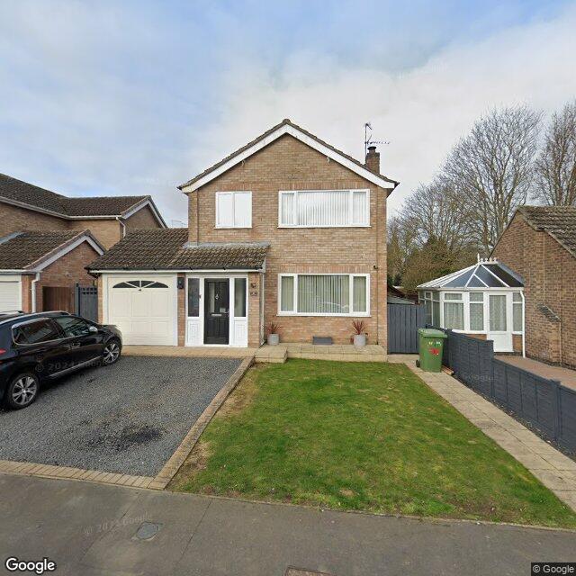
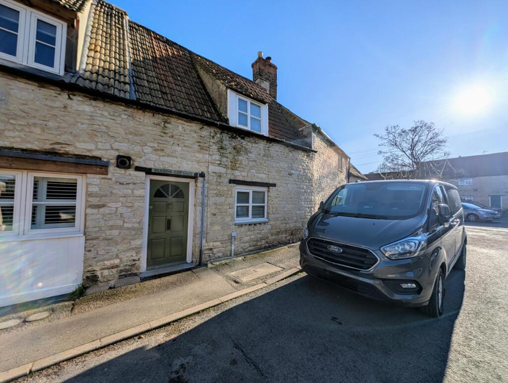
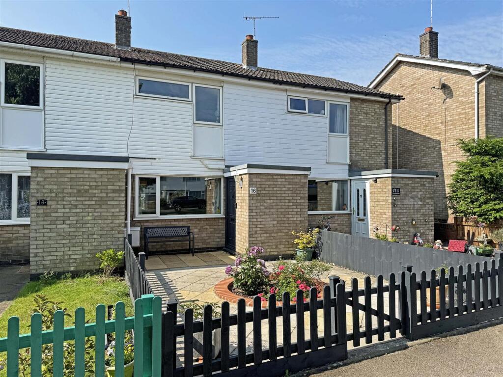
Street View
House Prices in Rutland
Last 12 months
-
Average Price Change
£29,224
Increased by 9%
-
Detached Price Change
£39,261
Increased by 9%
Average House Prices
Last 12 months for all property types.
Since Last Sale - 7th August 2024
-
Average Price Change
£76,386
Increased by 29%
-
Detached Price Change
£105,099
Increased by 28%
Average House Prices
Since 2020 for all property types
EPC
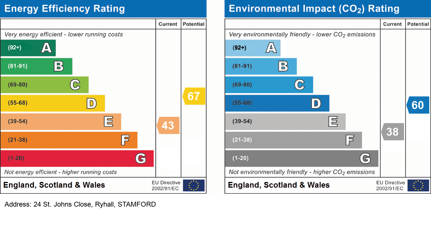
EPC Information
Details taken from the EPC register
- Date
- 2024-04-04
- Valid Until
- 2034-04-03
- Energy Efficiency - Current
- 65
- Energy Efficiency - Potential
- 82
- Environmental Impact - Current
- 64
- Environmental Impact - Potential
- 82
Properties For Sale in the Area
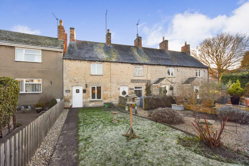
Forresters Cottage
0.13 km away
St. Tibba House
0.19 km away
Bridge Street
0.21 km away
Parkfield Road
0.23 km away
Bridge Street
0.23 km away
Parkfield Road
0.30 km away
Schools
| Name | Type | Postcode | Distance | Rating |
|---|---|---|---|---|
| Ryhall CofE Academy | Primary | PE9 4HR | 0.12 km | Good |
| St Augustine's Catholic Voluntary Academy | Primary | PE9 1SR | 2.54 km | Not rated |
| St George's Church of England Aided Primary School | Primary | PE9 1SX | 2.69 km | Good |
| The Bluecoat School | Nursery, Primary | PE9 1HE | 2.87 km | Not rated |
| Stamford Welland Academy | Secondary, Post 16 | PE9 1HE | 2.87 km | Good |
Transport
Bus Stops & Stations
Details provided by Department for Transport
| Name | Distance |
|---|---|
| Rutland Way | 0.16 km |
| Bus Interchange, Church Street | 0.16 km |
| The Square, New Road | 0.20 km |
| Coppice Road | 0.57 km |
| Castle Rise, Shepherd's Walk | 0.70 km |
Train Stations
Details provided by Department for Transport
| Name | Distance |
|---|---|
| Stamford Rail Station | 4.16 km |
Nearest Motorway
Details provided by Department for Transport
| Name | Distance |
|---|---|
| A1(M) | 19.80 km |
Coverage
- Average Broadband Speed:
-
39mb Superfast
-
1800mb Ultrafast
-
1800mb Overall
- Mobile Coverage:
-
EEOkay
-
O2Good
-
ThreeOkay
-
VodafoneOkay
01780 672030 | 63 Scotgate, Stamford, Lincolnshire, PE9 2YB
Recently Sold Properties in the Area
| Address | Property Type | Distance | Price | Completed |
|---|---|---|---|---|
|
24 St. Johns Close Ryhall, Stamford, PE9 4HS |
Semi-Detached | away | £412,500 | 11 months ago |
|
13 St. Johns Close Ryhall, Stamford, PE9 4HS |
Detached | 0.10 km away | £475,000 | 6 months ago |
|
Poppin, New Road Ryhall, Stamford, PE9 4HL |
Semi-Detached | 0.23 km away | £375,000 | 2 months ago |
|
18 Parkfield Road Ryhall, Stamford, PE9 4ER |
Terraced | 0.30 km away | £200,000 | 11 months ago |
|
26 Parkfield Road Ryhall, Stamford, PE9 4ER |
Semi-Detached | 0.31 km away | £280,000 | 10 months ago |
|
25 Balk Road Ryhall, Stamford, PE9 4HT |
Semi-Detached | 0.33 km away | £360,000 | 10 months ago |
|
12a, Balk Road Ryhall, Stamford, PE9 4HT |
Terraced | 0.36 km away | £270,000 | 8 months ago |
|
16 St. Tibba Way Ryhall, Stamford, PE9 4EN |
Semi-Detached | 0.39 km away | £319,950 | 10 months ago |
|
12 New Road Ryhall, Stamford, PE9 4HL |
Semi-Detached | 0.46 km away | £300,000 | 4 months ago |
|
9 Highlands Ryhall, Stamford, PE9 4HN |
Semi-Detached | 0.48 km away | £260,000 | 8 months ago |
Important Notice - This report is intended for general informational purposes only and should act only as a guide. The report is produced automatically on behalf of Eastaway Property - Eastaway Property by Street Insights, a product of Street Systems Ltd. Street Systems maintains and aggregates data from multiple public data sources and whilst every effort is made to keep information up to date and accurate, we make no representations or warranties of any kind about the accuracy, reliability or completeness of the information contained within this report for any purpose. Any reliance you place on the data contained within this report is strictly at your own risk. In no event will Eastaway Property - Eastaway Property or Street Systems Ltd be liable for any loss or damage including without limitation, indirect or consequential loss or damage, or any loss or damage whatsoever arising from loss of data or profits arising out of, or in connection with, the use of this report.
This report contains public sector information licensed under the Open Government License v3.0
Transaction data and HPI data is produced by HM Land Registry. Crown copyright and database rights 2025