Property Information Report
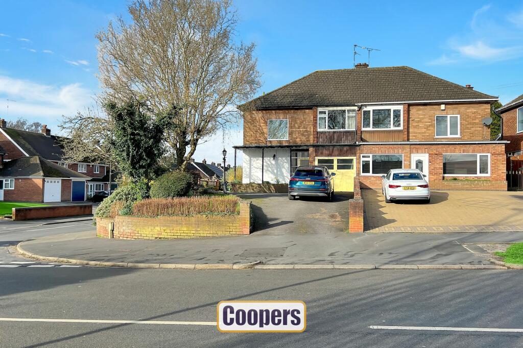
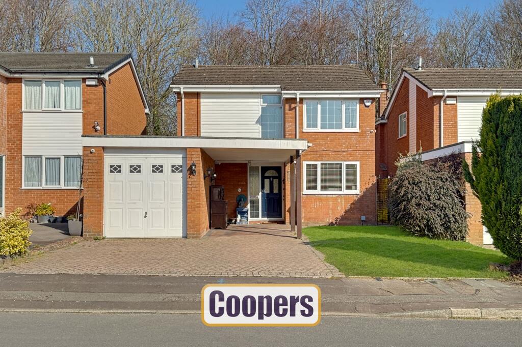
Baginton Road
Coventry, CV3

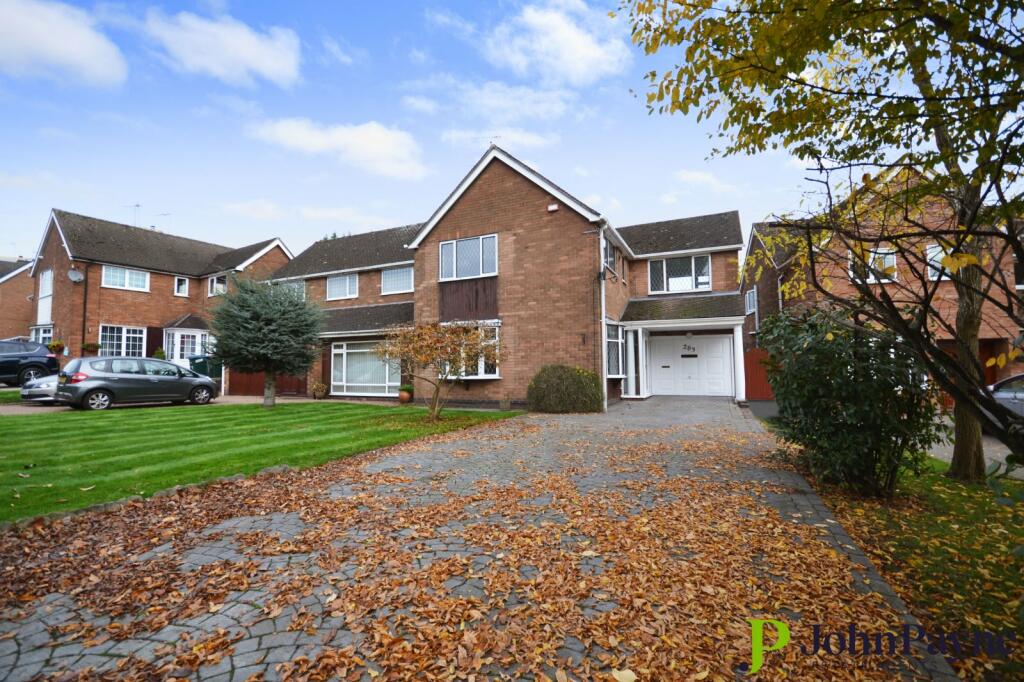
Description
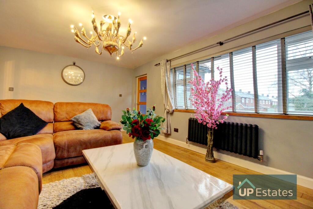
Enjoying a prime corner position, this spacious and extended semi detached family home is available for early purchase. Scope for some updating to your own personal taste. Hall with cloakroom off, kitchen, full width lounge/diner and large conservatory at the rear. Upstairs there are three good bedrooms and shower room. Gardens to three sides with direct car access to private driveway and garage.
Key Facts
Title Plan
 Contains OS data © Crown copyright 2025
Title Information
Details provided by the Land Registry
- Title Number
- MM150661
- Plot Size
- 0.11 acres (428 sq metres)
Street View
House Prices in Coventry
Last 12 months
-
Average Price Change
£13,178
Increased by 6%
-
Semi-Detached Price Change
£17,130
Increased by 7%
Average House Prices
Last 12 months for all property types.
Since - February 2020
-
Average Price Change
£45,827
Increased by 25%
-
Semi-Detached Price Change
£54,917
Increased by 26%
Average House Prices
Since 2020 for all property types
EPC

EPC Information
Details taken from the EPC register
- Date
- 2021-02-11
- Valid Until
- 2031-02-10
- Energy Efficiency - Current
- 58
- Energy Efficiency - Potential
- 81
- Environmental Impact - Current
- 51
- Environmental Impact - Potential
- 76
Properties For Sale in the Area
Baginton Road
Baginton Road
24 metres away
Arnold Avenue
0.16 km away
Arnold Avenue
0.17 km away
Rees Drive
0.17 km away
Fenside Avenue
0.19 km away
Properties To Let in the Area

Fenside Avenue
0.20 km away
Fenside Avenue
0.20 km away
Charminster Drive
0.35 km away
Leamington Road
0.41 km away
Frankton Avenue
0.42 km away
Roman Way
0.43 km away
Schools
| Name | Type | Postcode | Distance | Rating |
|---|---|---|---|---|
| St Thomas More Catholic Primary School | Nursery, Primary | CV3 5DE | 0.69 km | Good |
| Grange Farm Primary School | Primary | CV3 6NF | 0.75 km | Good |
| Howes Community Primary School | Nursery, Primary | CV3 5EH | 0.79 km | Not rated |
| Finham Primary School | Nursery, Primary | CV3 6EJ | 0.81 km | Good |
| Finham Park School | Secondary, Post 16 | CV3 6EA | 1.26 km | Outstanding |
Transport
Bus Stops & Stations
Details provided by Department for Transport
| Name | Distance |
|---|---|
| Old Mill, Mill Hill | 0.72 km |
| Holly Walk | 1.16 km |
| Baginton Stores, Coventry Road | 1.48 km |
Train Stations
Details provided by Department for Transport
| Name | Distance |
|---|---|
| Coventry Rail Station | 2.38 km |
| Canley Rail Station | 3.39 km |
Nearest Motorway
Details provided by Department for Transport
| Name | Distance |
|---|---|
| M6 | 8.56 km |
Airports
Details provided by Department for Transport
| Name | Distance |
|---|---|
| Coventry Airport | 2.68 km |
| Birmingham International Airport | 17.12 km |
| East Midlands Airport | 51.15 km |
| London Oxford Airport | 62.40 km |
| Gloucestershire Airport | 70.26 km |
Coverage
- Average Broadband Speed:
-
16mb Basic
-
80mb Superfast
-
1800mb Ultrafast
-
1800mb Overall
- Mobile Coverage:
-
EEOkay
-
O2Good
-
ThreeOkay
-
VodafoneOkay
Recently Sold Properties in the Area
| Address | Property Type | Distance | Price | Completed |
|---|---|---|---|---|
|
152 Maidavale Crescent Coventry, CV3 6GD |
Terraced | 72 metres away | £320,000 | 9 months ago |
|
205 Baginton Road Coventry, CV3 6FW |
Semi-Detached | 0.11 km away | £350,000 | 7 months ago |
|
205 Baginton Road Coventry, CV3 6FW |
Semi-Detached | 0.11 km away | £332,500 | 7 months ago |
|
120 Arnold Avenue Coventry, CV3 5NE |
Terraced | 0.13 km away | £385,000 | 7 months ago |
|
138 Maidavale Crescent Coventry, CV3 6GD |
Terraced | 0.13 km away | £445,000 | 3 months ago |
|
26 Rees Drive Coventry, CV3 6QF |
Detached | 0.20 km away | £380,000 | 10 months ago |
|
74 Arnold Avenue Coventry, CV3 5LX |
Detached | 0.22 km away | £535,000 | 9 months ago |
|
15 Charminster Drive Coventry, CV3 5AA |
Flats/Maisonettes | 0.23 km away | £105,000 | 7 months ago |
|
113 Alfriston Road Coventry, CV3 6QD |
Terraced | 0.24 km away | £273,000 | 10 months ago |
|
170 Baginton Road Coventry, CV3 6FT |
Semi-Detached | 0.26 km away | £475,000 | 2 months ago |
Important Notice - This report is intended for general informational purposes only and should act only as a guide. The report is produced automatically on behalf of Coopers Estate Agents - Coventry by Street Insights, a product of Street Systems Ltd. Street Systems maintains and aggregates data from multiple public data sources and whilst every effort is made to keep information up to date and accurate, we make no representations or warranties of any kind about the accuracy, reliability or completeness of the information contained within this report for any purpose. Any reliance you place on the data contained within this report is strictly at your own risk. In no event will Coopers Estate Agents - Coventry or Street Systems Ltd be liable for any loss or damage including without limitation, indirect or consequential loss or damage, or any loss or damage whatsoever arising from loss of data or profits arising out of, or in connection with, the use of this report.
This report contains public sector information licensed under the Open Government License v3.0
Transaction data and HPI data is produced by HM Land Registry. Crown copyright and database rights 2025