Property Information Report
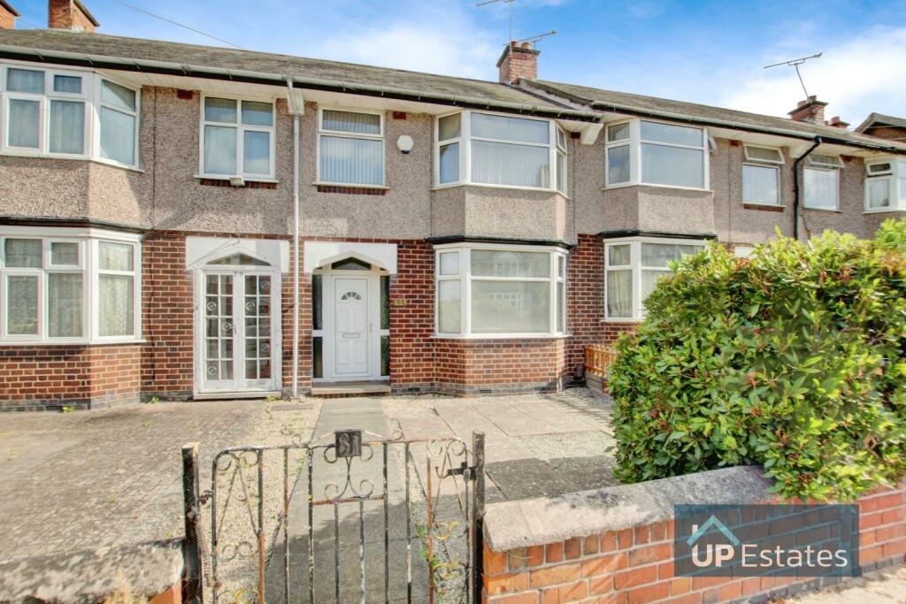
Glencoe Road
Coventry, CV3

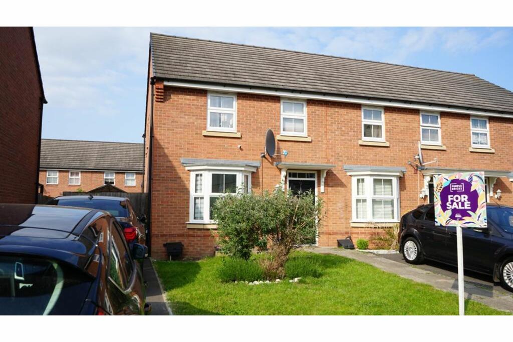
Description
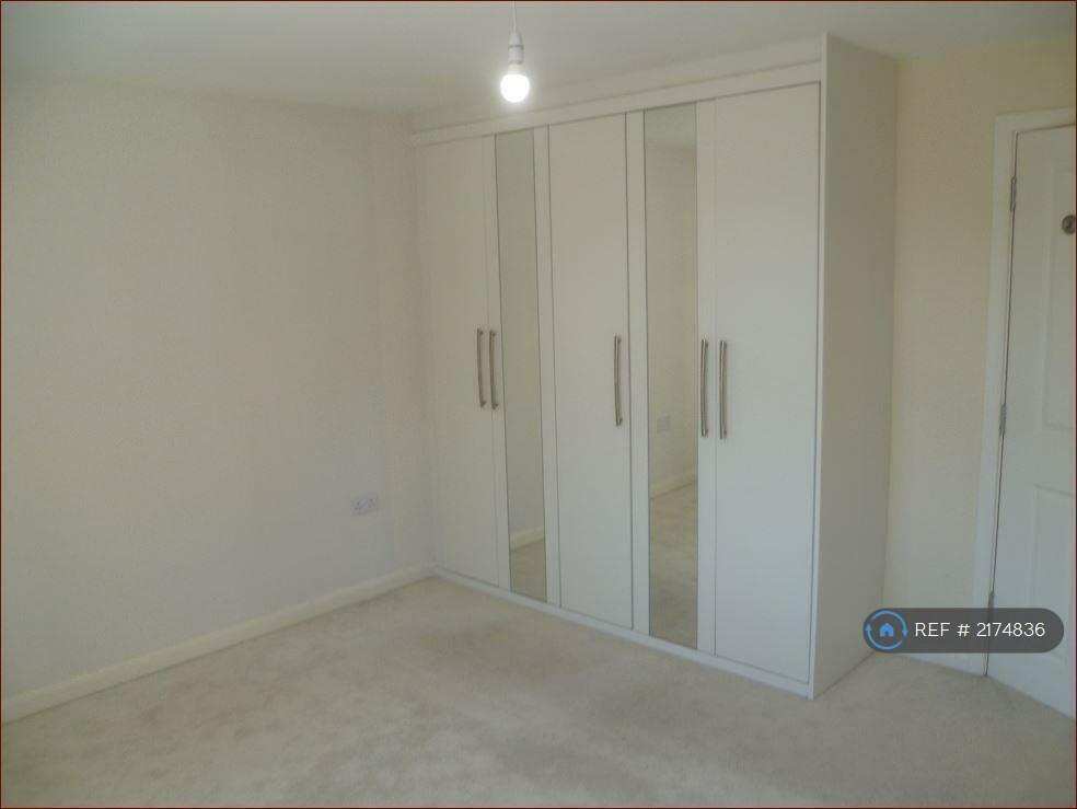
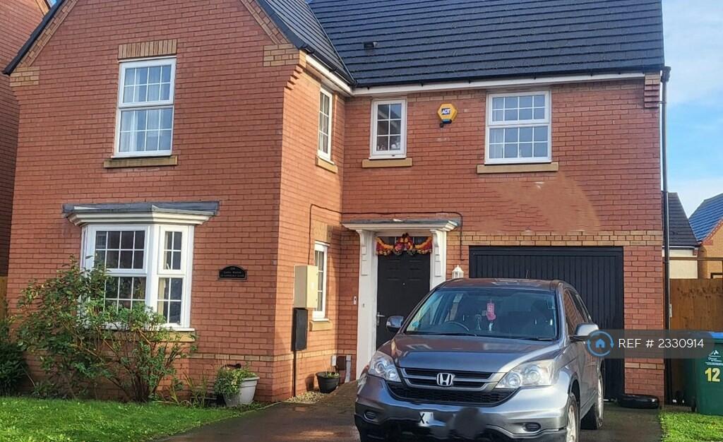
This 3-bedroom terraced home presents an excellent opportunity for first-time buyers or investors. While it is in need of some modernisation, it offers great potential to transform it into a comfortable and stylish living space.
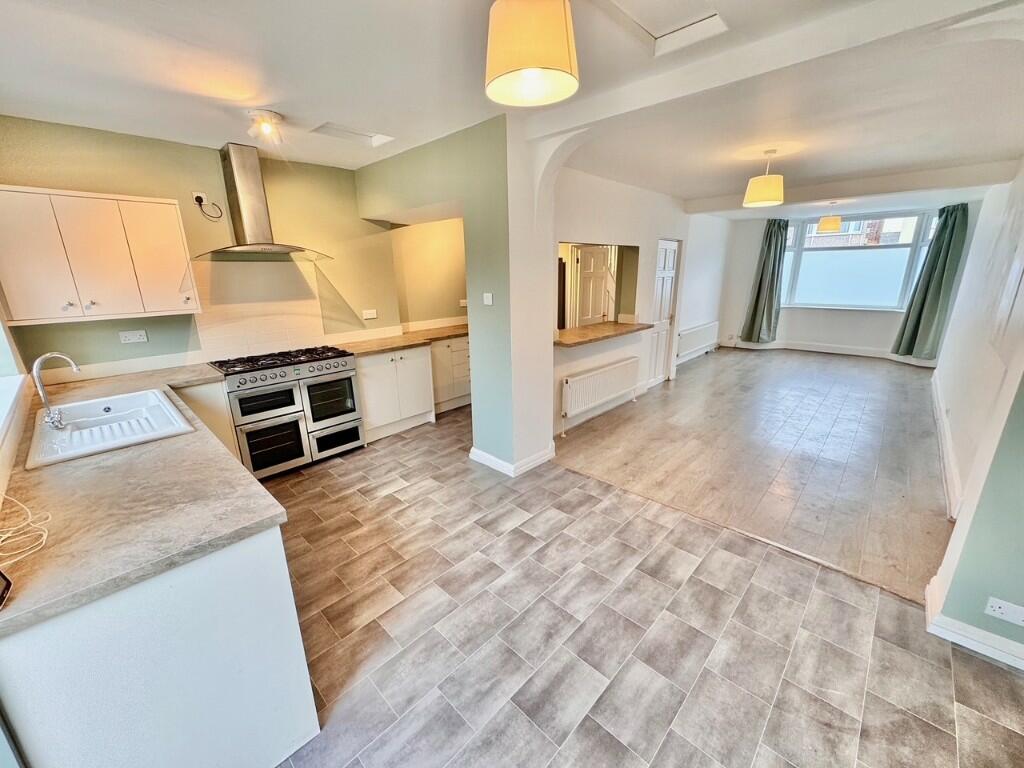
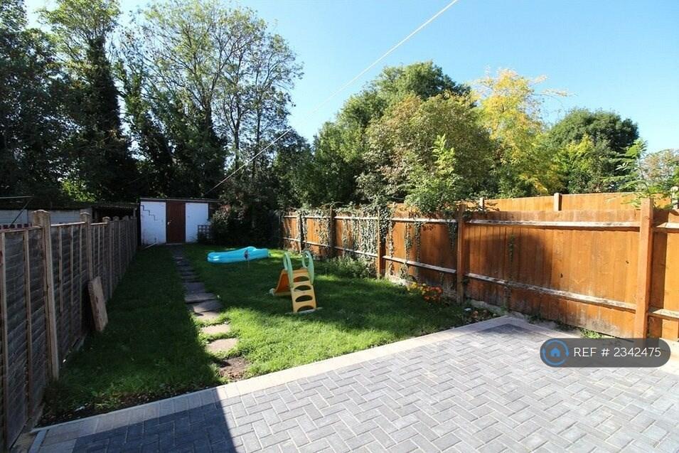
Upon entering the property, you are greeted by the hallway that leads to the spacious lounge/diner. The kitchen is situated at the rear of the property and provides access to the garden and to the garage, which could serve as a valuable addition for parking, storage, or even a potential workspace.
Upstairs there are three good-sized bedrooms and a shower room. Access to the partially borded loft is off the landing.
The property benefits from gas central heating and double glazing.
With its prime location and the opportunity to make your mark, viewing is essential!
Key Facts
Title Plan
 Contains OS data © Crown copyright 2025
Title Information
Details provided by the Land Registry
- Title Number
- WK474
- Plot Size
- 0.04 acres (168 sq metres)
Street View
House Prices in Coventry
Last 12 months
-
Average Price Change
£12,256
Increased by 6%
-
Terraced Price Change
£11,350
Increased by 6%
Average House Prices
Last 12 months for all property types.
Since - January 2020
-
Average Price Change
£44,175
Increased by 24%
-
Terraced Price Change
£42,174
Increased by 25%
Average House Prices
Since 2020 for all property types
EPC
 No EPC data available for this property.
Properties For Sale in the Area
Buttercup Walk
40 metres away
Glencoe Road
53 metres away
Buttercup Walk
75 metres away
Esme Close
97 metres away
Glencoe Road
0.10 km away
Isadora Lea
0.11 km away
Properties To Let in the Area
GLENCOE Road
52 metres away

Glencoe Road
0.10 km away
Brympton Road
0.14 km away
Amelia Crescent
0.17 km away
Constance Close
0.28 km away
Glencoe Road
0.35 km away
Schools
| Name | Type | Postcode | Distance | Rating |
|---|---|---|---|---|
| Aldermoor Farm Primary School | Nursery, Primary | CV3 1DP | 0.58 km | Good |
| Pattison College | Independent, Nursery, Primary, Post 16 | CV3 1FQ | 0.59 km | Not rated |
| Sacred Heart Catholic Primary School | Nursery, Primary | CV2 4DW | 0.93 km | Not rated |
| Ravensdale Primary School | Nursery, Primary | CV2 5GQ | 1.07 km | Good |
| Richard Lee Primary School | Nursery, Primary | CV2 5FU | 1.11 km | Not rated |
Transport
Train Stations
Details provided by Department for Transport
| Name | Distance |
|---|---|
| Coventry Rail Station | 2.86 km |
Nearest Motorway
Details provided by Department for Transport
| Name | Distance |
|---|---|
| M6 | 4.90 km |
Airports
Details provided by Department for Transport
| Name | Distance |
|---|---|
| Coventry Airport | 3.93 km |
| Birmingham International Airport | 18.47 km |
| East Midlands Airport | 48.03 km |
| London Oxford Airport | 64.46 km |
| Gloucestershire Airport | 73.93 km |
Coverage
- Average Broadband Speed:
-
9mb Basic
-
35mb Superfast
-
1800mb Ultrafast
-
1800mb Overall
- Mobile Coverage:
-
EEOkay
-
O2Good
-
ThreeGood
-
VodafoneOkay
Recently Sold Properties in the Area
| Address | Property Type | Distance | Price | Completed |
|---|---|---|---|---|
|
110 Glencoe Road Coventry, CV3 1GP |
Terraced | 56 metres away | £185,000 | 8 months ago |
|
10 Buttercup Walk Coventry, CV3 1LR |
Semi-Detached | 70 metres away | £199,500 | 6 months ago |
|
3 Isadora Lea Coventry, CV3 1JH |
Detached | 0.13 km away | £390,000 | 8 months ago |
|
74 Amelia Crescent Coventry, CV3 1NA |
Detached | 0.16 km away | £405,000 | 11 months ago |
|
23 Grant Road Coventry, CV3 1GQ |
Terraced | 0.18 km away | £202,000 | 2 months ago |
|
24 Lindley Road Coventry, CV3 1GY |
Semi-Detached | 0.22 km away | £190,000 | 8 months ago |
|
3 Constance Close Coventry, CV3 1LN |
Semi-Detached | 0.23 km away | £260,000 | 9 months ago |
|
5 Lindley Road Coventry, CV3 1GX |
Semi-Detached | 0.24 km away | £232,000 | 11 months ago |
|
37 Biggin Hall Crescent Coventry, CV3 1GR |
Terraced | 0.28 km away | £265,000 | 9 months ago |
|
7 Phoebe Close Coventry, CV3 1LJ |
Detached | 0.30 km away | £355,000 | 7 months ago |
Important Notice - This report is intended for general informational purposes only and should act only as a guide. The report is produced automatically on behalf of Coopers Estate Agents - Coventry by Street Insights, a product of Street Systems Ltd. Street Systems maintains and aggregates data from multiple public data sources and whilst every effort is made to keep information up to date and accurate, we make no representations or warranties of any kind about the accuracy, reliability or completeness of the information contained within this report for any purpose. Any reliance you place on the data contained within this report is strictly at your own risk. In no event will Coopers Estate Agents - Coventry or Street Systems Ltd be liable for any loss or damage including without limitation, indirect or consequential loss or damage, or any loss or damage whatsoever arising from loss of data or profits arising out of, or in connection with, the use of this report.
This report contains public sector information licensed under the Open Government License v3.0
Transaction data and HPI data is produced by HM Land Registry. Crown copyright and database rights 2025