Property Information Report
The Galliards
Coventry, CV4
Last Sold - Apr, 2005

Description
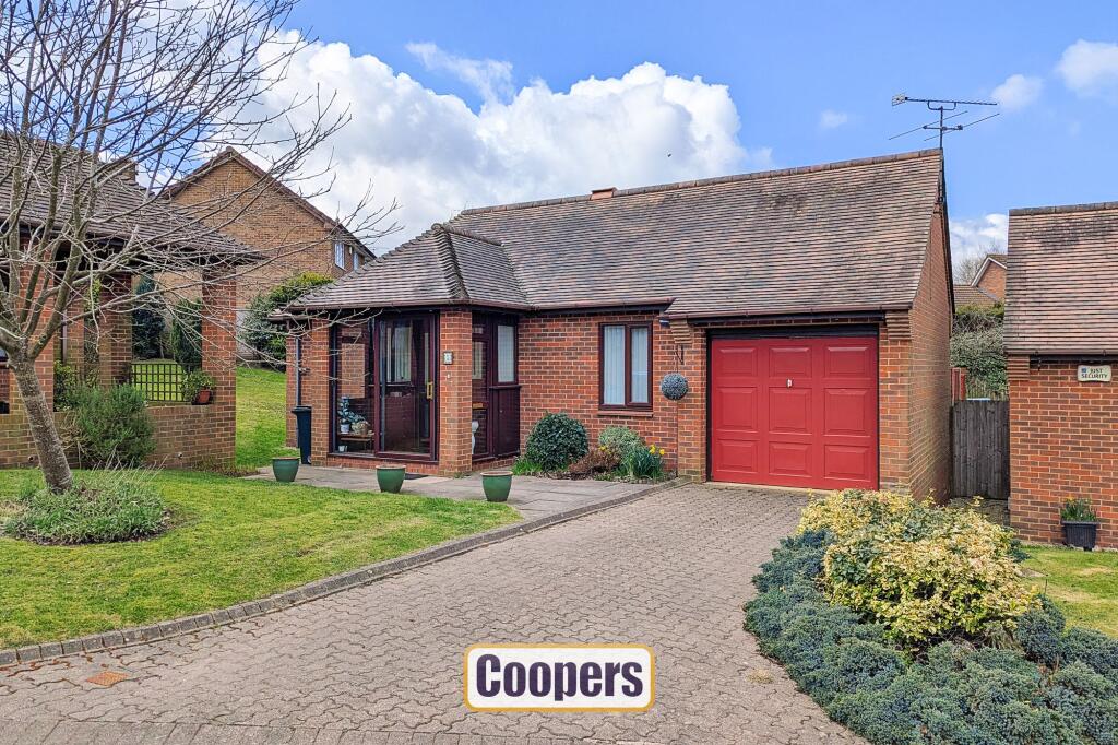
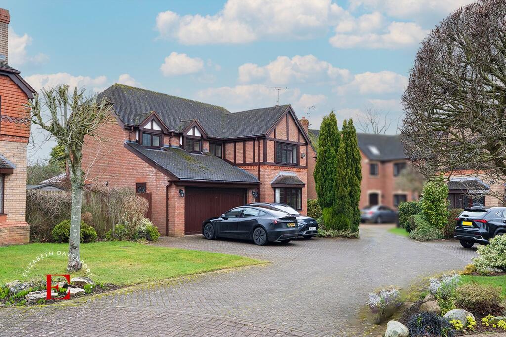
Nestled within an exclusive location, we are delighted to present this charming 2-bedroom retirement bungalow tailored for the over 55s. Boasting a well-thought-out design, this spacious detached home is on a prominent corner and benefits from dual aspect windows and plenty of light.
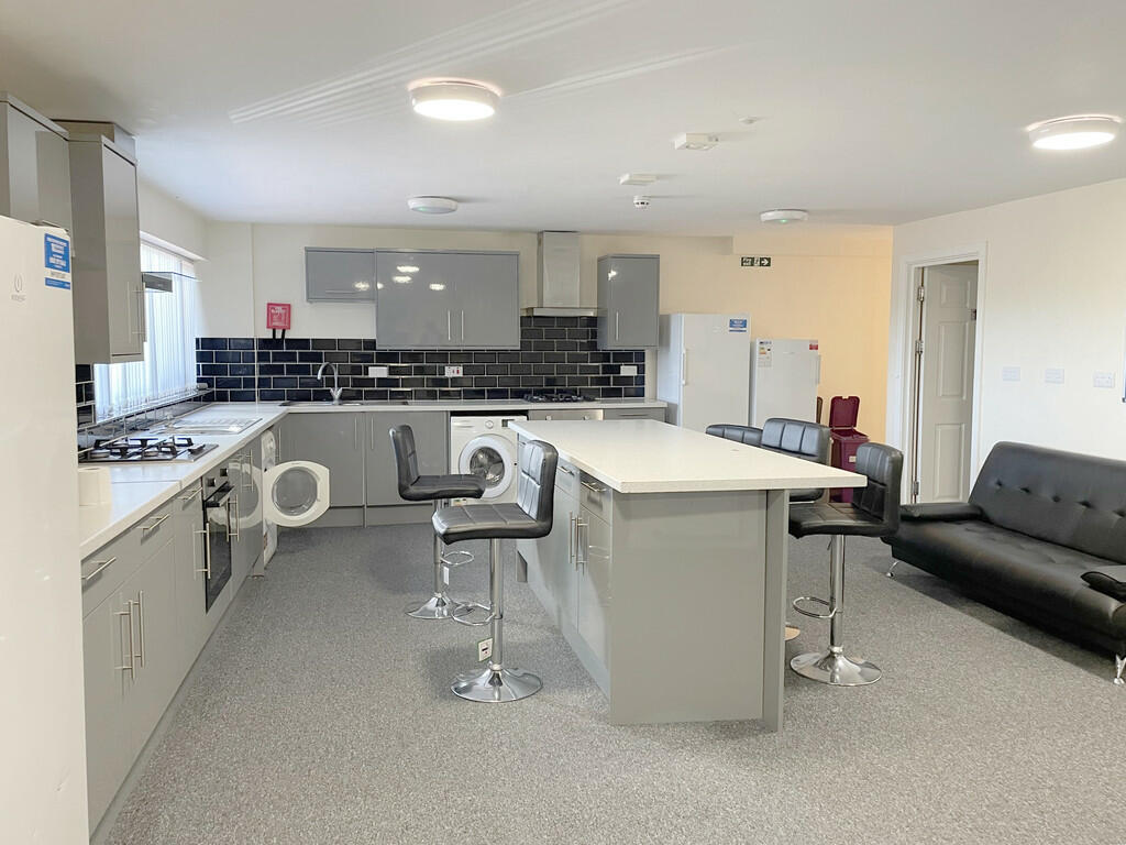
The property features two generously sized bedrooms, including a master bedroom with an ensuite, and an additional bathroom . The heart of the home comprises a good-sized living room leading into the conservatory. There is a well-appointed fitted kitchen.
This delightful bungalow is leasehold with 999-year lease from 1987, complemented by a peppercorn ground rent and service charge.
Stepping outside, the property has a charming outdoor space together with plenty of off-road parking.
Key Facts
Title Plan
 Contains OS data © Crown copyright 2025
Title Information
Details provided by the Land Registry
- Title Number
- WM447321
- Plot Size
- 0.02 acres (95 sq metres)
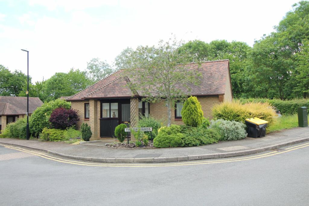
Street View
House Prices in Coventry
Last 12 months
-
Average Price Change
£13,178
Increased by 6%
-
Detached Price Change
£26,442
Increased by 7%
Average House Prices
Last 12 months for all property types.
Since - February 2020
-
Average Price Change
£45,827
Increased by 25%
-
Detached Price Change
£82,302
Increased by 25%
Average House Prices
Since 2020 for all property types
EPC

EPC Information
Details taken from the EPC register
- Date
- 2024-02-28
- Valid Until
- 2034-02-27
- Energy Efficiency - Current
- 65
- Energy Efficiency - Potential
- 84
- Environmental Impact - Current
- 62
- Environmental Impact - Potential
- 81
Properties For Sale in the Area
The Galliards
41 metres away
The Galliards
52 metres away
The Galliards
74 metres away
Heycroft
0.13 km away
Heritage Court
0.25 km away
Moreall Meadows
0.27 km away
Properties To Let in the Area

Moreall Meadows
0.27 km away
Old Mill Avenue
0.36 km away

Old Mill Avenue
0.36 km away

Old Mill Avenue
0.36 km away
Old Mill Avenue
0.36 km away
Old Mill Avenue
0.36 km away
Schools
| Name | Type | Postcode | Distance | Rating |
|---|---|---|---|---|
| Cannon Park Primary School | Primary | CV4 7PS | 0.51 km | Good |
| Bishop Ullathorne Catholic School | Secondary, Post 16 | CV3 6BH | 0.86 km | Good |
| Woodfield | Special | CV4 7AB | 1.25 km | Good |
| Woodfield | Special | CV4 7AB | 1.25 km | Not rated |
| University of Warwick | University | CV4 8UW | 1.38 km | Not rated |
Transport
Train Stations
Details provided by Department for Transport
| Name | Distance |
|---|---|
| Canley Rail Station | 2.30 km |
| Coventry Rail Station | 3.41 km |
| Tile Hill Rail Station | 3.79 km |
| Kenilworth Rail Station | 4.33 km |
Nearest Motorway
Details provided by Department for Transport
| Name | Distance |
|---|---|
| M6 | 10.09 km |
Coverage
- Average Broadband Speed:
-
15mb Basic
-
1800mb Ultrafast
-
1800mb Overall
- Mobile Coverage:
-
EEOkay
-
O2Good
-
ThreeGood
-
VodafoneOkay
Recently Sold Properties in the Area
| Address | Property Type | Distance | Price | Completed |
|---|---|---|---|---|
|
11 Old Mill Avenue Coventry, CV4 7DY |
Detached | 0.34 km away | £625,000 | 6 months ago |
|
21 Old Mill Avenue Coventry, CV4 7DY |
Detached | 0.38 km away | £480,000 | 10 months ago |
|
4 Poppyfield Court Coventry, CV4 7HW |
Detached | 0.40 km away | £685,000 | 5 months ago |
|
5 The Shrubberies Coventry, CV4 7EF |
Detached | 0.43 km away | £800,000 | 7 months ago |
|
6 Aldrin Way Coventry, CV4 7DP |
Detached | 0.55 km away | £425,000 | 4 months ago |
|
1a, Cannon Hill Road Coventry, CV4 7AZ |
Detached | 0.57 km away | £525,000 | 11 months ago |
|
7 Aldrin Way Coventry, CV4 7DP |
Detached | 0.59 km away | £400,000 | 11 months ago |
|
54 Merynton Avenue Coventry, CV4 7BN |
Detached | 0.64 km away | £520,000 | 9 months ago |
|
17 The Arboretum Coventry, CV4 7HX |
Detached | 0.64 km away | £840,000 | 5 months ago |
|
10 Blackthorn Close Coventry, CV4 7DQ |
Detached | 0.65 km away | £550,000 | 6 months ago |
Important Notice - This report is intended for general informational purposes only and should act only as a guide. The report is produced automatically on behalf of Coopers Estate Agents - Coventry by Street Insights, a product of Street Systems Ltd. Street Systems maintains and aggregates data from multiple public data sources and whilst every effort is made to keep information up to date and accurate, we make no representations or warranties of any kind about the accuracy, reliability or completeness of the information contained within this report for any purpose. Any reliance you place on the data contained within this report is strictly at your own risk. In no event will Coopers Estate Agents - Coventry or Street Systems Ltd be liable for any loss or damage including without limitation, indirect or consequential loss or damage, or any loss or damage whatsoever arising from loss of data or profits arising out of, or in connection with, the use of this report.
This report contains public sector information licensed under the Open Government License v3.0
Transaction data and HPI data is produced by HM Land Registry. Crown copyright and database rights 2025