Property Information Report

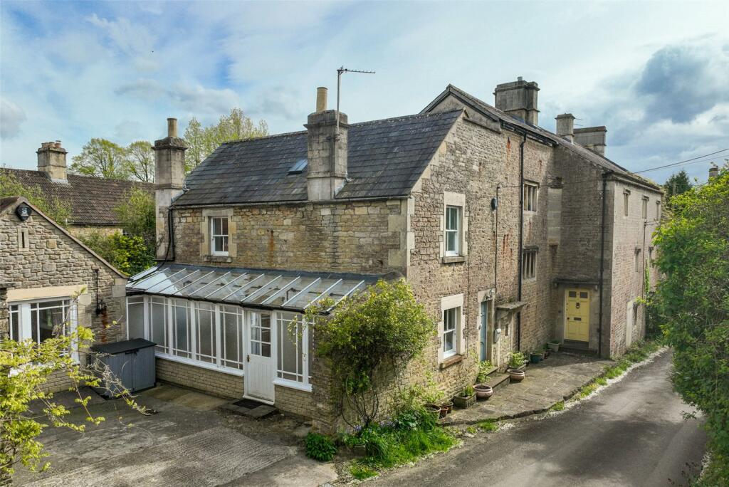
Justcars, 43a Wildcross
South Wraxall, Bradford-On-Avon, BA15 2RL
Estimated Rental Value - £1,525 PCM

Key Facts
No lease data available
Properties To Let in the Area
 We couldn’t find properties to let in the area for this property.
Street View

House Prices in Wiltshire
Last 12 months
-
Average Price Change
£19,108
Increased by 6%
-
Detached Price Change
£24,440
Increased by 5%
Average House Prices
Last 12 months for all property types.
Since - March 2020
-
Average Price Change
£66,023
Increased by 25%
-
Detached Price Change
£96,817
Increased by 23%
Average House Prices
Since 2020 for all property types
EPC
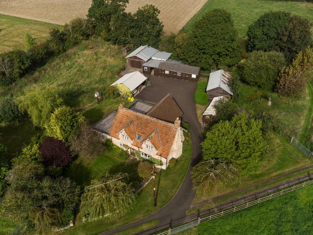
Properties For Sale in the Area
Lower South Wraxall
0.42 km away
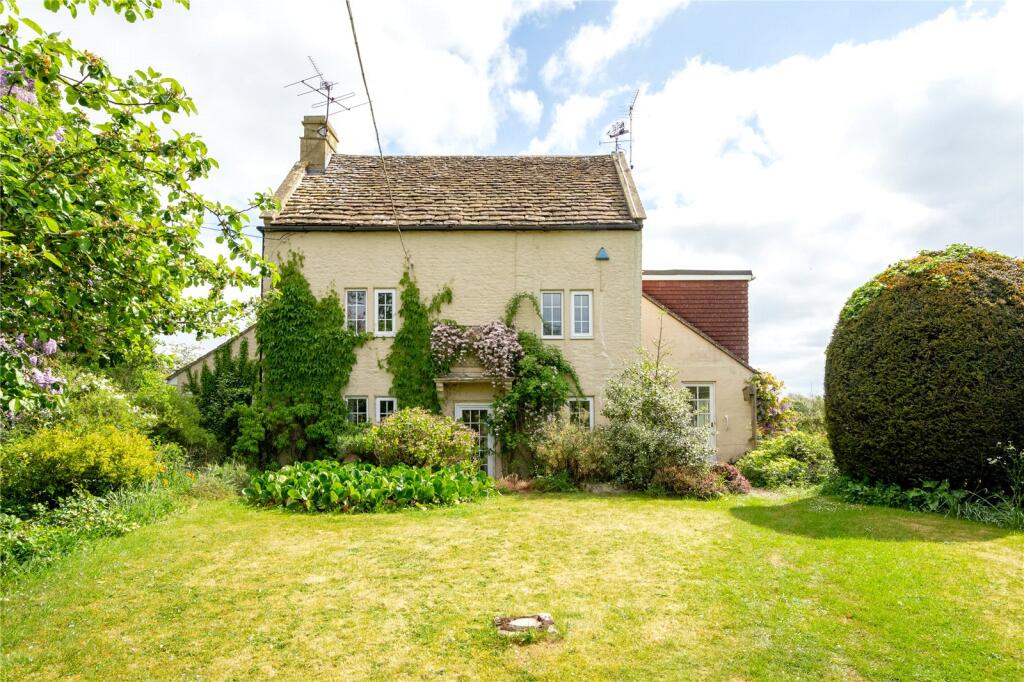
Upper South Wraxall
0.49 km away
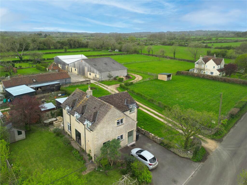
Upper South Wraxall
0.57 km away
Upper South Wraxall
0.61 km away
Lower South Wraxall
0.42 km away
Upper South Wraxall
0.49 km away
Upper South Wraxall
0.57 km away
Upper South Wraxall
0.61 km away
Recently Sold Properties in the Area
| Address | Property Type | Distance | Price | Completed |
|---|---|---|---|---|
|
68b Upper South Wraxall, Bradford-On-Avon, BA15 2SA |
Detached | 0.58 km away | £640,000 | 7 months ago |
|
72a Upper South Wraxall, Bradford-On-Avon, BA15 2SG |
Detached | 0.61 km away | £710,000 | 9 months ago |
| Address | Property Type | Distance | Price | Completed |
|---|---|---|---|---|
|
68b Upper South Wraxall, Bradford-On-Avon, BA15 2SA |
Detached | 0.58 km away | £640,000 | 7 months ago |
|
72a Upper South Wraxall, Bradford-On-Avon, BA15 2SG |
Detached | 0.61 km away | £710,000 | 9 months ago |
Schools
| Name | Type | Postcode | Distance | Rating |
|---|---|---|---|---|
| Stonar School | Independent, Nursery, Primary, Post 16 | SN12 8NT | 1.57 km | Not rated |
| Churchfields, the Village School | Primary | SN12 8HY | 2.73 km | Good |
| Christ Church Church of England Controlled Primary School | Primary | BA15 1ST | 3.27 km | Good |
| St Laurence School | Secondary, Post 16 | BA15 1DZ | 3.51 km | Good |
| Neston Primary School | Primary | SN13 9SX | 3.57 km | Good |
Transport
Bus Stops & Stations
Details provided by Department for Transport
| Name | Distance |
|---|---|
| The Green, Main Street | 0.40 km |
| The Old Rectory, Lower Wraxall | 0.51 km |
| Longs Arms | 0.56 km |
Train Stations
Details provided by Department for Transport
| Name | Distance |
|---|---|
| Bradford-On-Avon Rail Station | 4.07 km |
Nearest Motorway
Details provided by Department for Transport
| Name | Distance |
|---|---|
| M4 | 15.74 km |
Coverage
- Average Broadband Speed:
-
4mb Basic
-
63mb Superfast
-
63mb Overall
- Mobile Coverage:
-
EEOkay
-
O2Good
-
ThreeOkay
-
VodafoneOkay
About Us

Kingstons
Kingstons Estate Agents have been successfully selling and letting residential and commercial properties in and around Bradford on Avon since 1994.
Important Notice - This report is intended for general informational purposes only and should act only as a guide. The report is produced automatically on behalf of Kingstons Estate Agents - Bradford on Avon by Street Insights, a product of Street Systems Ltd. Street Systems maintains and aggregates data from multiple public data sources and whilst every effort is made to keep information up to date and accurate, we make no representations or warranties of any kind about the accuracy, reliability or completeness of the information contained within this report for any purpose. Any reliance you place on the data contained within this report is strictly at your own risk. In no event will Kingstons Estate Agents - Bradford on Avon or Street Systems Ltd be liable for any loss or damage including without limitation, indirect or consequential loss or damage, or any loss or damage whatsoever arising from loss of data or profits arising out of, or in connection with, the use of this report.
This report contains public sector information licensed under the Open Government License v3.0
Transaction data and HPI data is produced by HM Land Registry. Crown copyright and database rights 2025