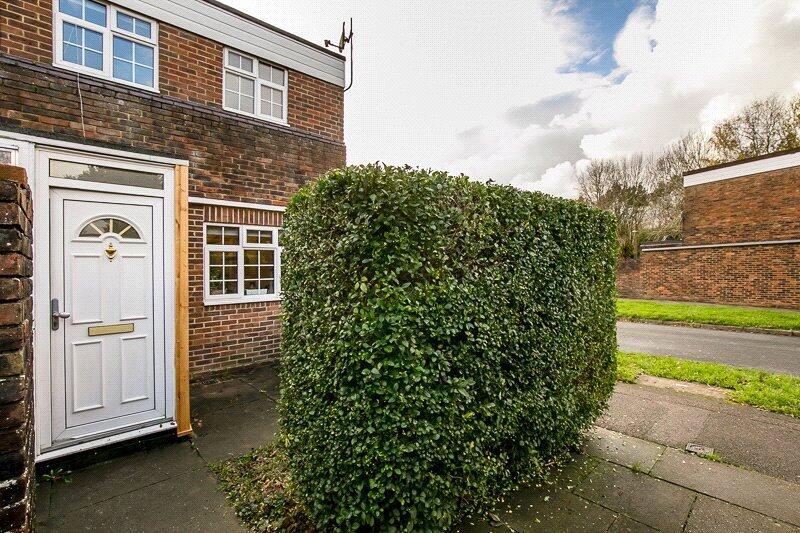
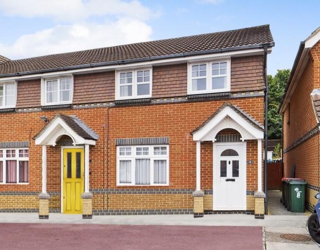
Property Information Report

10 Stonecrop Close
Crawley, RH11 9EP
Last Sold - Feb, 2011

Key Facts
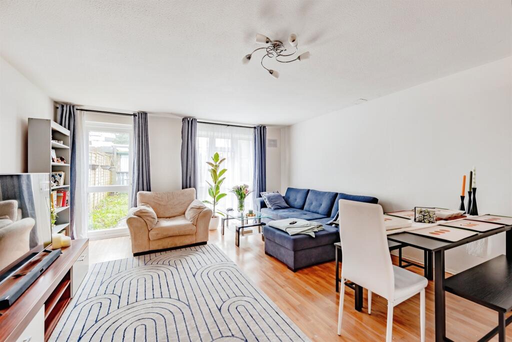
About Us

Let us Inspire you
Are you considering selling or letting in Crawley or the surrounding areas? Would you like to deal with property professionals, who have lived and worked in the area for many years?
If you are, we guarantee you will be impressed with our service. We are so confident that you will love our honest and pro-active approach that we don't need to tie you into restrictive sole agency agreements!
Find out more at our website
Title Plan
 Contains OS data © Crown copyright 2025
Title Information
Details provided by the Land Registry
- Title Number
- WSX59834
- Plot Size
- 0.03 acres (137 sq metres)
Street View

House Prices in Crawley
Last 12 months
-
Average Price Change
£28,026
Increased by 9%
-
Terraced Price Change
£30,588
Increased by 10%
Average House Prices
Last 12 months for all property types.
Since - March 2020
-
Average Price Change
£60,292
Increased by 22%
-
Terraced Price Change
£68,998
Increased by 25%
Average House Prices
Since 2020 for all property types
EPC

EPC Information
Details taken from the EPC register
- Date
- 2019-07-24
- Valid Until
- 2029-07-23
- Energy Efficiency - Current
- 64
- Energy Efficiency - Potential
- 86
- Environmental Impact - Current
- 58
- Environmental Impact - Potential
- 84
Properties For Sale in the Area
Bilberry Close
38 metres away
Heather Walk
81 metres away
Argus Walk
0.12 km away
Teasel Close
0.13 km away
Lulworth Close
0.15 km away
Glanville Walk
0.15 km away
Bilberry Close
38 metres away
Heather Walk
81 metres away
Argus Walk
0.12 km away
Teasel Close
0.13 km away
Lulworth Close
0.15 km away
Glanville Walk
0.15 km away
Recently Sold Properties in the Area
| Address | Property Type | Distance | Price | Completed |
|---|---|---|---|---|
|
24 Glanville Walk Crawley, RH11 8AU |
Terraced | 0.12 km away | £325,000 | 6 months ago |
|
13 Charlock Close Crawley, RH11 9ED |
Terraced | 0.20 km away | £268,000 | 8 months ago |
|
4 Caraway Close Crawley, RH11 9EA |
Terraced | 0.21 km away | £262,000 | 9 months ago |
|
18 Lismore Crescent Crawley, RH11 9DB |
Terraced | 0.24 km away | £300,000 | 6 months ago |
|
19 Lismore Crescent Crawley, RH11 9DA |
Terraced | 0.26 km away | £360,000 | 11 months ago |
|
33 Lismore Crescent Crawley, RH11 9DA |
Terraced | 0.29 km away | £220,000 | 6 months ago |
|
5 Trefoil Crescent Crawley, RH11 9EY |
Terraced | 0.29 km away | £325,000 | 5 months ago |
|
24 Burney Court, Gunning Close Crawley, RH11 8NX |
Terraced | 0.35 km away | £320,000 | 6 months ago |
|
2 Tiree Path Crawley, RH11 9DE |
Terraced | 0.36 km away | £360,000 | 8 months ago |
|
24 Kenilworth Close Crawley, RH11 9PY |
Terraced | 0.39 km away | £197,500 | 10 months ago |
Schools
| Name | Type | Postcode | Distance | Rating |
|---|---|---|---|---|
| Seymour Primary School | Nursery, Primary | RH11 9ES | 0.25 km | Good |
| Holy Trinity CofE Secondary School, Crawley | Secondary, Post 16 | RH11 8JE | 0.49 km | Good |
| Broadfield Primary Academy | Nursery, Primary | RH11 9PD | 0.92 km | Good |
| Gossops Green Primary | Primary | RH11 8HW | 0.96 km | Good |
| The Bewbush Academy | Primary | RH11 8XW | 0.97 km | Not rated |
Transport
Bus Stops & Stations
Details provided by Department for Transport
| Name | Distance |
|---|---|
| Admiral Walk | 0.22 km |
| Broadfield Drive | 0.22 km |
| Seymour School, Seymour Road | 0.24 km |
| Breezehurst Roundabout, Horsham Road | 0.25 km |
| Sandringham Road | 0.32 km |
Train Stations
Details provided by Department for Transport
| Name | Distance |
|---|---|
| Ifield Rail Station | 1.59 km |
| Crawley Rail Station | 1.92 km |
| Three Bridges Rail Station | 3.74 km |
| Faygate Rail Station | 3.82 km |
Nearest Motorway
Details provided by Department for Transport
| Name | Distance |
|---|---|
| M23 | 1.89 km |
Coverage
- Average Broadband Speed:
-
4mb Basic
-
80mb Superfast
-
1000mb Ultrafast
-
1000mb Overall
- Mobile Coverage:
-
EEOkay
-
O2Good
-
ThreeOkay
-
VodafoneOkay
Important Notice - This report is intended for general informational purposes only and should act only as a guide. The report is produced automatically on behalf of Inspire Estate Agents - Crawley by Street Insights, a product of Street Systems Ltd. Street Systems maintains and aggregates data from multiple public data sources and whilst every effort is made to keep information up to date and accurate, we make no representations or warranties of any kind about the accuracy, reliability or completeness of the information contained within this report for any purpose. Any reliance you place on the data contained within this report is strictly at your own risk. In no event will Inspire Estate Agents - Crawley or Street Systems Ltd be liable for any loss or damage including without limitation, indirect or consequential loss or damage, or any loss or damage whatsoever arising from loss of data or profits arising out of, or in connection with, the use of this report.
This report contains public sector information licensed under the Open Government License v3.0
Transaction data and HPI data is produced by HM Land Registry. Crown copyright and database rights 2025