Property Information Report
2 Railway Cottages
Mountfield, Robertsbridge, TN32 5LS
Estimated Rental Value - £1,650 PCM
Last Sold - May, 2023


Key Facts
Title Plan
 Contains OS data © Crown copyright 2025
Title Information
Details provided by the Land Registry
- Title Number
- ESX129130
- Plot Size
- 0.08 acres (343 sq metres)
Street View
House Prices in Rother
Last 12 months
-
Average Price Change
£16,898
Increased by 5%
-
Semi-Detached Price Change
£27,478
Increased by 8%
Average House Prices
Last 12 months for all property types.
Since Last Sale - 30th May 2023
-
Average Price Change
£8,309
Increased by 2%
-
Semi-Detached Price Change
£18,633
Increased by 5%
Average House Prices
Since last sale in 2023 for all property types
EPC

EPC Information
Details taken from the EPC register
- Date
- 2022-07-18
- Valid Until
- 2032-07-17
- Energy Efficiency - Current
- 47
- Energy Efficiency - Potential
- 63
- Environmental Impact - Current
- 44
- Environmental Impact - Potential
- 56
Properties For Sale in the Area
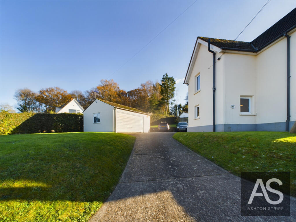
Railway Cottages
6 metres away
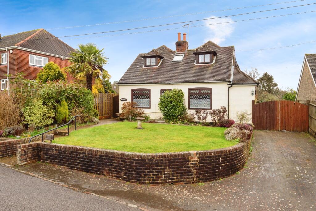
Mountfield
0.26 km away
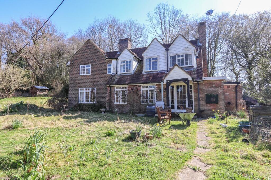
London Road
0.26 km away
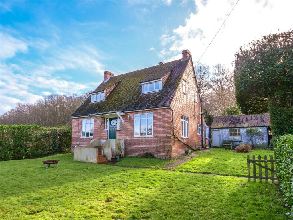
Eatenden Lane
0.26 km away

Hoath Hill
0.62 km away
Properties To Let in the Area
 We couldn’t find properties to let in the area for this property.
Schools
| Name | Type | Postcode | Distance | Rating |
|---|---|---|---|---|
| Vinehall School | Independent, Nursery, Primary | TN32 5JL | 1.27 km | Not rated |
| Mountfield Heath School | Special, Independent | TN32 5FA | 1.35 km | Outstanding |
| Netherfield CofE Primary School | Primary | TN33 9QF | 3.24 km | Outstanding |
| Battle and Langton Church of England Primary School | Primary | TN33 0HQ | 3.79 km | Good |
| Salehurst Church of England Primary School | Primary | TN32 5BU | 3.81 km | Good |
Transport
Bus Stops & Stations
Details provided by Department for Transport
| Name | Distance |
|---|---|
| Eatenden Lane | 8 metres |
| Level Crossing, London Road | 0.36 km |
| Solomon'S Lane | 0.37 km |
| Hoath Hill, Hoath Hill | 0.44 km |
| New Cut, New Cut | 0.63 km |
Train Stations
Details provided by Department for Transport
| Name | Distance |
|---|---|
| Robertsbridge Rail Station | 3.88 km |
| Battle Rail Station | 4.36 km |
Coverage
- Average Broadband Speed:
-
11mb Basic
-
1800mb Ultrafast
-
1800mb Overall
- Mobile Coverage:
-
EEOkay
-
O2Good
-
ThreeOkay
-
VodafoneOkay
Recently Sold Properties in the Area
| Address | Property Type | Distance | Price | Completed |
|---|---|---|---|---|
|
2 Mountfield Villas, Hoath Hill Mountfield, Robertsbridge, TN32 5LL |
Semi-Detached | 0.62 km away | £400,000 | 9 months ago |
Important Notice - This report is intended for general informational purposes only and should act only as a guide. The report is produced automatically on behalf of Paul Stripp Estate Agent - Battle by Street Insights, a product of Street Systems Ltd. Street Systems maintains and aggregates data from multiple public data sources and whilst every effort is made to keep information up to date and accurate, we make no representations or warranties of any kind about the accuracy, reliability or completeness of the information contained within this report for any purpose. Any reliance you place on the data contained within this report is strictly at your own risk. In no event will Paul Stripp Estate Agent - Battle or Street Systems Ltd be liable for any loss or damage including without limitation, indirect or consequential loss or damage, or any loss or damage whatsoever arising from loss of data or profits arising out of, or in connection with, the use of this report.
This report contains public sector information licensed under the Open Government License v3.0
Transaction data and HPI data is produced by HM Land Registry. Crown copyright and database rights 2025