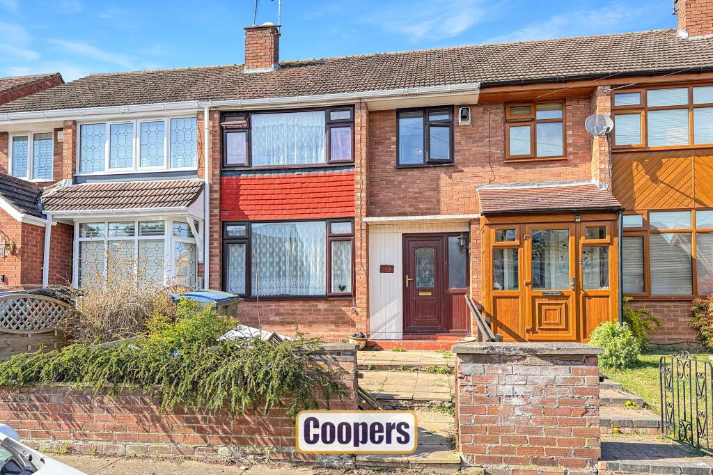
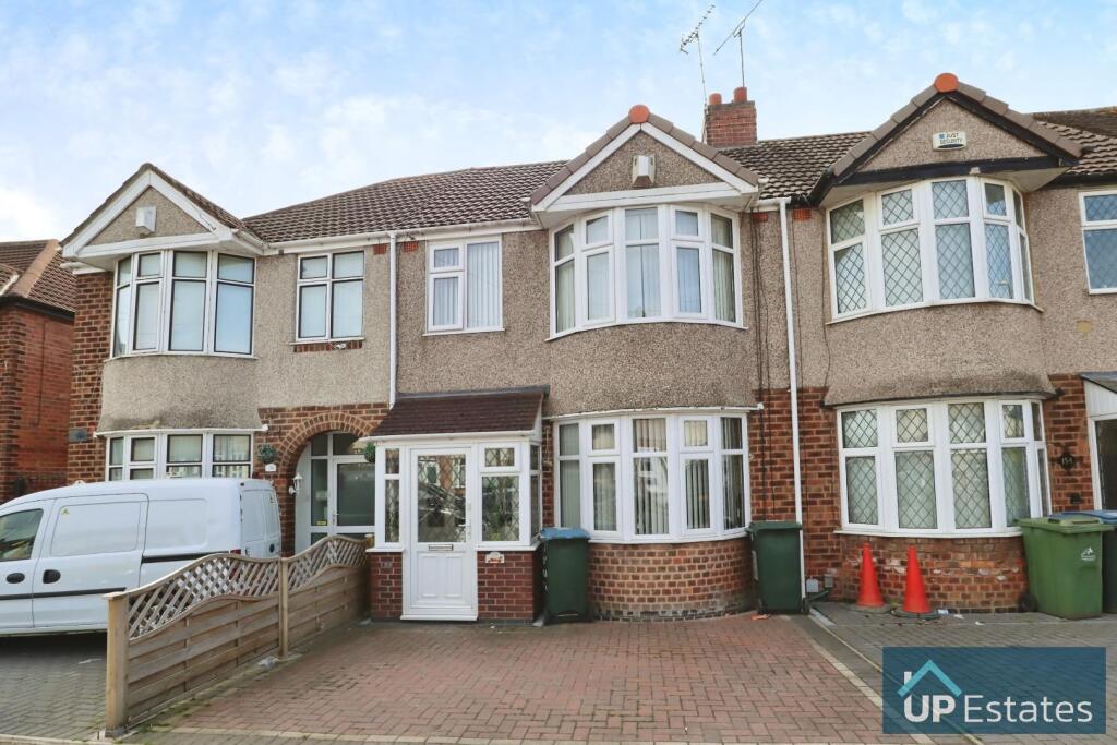
Property Information Report
Armscott Road
Coventry, CV2


Description
The ground floor features an L-shaped open-plan lounge, dining room, and kitchen, creating a spacious and cohesive living area. A conservatory extends the living space and includes a convenient downstairs toilet. Upstairs, there are three well-proportioned bedrooms and a family shower room. Outside, the property boasts a generous rear garden with a lawn and patio area, complemented by an outbuilding shed for additional storage or potential workspace.
Key Facts
Title Plan
 We couldn’t find a title plan for this property.
Street View
House Prices in Coventry
Last 12 months
-
Average Price Change
£12,256
Increased by 6%
-
Terraced Price Change
£11,350
Increased by 6%
Average House Prices
Last 12 months for all property types.
Since - January 2020
-
Average Price Change
£44,175
Increased by 24%
-
Terraced Price Change
£42,174
Increased by 25%
Average House Prices
Since 2020 for all property types
EPC

EPC Information
Details taken from the EPC register
- Date
- 2023-11-01
- Valid Until
- 2033-10-31
- Energy Efficiency - Current
- 67
- Energy Efficiency - Potential
- 86
- Environmental Impact - Current
- 64
- Environmental Impact - Potential
- 85
Properties For Sale in the Area
Armscott Road
Armscott Road
5 metres away
Armscott Road
41 metres away
Armscott Road
41 metres away
Armscott Road
57 metres away
Cockcroft Avenue
0.12 km away
Properties To Let in the Area
Cockcroft Avenue
0.12 km away
Derbyshire Way
0.23 km away
Torcross Avenue
0.25 km away
Dartmouth Road
0.26 km away
Dartmouth Road
0.26 km away
Sewall Highway
0.26 km away
Schools
| Name | Type | Postcode | Distance | Rating |
|---|---|---|---|---|
| St John Fisher Catholic Primary School | Nursery, Primary | CV2 3NR | 0.20 km | Good |
| Lyng Hall School | Secondary, Post 16 | CV2 3JS | 0.33 km | Good |
| Wyken Croft Primary School | Nursery, Primary | CV2 3AA | 0.74 km | Good |
| Henley Green Primary | Nursery, Primary | CV2 1HQ | 0.86 km | Good |
| Stoke Heath Primary School | Nursery, Primary | CV2 4PR | 1.04 km | Good |
Transport
Train Stations
Details provided by Department for Transport
| Name | Distance |
|---|---|
| Coventry Arena Rail Station | 3.33 km |
| Coventry Rail Station | 3.91 km |
Nearest Motorway
Details provided by Department for Transport
| Name | Distance |
|---|---|
| M6 | 3.28 km |
Coverage
- Average Broadband Speed:
-
4mb Basic
-
45mb Superfast
-
1800mb Ultrafast
-
1800mb Overall
- Mobile Coverage:
-
EEOkay
-
O2Good
-
ThreeGood
-
VodafoneOkay
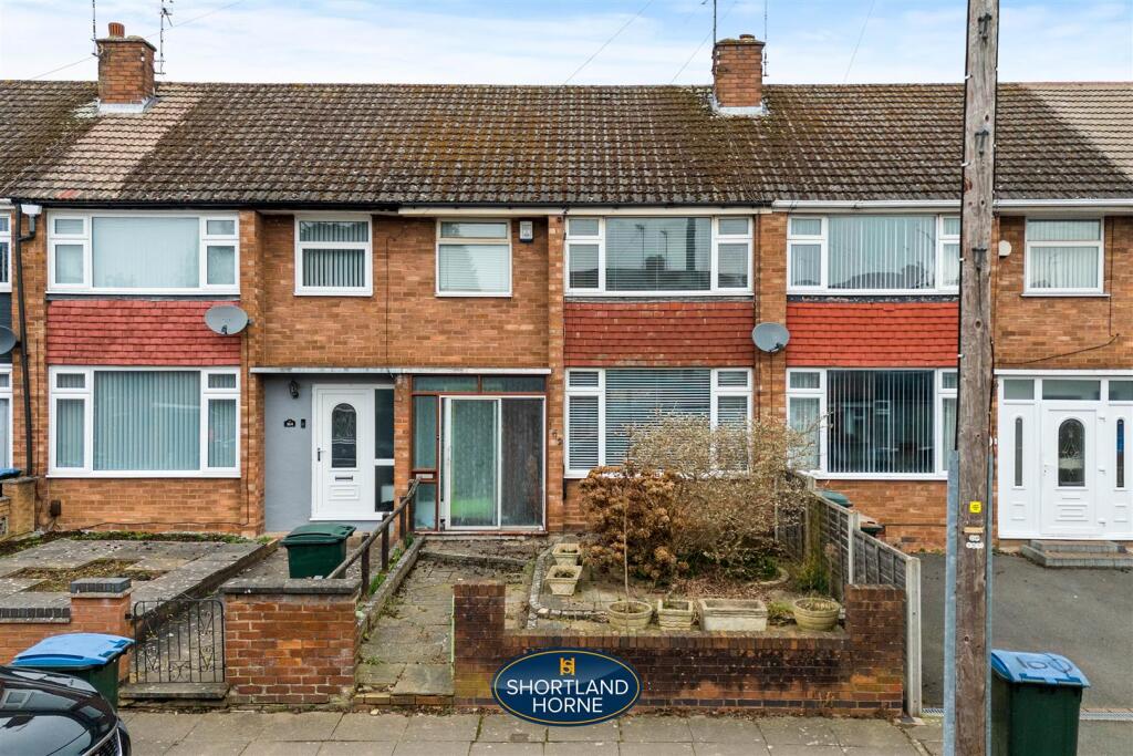
Recently Sold Properties in the Area
| Address | Property Type | Distance | Price | Completed |
|---|---|---|---|---|
|
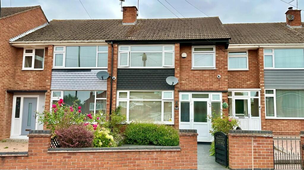
172 Armscott Road Coventry, CV2 3AP |
Terraced | 57 metres away | £245,000 | 2 months ago |
|
14 Shipston Road Coventry, CV2 3AH |
Terraced | 0.10 km away | £195,000 | 5 months ago |
|
8 Shipston Road Coventry, CV2 3AH |
Terraced | 0.11 km away | £210,000 | 1 year ago |
|
70 Torcross Avenue Coventry, CV2 3NQ |
Terraced | 0.16 km away | £195,000 | 5 months ago |
|
58 Dartmouth Road Coventry, CV2 3DQ |
Terraced | 0.18 km away | £225,000 | 8 months ago |
|
48 Derbyshire Way Coventry, CV2 3FA |
Terraced | 0.21 km away | £305,000 | 10 months ago |
|
8 Roberts Grove Coventry, CV2 3FU |
Semi-Detached | 0.22 km away | £255,000 | 4 months ago |
|
37 Dartmouth Road Coventry, CV2 3DP |
Terraced | 0.25 km away | £193,000 | 9 months ago |
|
31 Dartmouth Road Coventry, CV2 3DP |
Terraced | 0.26 km away | £290,000 | 11 months ago |
|
5 Curtis Road Coventry, CV2 3AG |
Terraced | 0.27 km away | £190,000 | 4 months ago |
Important Notice - This report is intended for general informational purposes only and should act only as a guide. The report is produced automatically on behalf of Coopers Estate Agents - Coventry by Street Insights, a product of Street Systems Ltd. Street Systems maintains and aggregates data from multiple public data sources and whilst every effort is made to keep information up to date and accurate, we make no representations or warranties of any kind about the accuracy, reliability or completeness of the information contained within this report for any purpose. Any reliance you place on the data contained within this report is strictly at your own risk. In no event will Coopers Estate Agents - Coventry or Street Systems Ltd be liable for any loss or damage including without limitation, indirect or consequential loss or damage, or any loss or damage whatsoever arising from loss of data or profits arising out of, or in connection with, the use of this report.
This report contains public sector information licensed under the Open Government License v3.0
Transaction data and HPI data is produced by HM Land Registry. Crown copyright and database rights 2025