Property Information Report
Trafford Gardens
Nottingham, NG8
Last Sold - Jun, 1997
Key Facts
Title Plan
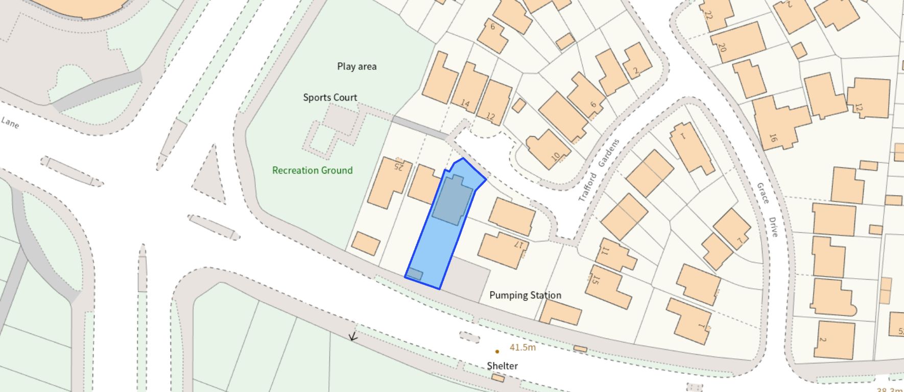 Contains OS data © Crown copyright 2025
Title Information
Details provided by the Land Registry
- Title Number
- NT295996
- Plot Size
- 0.10 acres (417 sq metres)
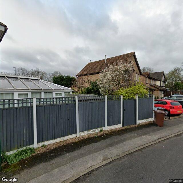
Street View
EPC
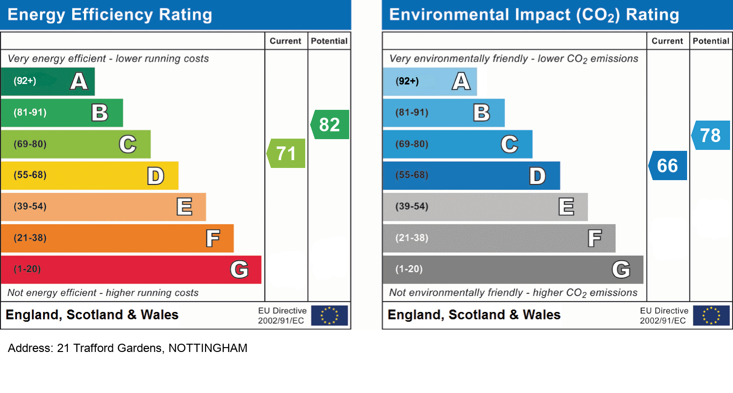
EPC Information
Details taken from the EPC register
- Date
- 2025-05-12
- Valid Until
- 2035-05-11
- Energy Efficiency - Current
- 71
- Energy Efficiency - Potential
- 82
- Environmental Impact - Current
- 66
- Environmental Impact - Potential
- 78
Schools
| Name | Type | Postcode | Distance | Rating |
|---|---|---|---|---|
| Bluecoat Aspley Academy | Secondary, Post 16 | NG8 5GY | 0.14 km | Good |
| Berridge Primary and Nursery School | Nursery, Primary | NG7 5LE | 0.82 km | Good |
| Nottingham Girls' Academy | Secondary, Post 16 | NG8 3LD | 0.85 km | Outstanding |
| Robert Shaw Primary and Nursery School | Nursery, Primary | NG8 3PL | 0.93 km | Good |
| Whitemoor Academy (Primary and Nursery) | Nursery, Primary | NG8 5FF | 1.00 km | Good |
Transport
Bus Stops & Stations
Details provided by Department for Transport
| Name | Distance |
|---|---|
| Fitness Centre, Aspley Lane | 63 metres |
| Bluecoat School, Western Boulevard | 91 metres |
| Aspley Gardens | 0.13 km |
| Bluecoat School, Aspley Lane | 0.16 km |
| Aspley Lane | 0.28 km |
Train Stations
Details provided by Department for Transport
| Name | Distance |
|---|---|
| Bulwell Rail Station | 3.61 km |
| Nottingham Rail Station | 3.64 km |
Nearest Motorway
Details provided by Department for Transport
| Name | Distance |
|---|---|
| M1 | 3.88 km |
Tram and Metro Stations
Details provided by Department for Transport
| Name | Distance |
|---|---|
| Wilkinson Street Tram Stop | 0.88 km |
| Radford Road Tram Stop | 1.06 km |
| Shipstone Street Tram Stop | 1.14 km |
| Hyson Green Market Tram Stop | 1.24 km |
| Beaconsfield Street Tram Stop | 1.29 km |
Coverage
- Average Broadband Speed:
-
8mb Basic
-
75mb Superfast
-
1000mb Ultrafast
-
1000mb Overall
- Mobile Coverage:
-
EEOkay
-
O2Good
-
ThreeOkay
-
VodafoneOkay
Important Notice - This report is intended for general informational purposes only and should act only as a guide. The report is produced automatically on behalf of David James Estate Agents - Mapperley by Street Insights, a product of Street Systems Ltd. Street Systems maintains and aggregates data from multiple public data sources and whilst every effort is made to keep information up to date and accurate, we make no representations or warranties of any kind about the accuracy, reliability or completeness of the information contained within this report for any purpose. Any reliance you place on the data contained within this report is strictly at your own risk. In no event will David James Estate Agents - Mapperley or Street Systems Ltd be liable for any loss or damage including without limitation, indirect or consequential loss or damage, or any loss or damage whatsoever arising from loss of data or profits arising out of, or in connection with, the use of this report.
This report contains public sector information licensed under the Open Government License v3.0
Transaction data and HPI data is produced by HM Land Registry. Crown copyright and database rights 2025