Property Information Report
Cecily Road
Coventry, CV3

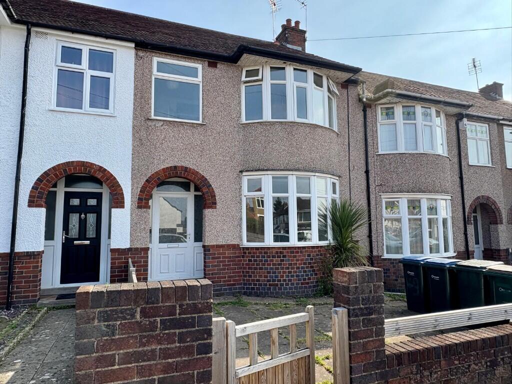
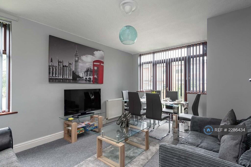
Description
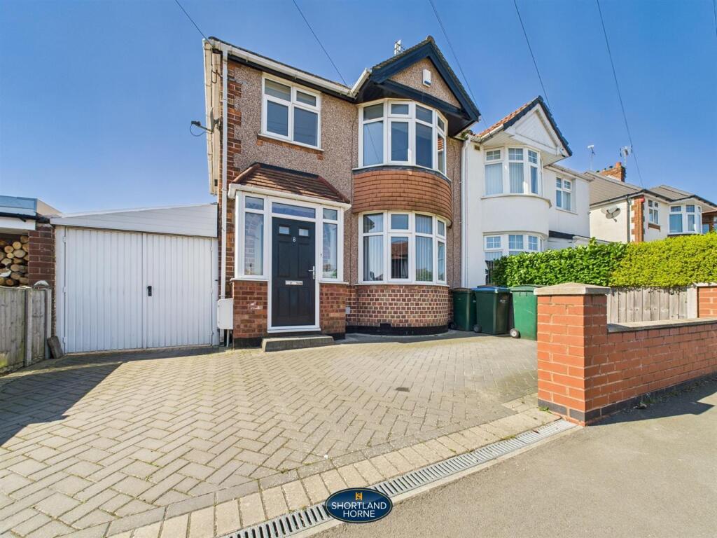
The property on offer is a charming 4 bedroom semi-detached house, perfect for a growing family. Situated in a popular location, it is conveniently close to Cheylesmore shops, the city centre, and train station, providing easy access to amenities and transport links.
Inside, the house has an extended kitchen and dining area, offering bags of potential. The loft has been converted to create a fourth bedroom, providing flexibility for a home office or guest room. The three first floor bedrooms and bathroom provide comfortable living arrangements for the whole family.
Moving outside, the property offers a pleasant garden and the brick garage adds an additional space, ensuring convenience and practicality.
Overall, this property presents an excellent opportunity for families looking for a spacious and well-located home with huge potential.
Key Facts
Title Plan
 Contains OS data © Crown copyright 2025
Title Information
Details provided by the Land Registry
- Title Number
- WM321078
- Plot Size
- 0.05 acres (188 sq metres)
Street View
House Prices in Coventry
Last 12 months
-
Average Price Change
£13,178
Increased by 6%
-
Semi-Detached Price Change
£17,130
Increased by 7%
Average House Prices
Last 12 months for all property types.
Since - February 2020
-
Average Price Change
£45,827
Increased by 25%
-
Semi-Detached Price Change
£54,917
Increased by 26%
Average House Prices
Since 2020 for all property types
EPC

EPC Information
Details taken from the EPC register
- Date
- 2018-10-14
- Valid Until
- 2028-10-13
- Energy Efficiency - Current
- 49
- Energy Efficiency - Potential
- 76
- Environmental Impact - Current
- 41
- Environmental Impact - Potential
- 70
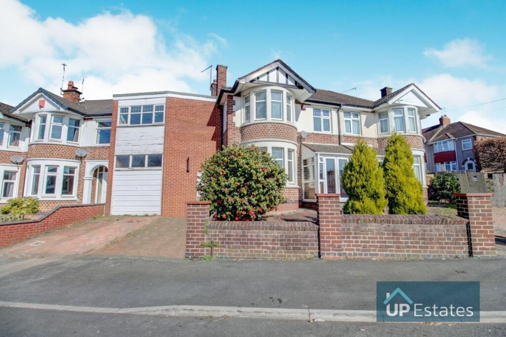
Properties For Sale in the Area

Cecily Road
William Bristow Road
0.12 km away
Frankpledge Road
0.15 km away
William Bristow Road
0.17 km away

Montalt Road
0.18 km away
Courtleet Road
0.18 km away
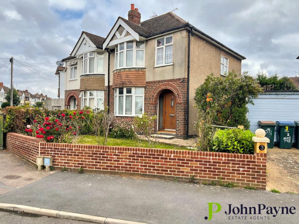
Properties To Let in the Area
William Bristow Road
0.15 km away

Frankpledge Road
0.17 km away
Frankpledge Road
0.17 km away
Montalt Road
0.18 km away

The Park Paling
0.19 km away
Montalt Road
0.24 km away
Schools
| Name | Type | Postcode | Distance | Rating |
|---|---|---|---|---|
| Manor Park Primary School | Nursery, Primary | CV3 5EZ | 0.81 km | Good |
| Howes Community Primary School | Nursery, Primary | CV3 5EH | 0.88 km | Not rated |
| Meadow Park School | Secondary, Post 16 | CV3 4BD | 1.00 km | Not rated |
| Blue Coat Church of England School and Music College | Secondary, Post 16 | CV1 2BA | 1.03 km | Good |
| All Saints Church of England Primary School | Nursery, Primary | CV1 2AF | 1.07 km | Good |
Transport
Train Stations
Details provided by Department for Transport
| Name | Distance |
|---|---|
| Coventry Rail Station | 1.44 km |
| Canley Rail Station | 3.50 km |
Nearest Motorway
Details provided by Department for Transport
| Name | Distance |
|---|---|
| M6 | 6.94 km |
Airports
Details provided by Department for Transport
| Name | Distance |
|---|---|
| Coventry Airport | 3.13 km |
| Birmingham International Airport | 17.24 km |
| East Midlands Airport | 49.56 km |
| London Oxford Airport | 63.63 km |
| Gloucestershire Airport | 71.90 km |
Coverage
- Average Broadband Speed:
-
15mb Basic
-
80mb Superfast
-
1800mb Ultrafast
-
1800mb Overall
- Mobile Coverage:
-
EEOkay
-
O2Good
-
ThreeOkay
-
VodafoneGood
Recently Sold Properties in the Area
| Address | Property Type | Distance | Price | Completed |
|---|---|---|---|---|
|
108 Cecily Road Coventry, CV3 5LB |
Semi-Detached | 35 metres away | £410,000 | 9 months ago |
|
12 Seneschal Road Coventry, CV3 5LH |
Terraced | 77 metres away | £277,000 | 9 months ago |
|
96 Cecily Road Coventry, CV3 5LA |
Terraced | 0.10 km away | £285,000 | 9 months ago |
|
94 Cecily Road Coventry, CV3 5LA |
Terraced | 0.11 km away | £240,500 | 6 months ago |
|
4 Courtleet Road Coventry, CV3 5GS |
Semi-Detached | 0.18 km away | £275,000 | 8 months ago |
|
2 Courtleet Road Coventry, CV3 5GS |
Semi-Detached | 0.18 km away | £310,000 | 11 months ago |
|
85 Cecily Road Coventry, CV3 5JZ |
Semi-Detached | 0.20 km away | £260,100 | 3 months ago |
|
45 Seedfield Croft Coventry, CV3 5HU |
Terraced | 0.22 km away | £255,000 | 10 months ago |
|
49 Crecy Road Coventry, CV3 5HS |
Other | 0.22 km away | £315,000 | 10 months ago |
|
18 Agincourt Road Coventry, CV3 5PT |
Terraced | 0.27 km away | £170,000 | 6 months ago |
Important Notice - This report is intended for general informational purposes only and should act only as a guide. The report is produced automatically on behalf of Coopers Estate Agents - Coventry by Street Insights, a product of Street Systems Ltd. Street Systems maintains and aggregates data from multiple public data sources and whilst every effort is made to keep information up to date and accurate, we make no representations or warranties of any kind about the accuracy, reliability or completeness of the information contained within this report for any purpose. Any reliance you place on the data contained within this report is strictly at your own risk. In no event will Coopers Estate Agents - Coventry or Street Systems Ltd be liable for any loss or damage including without limitation, indirect or consequential loss or damage, or any loss or damage whatsoever arising from loss of data or profits arising out of, or in connection with, the use of this report.
This report contains public sector information licensed under the Open Government License v3.0
Transaction data and HPI data is produced by HM Land Registry. Crown copyright and database rights 2025