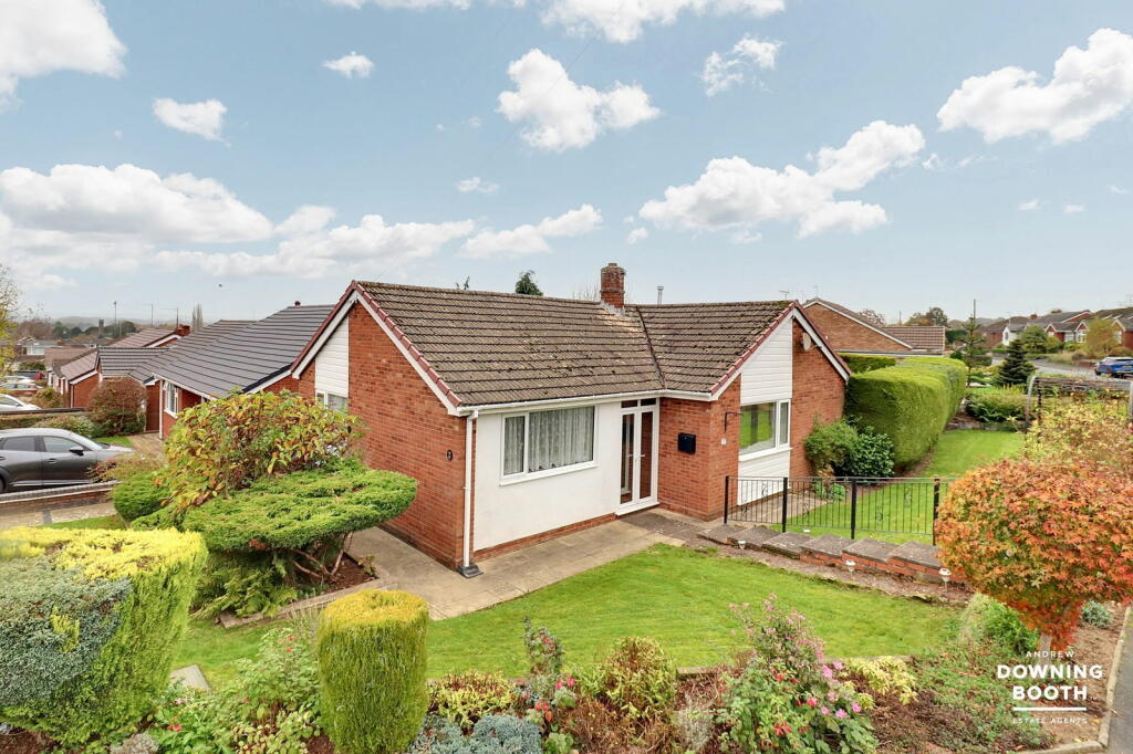
Buyer Information Report
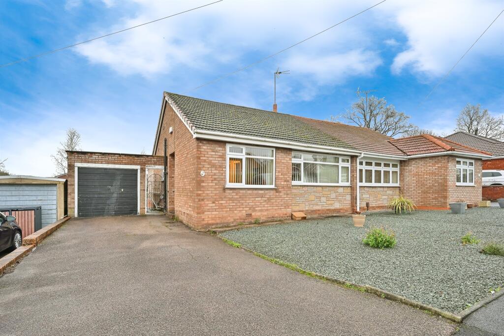
8 Rockhouse Drive
Great Haywood, Stafford, ST18 0TD
Last Sold - Nov, 2024
Key Facts
About Us

We dont just 'sell' houses, we help people move!
Have you used an estate agent before? We have, as a tenant, landlord, buyer and seller and that is what made us want to set out on this journey. A property is arguably the biggest asset you will own and the transaction of buying or selling this asset can take on average (May 2022) 22 weeks you really need to know that the person you choose to sell your property for you is going to deliver on what they say and have your best interests at heart.
Our dedicated, personal, 121 service enables you to have the owner of the business as your 1 point of contact all the way through the transaction.
Title Plan
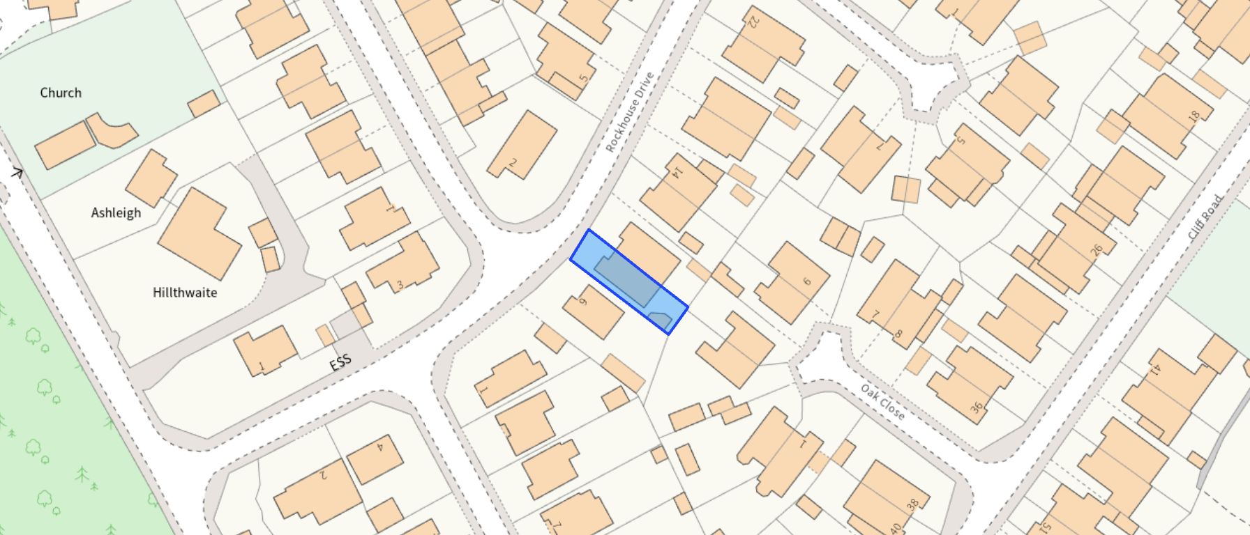 Contains OS data © Crown copyright 2025
Title Information
Details provided by the Land Registry
- Title Number
- SF343545
- Plot Size
- 0.05 acres (211 sq metres)
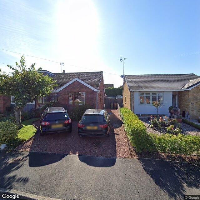
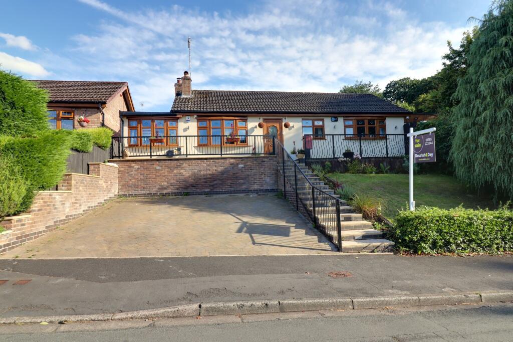
Street View
House Prices in Stafford
Last 12 months
-
Average Price Change
£15,478
Increased by 6%
-
Semi-Detached Price Change
£15,986
Increased by 7%
Average House Prices
Last 12 months for all property types.
Since Last Sale - 21st November 2024
-
Average Price Change
£61,184
Increased by 31%
-
Semi-Detached Price Change
£61,779
Increased by 34%
Average House Prices
Since 2020 for all property types
EPC
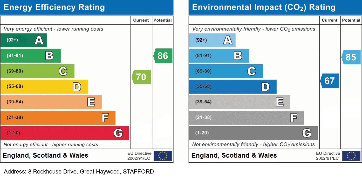
EPC Information
Details taken from the EPC register
- Date
- 2024-08-06
- Valid Until
- 2034-08-05
- Energy Efficiency - Current
- 70
- Energy Efficiency - Potential
- 86
- Environmental Impact - Current
- 67
- Environmental Impact - Potential
- 85
Properties For Sale in the Area
Rockhouse Drive
83 metres away
Lichfield Drive
96 metres away
Cliff Road
0.11 km away
Cliff Road
0.11 km away
Church View
0.17 km away
Cliff Road
0.18 km away
Properties To Let in the Area
 We couldn’t find properties to let in the area for this property.
Schools
| Name | Type | Postcode | Distance | Rating |
|---|---|---|---|---|
| Anson CofE Primary School | Primary | ST18 0SU | 0.19 km | Good |
| St John's Catholic Primary School | Nursery, Primary | ST18 0SL | 0.29 km | Good |
| Colwich CofE Primary School | Primary | ST17 0XD | 1.64 km | Good |
| St Peter's CofE Primary School | Nursery, Primary | ST18 0PS | 2.92 km | Good |
| Berkswich CofE (VC) Primary School | Nursery, Primary | ST17 0LU | 4.56 km | Outstanding |
Transport
Bus Stops & Stations
Details provided by Department for Transport
| Name | Distance |
|---|---|
| Rockhouse Drive | 0.11 km |
| Clifford Arms Ph, Main Road | 0.31 km |
| Abbeyfields, Mill Lane | 0.44 km |
| Jubilee Playing Field, Main Road | 0.53 km |
| Shephard Close | 0.62 km |
Train Stations
Details provided by Department for Transport
| Name | Distance |
|---|
Nearest Motorway
Details provided by Department for Transport
| Name | Distance |
|---|---|
| M6 | 8.17 km |
Coverage
- Average Broadband Speed:
-
14mb Basic
-
14mb Overall
- Mobile Coverage:
-
EEOkay
-
O2Good
-
ThreeOkay
-
VodafoneOkay
Recently Sold Properties in the Area
| Address | Property Type | Distance | Price | Completed |
|---|---|---|---|---|
|
8 Rockhouse Drive Great Haywood, Stafford, ST18 0TD |
Semi-Detached | away | £287,000 | 8 months ago |
|
38 Cliff Road Great Haywood, Stafford, ST18 0SZ |
Semi-Detached | 76 metres away | £280,000 | 4 months ago |
|
10 Tylecote Crescent Great Haywood, Stafford, ST18 0TA |
Terraced | 77 metres away | £215,000 | 11 months ago |
|
2 Rockhouse Drive Great Haywood, Stafford, ST18 0TE |
Detached | 83 metres away | £337,500 | 3 months ago |
|
1 Cliff View, The Butts, Main Road Great Haywood, Stafford, ST18 0TF |
Other | 0.14 km away | £238,000 | 10 months ago |
|
1 Cliff View, The Butts, Main Road Great Haywood, Stafford, ST18 0TF |
Semi-Detached | 0.14 km away | £238,000 | 10 months ago |
|
49 The Uplands Great Haywood, Stafford, ST18 0SH |
Terraced | 0.18 km away | £199,000 | 7 months ago |
|
Flat 8, The Old Forge, Main Road Great Haywood, Stafford, ST18 0RZ |
Flats/Maisonettes | 0.31 km away | £135,000 | 9 months ago |
|
8 Yelland Walk Great Haywood, Stafford, ST18 0WJ |
Semi-Detached | 0.37 km away | £270,000 | 6 months ago |
|
59a, Little Tixall Lane Great Haywood, Stafford, ST18 0SE |
Detached | 0.41 km away | £480,000 | 4 months ago |
Important Notice - This report is intended for general informational purposes only and should act only as a guide. The report is produced automatically on behalf of EweMove Stafford - EweMove Stafford by Street Insights, a product of Street Systems Ltd. Street Systems maintains and aggregates data from multiple public data sources and whilst every effort is made to keep information up to date and accurate, we make no representations or warranties of any kind about the accuracy, reliability or completeness of the information contained within this report for any purpose. Any reliance you place on the data contained within this report is strictly at your own risk. In no event will EweMove Stafford - EweMove Stafford or Street Systems Ltd be liable for any loss or damage including without limitation, indirect or consequential loss or damage, or any loss or damage whatsoever arising from loss of data or profits arising out of, or in connection with, the use of this report.
This report contains public sector information licensed under the Open Government License v3.0
Transaction data and HPI data is produced by HM Land Registry. Crown copyright and database rights 2025