Property Information Report
Nuthatch Drive
Finberry, Ashford, TN25
Estimated Value - £295,000
Estimated Rental Value - £1,325 PCM
Last Sold - Jun, 2024
Description
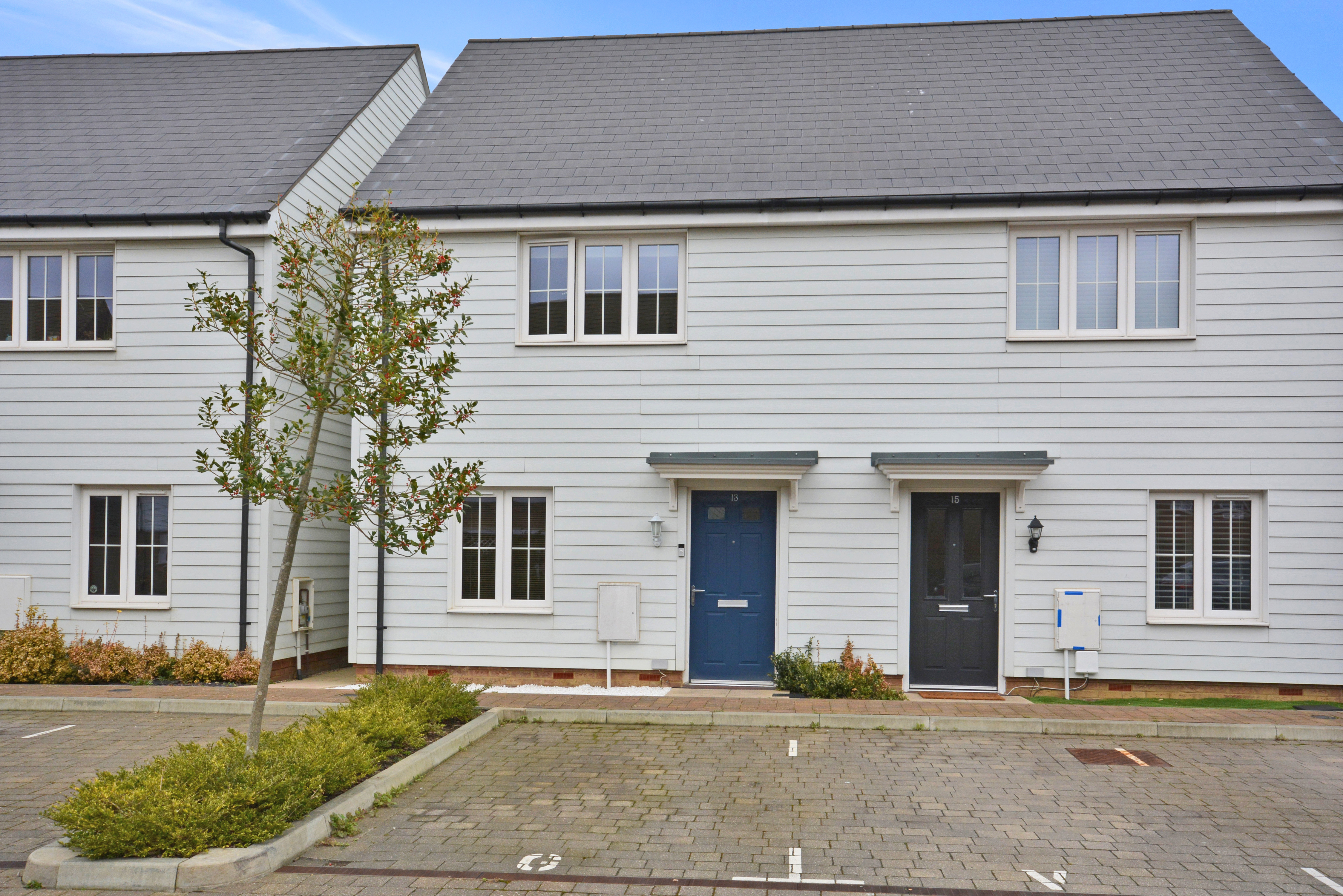
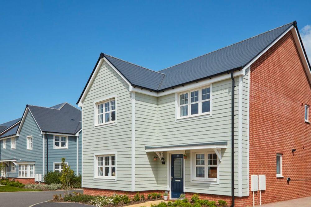
This 2 bedroom semi-detached house is priced at £295,000 and offers a fantastic opportunity for both first time buyers and investors. Situated within the highly sought-after Finberry location, this delightful property is offered with no onward chain, providing a smooth and hassle-free buying process.
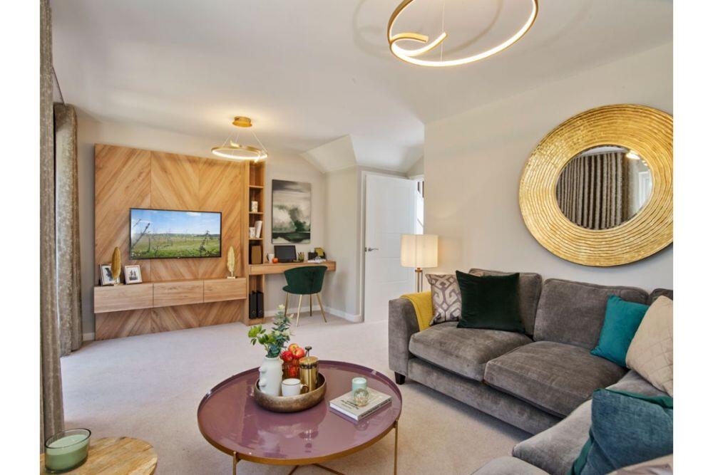
The ground floor of the property boasts a spacious and inviting living area, perfect for entertaining guests or simply relaxing after a long day. The property also features a convenient downstairs cloakroom, ensuring practicality and ease of living. The north-facing rear garden provides a peaceful and tranquil outdoor space, ideal for enjoying the fresh air or hosting summer barbeques.
A notable benefit of this property is its close proximity to Finberry primary school and play area, making it an excellent choice for families with young children. In addition, the property includes one allocated parking space, ensuring easy access for residents and their guests.
The outside space of this property is equally impressive, with white shingle and flower beds enhancing the overall kerb appeal. The front garden offers a welcoming entrance, while the rear garden is predominantly laid to lawn with a paved patio area, perfect for alfresco dining and outdoor activities. With the added practicality of a wooden shed and side access to the front, this property provides a well-rounded and functional outdoor space.
Overall, this 2 bedroom semi-detached house offers an enticing opportunity to own a charming property in the heart of the popular Finberry location. With its attractive price point, convenient location, and ample outdoor space, this property is a must-see for anyone seeking an ideal home or investment opportunity.
Key Facts
Title Plan
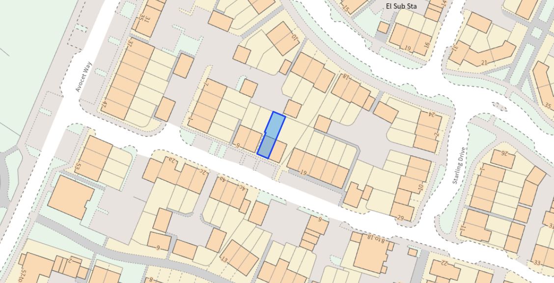 Contains OS data © Crown copyright 2025
Title Information
Details provided by the Land Registry
- Title Number
- TT159365
- Plot Size
- 0.02 acres (100 sq metres)
Street View
House Prices in Ashford
Last 12 months
-
Average Price Change
£14,986
Increased by 4%
-
Semi-Detached Price Change
£15,607
Increased by 5%
Average House Prices
Last 12 months for all property types.
Since Last Sale - 21st June 2024
-
Average Price Change
£64,718
Increased by 23%
-
Semi-Detached Price Change
£66,631
Increased by 24%
Average House Prices
Since 2020 for all property types
EPC
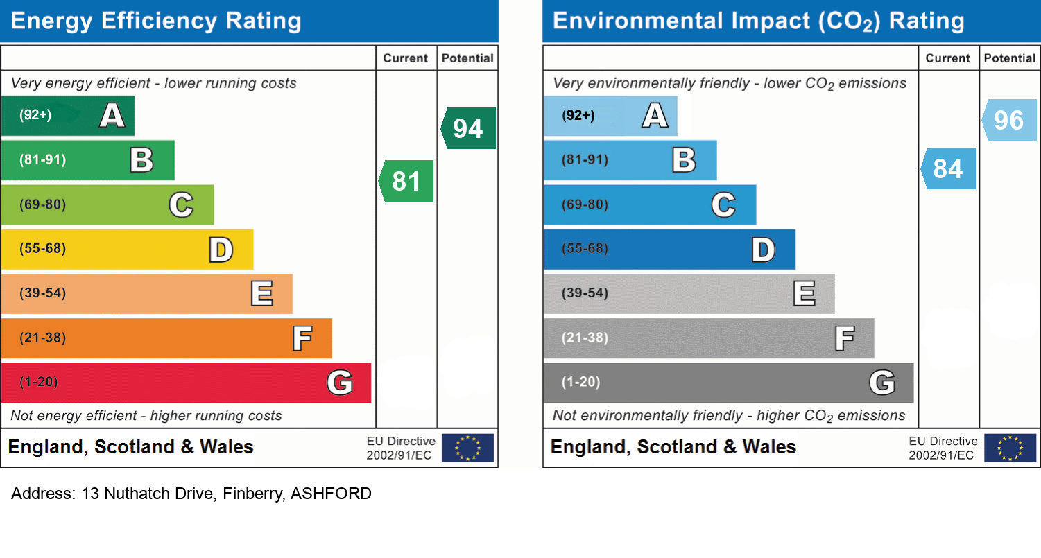
EPC Information
Details taken from the EPC register
- Date
- 2018-02-20
- Valid Until
- 2028-02-19
- Energy Efficiency - Current
- 81
- Energy Efficiency - Potential
- 94
- Environmental Impact - Current
- 84
- Environmental Impact - Potential
- 96
Properties For Sale in the Area
Avocet Way
78 metres away
Avocet Way
78 metres away
Avocet Way
78 metres away

Avocet Way
78 metres away

Avocet Way
78 metres away
Avocet Way
78 metres away
Schools
| Name | Type | Postcode | Distance | Rating |
|---|---|---|---|---|
| Finberry Primary School | Special, Nursery | TN25 7GS | 0.22 km | Good |
| Furley Park Primary Academy | Primary | TN23 3PA | 1.30 km | Not rated |
| East Stour Primary School | Nursery, Primary | TN24 0DW | 1.40 km | Not rated |
| Kingsnorth Church of England Primary School | Primary | TN23 3EF | 2.01 km | Good |
| Willesborough Junior School | Primary | TN24 0JU | 2.24 km | Good |
Transport
Bus Stops & Stations
Details provided by Department for Transport
| Name | Distance |
|---|---|
| Song Thrush Drive | 100 metres |
| Avocet Way Roundabout, Avocet Way | 0.13 km |
| Finberry Entrance, Avocet Way | 0.80 km |
| Farm, Cheeseman's Green Lane | 0.85 km |
| Finn Farm Road | 0.94 km |
Train Stations
Details provided by Department for Transport
| Name | Distance |
|---|---|
| Ashford International Rail Station | 2.91 km |
Nearest Motorway
Details provided by Department for Transport
| Name | Distance |
|---|---|
| M20 | 2.49 km |
Coverage
- Average Broadband Speed:
-
4mb Basic
-
1800mb Ultrafast
-
1800mb Overall
- Mobile Coverage:
-
EEOkay
-
O2Okay
-
ThreeOkay
-
VodafoneOkay
Recently Sold Properties in the Area
| Address | Property Type | Distance | Price | Completed |
|---|---|---|---|---|
|
12 Brambling Avenue Finberry, Ashford, TN25 7FB |
Terraced | 37 metres away | £340,000 | 3 months ago |
|
16 Brambling Avenue Finberry, Ashford, TN25 7FB |
Terraced | 37 metres away | £330,000 | 3 months ago |
|
21 Wagtail Walk Finberry, Ashford, TN25 7GE |
Terraced | 55 metres away | £290,000 | 5 months ago |
|
10 Starling Drive Finberry, Ashford, TN25 7GB |
Terraced | 61 metres away | £333,000 | 2 months ago |
|
18 Wagtail Walk Finberry, Ashford, TN25 7GQ |
Terraced | 75 metres away | £280,000 | 10 months ago |
|
28 Harrier Drive Finberry, Ashford, TN25 7GR |
Detached | 80 metres away | £352,000 | 8 months ago |
|
20 Nuthatch Drive Finberry, Ashford, TN25 7AA |
Flats/Maisonettes | 82 metres away | £241,000 | 2 months ago |
|
29 Harrier Drive Finberry, Ashford, TN25 7GR |
Detached | 87 metres away | £253,000 | 5 months ago |
|
7 Starling Drive Finberry, Ashford, TN25 7GB |
Terraced | 91 metres away | £300,000 | 3 months ago |
|
10 Song Thrush Drive Finberry, Ashford, TN25 7FP |
Detached | 97 metres away | £355,000 | 7 months ago |
Important Notice - This report is intended for general informational purposes only and should act only as a guide. The report is produced automatically on behalf of Andrew & Co Estate Agents Ltd - Ashford by Street Insights, a product of Street Systems Ltd. Street Systems maintains and aggregates data from multiple public data sources and whilst every effort is made to keep information up to date and accurate, we make no representations or warranties of any kind about the accuracy, reliability or completeness of the information contained within this report for any purpose. Any reliance you place on the data contained within this report is strictly at your own risk. In no event will Andrew & Co Estate Agents Ltd - Ashford or Street Systems Ltd be liable for any loss or damage including without limitation, indirect or consequential loss or damage, or any loss or damage whatsoever arising from loss of data or profits arising out of, or in connection with, the use of this report.
This report contains public sector information licensed under the Open Government License v3.0
Transaction data and HPI data is produced by HM Land Registry. Crown copyright and database rights 2025