Property Information Report

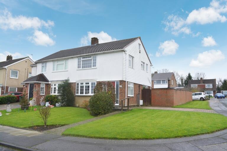
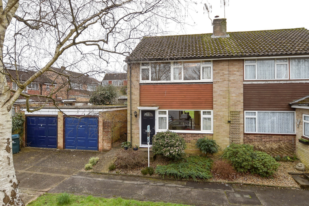
Hazelwood
Crawley, RH11
Last Sold - Sep, 2024

Key Facts
About Us

Let us Inspire you
Are you considering selling or letting in Crawley or the surrounding areas? Would you like to deal with property professionals, who have lived and worked in the area for many years?
If you are, we guarantee you will be impressed with our service. We are so confident that you will love our honest and pro-active approach that we don't need to tie you into restrictive sole agency agreements!
Find out more at our website
Title Plan
 Contains OS data © Crown copyright 2025
Title Information
Details provided by the Land Registry
- Title Number
- SX61003
- Plot Size
- 0.08 acres (306 sq metres)
Street View
House Prices in Crawley
Last 12 months
-
Average Price Change
£12,452
Increased by 4%
-
Semi-Detached Price Change
£17,028
Increased by 4%
Average House Prices
Last 12 months for all property types.
Since Last Sale - 19th September 2024
-
Average Price Change
£45,416
Increased by 16%
-
Semi-Detached Price Change
£59,753
Increased by 17%
Average House Prices
Since 2020 for all property types
EPC

EPC Information
Details taken from the EPC register
- Date
- 2024-05-02
- Valid Until
- 2034-05-01
- Energy Efficiency - Current
- 69
- Energy Efficiency - Potential
- 85
- Environmental Impact - Current
- 67
- Environmental Impact - Potential
- 83
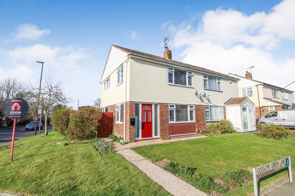
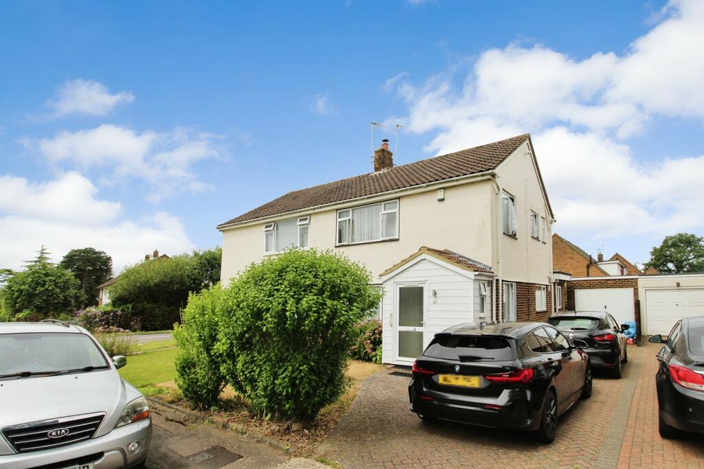
Properties For Sale in the Area
Cob Walk
55 metres away

Hazelwood
77 metres away
Gossops Green Lane
0.10 km away
Gossops Green
0.12 km away
Gossops Green Lane
0.12 km away
Filbert Crescent
0.15 km away
Recently Sold Properties in the Area
| Address | Property Type | Distance | Price | Completed |
|---|---|---|---|---|
|
2 Hazelwood Crawley, RH11 8DY |
Terraced | away | £357,000 | 7 months ago |
|
18 Hazelwood Crawley, RH11 8DX |
Semi-Detached | 0.13 km away | £415,000 | 7 months ago |
|
54 Filbert Crescent Crawley, RH11 8EA |
Semi-Detached | 0.15 km away | £370,000 | 10 months ago |
|
32 Oatlands Crawley, RH11 8EQ |
Terraced | 0.23 km away | £390,000 | 7 months ago |
|
51 Oatlands Crawley, RH11 8EE |
Terraced | 0.27 km away | £375,000 | 9 months ago |
|
30 Dower Walk Crawley, RH11 8EN |
Terraced | 0.32 km away | £335,000 | 11 months ago |
|
17 The Croft Crawley, RH11 8RQ |
Terraced | 0.34 km away | £432,500 | 9 months ago |
|
1 Dunsfold Close Crawley, RH11 8EY |
Flats/Maisonettes | 0.40 km away | £150,000 | 11 months ago |
|
83 Highams Hill Crawley, RH11 8BW |
Semi-Detached | 0.40 km away | £415,000 | 6 months ago |
|
81 Highams Hill Crawley, RH11 8BW |
Semi-Detached | 0.41 km away | £385,000 | 9 months ago |
Schools
| Name | Type | Postcode | Distance | Rating |
|---|---|---|---|---|
| Ifield Community College | Secondary, Post 16 | RH11 0DB | 0.45 km | Good |
| The Mill Primary Academy | Primary | RH11 0EL | 0.54 km | Good |
| St Wilfrid's Catholic Comprehensive School, Crawley | Secondary, Post 16 | RH11 8PG | 0.55 km | Good |
| Gossops Green Primary | Primary | RH11 8HW | 0.61 km | Good |
| Manor Green College | Special | RH11 0DX | 0.69 km | Good |
Transport
Bus Stops & Stations
Details provided by Department for Transport
| Name | Distance |
|---|---|
| Overdene Drive | 84 metres |
| Nurserylands, Overdene Drive | 0.14 km |
| Hazelwood, Overdene Drive | 0.17 km |
| Craigans, Gossops Drive | 0.35 km |
| Dower Walk | 0.53 km |
Train Stations
Details provided by Department for Transport
| Name | Distance |
|---|---|
| Ifield Rail Station | 0.44 km |
| Crawley Rail Station | 1.61 km |
| Three Bridges Rail Station | 3.40 km |
| Faygate Rail Station | 4.18 km |
Nearest Motorway
Details provided by Department for Transport
| Name | Distance |
|---|---|
| M23 | 3.15 km |
Coverage
- Average Broadband Speed:
-
2mb Basic
-
31mb Superfast
-
1000mb Ultrafast
-
1000mb Overall
- Mobile Coverage:
-
EEOkay
-
O2Good
-
ThreeOkay
-
VodafoneGood
Important Notice - This report is intended for general informational purposes only and should act only as a guide. The report is produced automatically on behalf of Inspire Estate Agents - Crawley by Street Insights, a product of Street Systems Ltd. Street Systems maintains and aggregates data from multiple public data sources and whilst every effort is made to keep information up to date and accurate, we make no representations or warranties of any kind about the accuracy, reliability or completeness of the information contained within this report for any purpose. Any reliance you place on the data contained within this report is strictly at your own risk. In no event will Inspire Estate Agents - Crawley or Street Systems Ltd be liable for any loss or damage including without limitation, indirect or consequential loss or damage, or any loss or damage whatsoever arising from loss of data or profits arising out of, or in connection with, the use of this report.
This report contains public sector information licensed under the Open Government License v3.0
Transaction data and HPI data is produced by HM Land Registry. Crown copyright and database rights 2025