Property Information Report
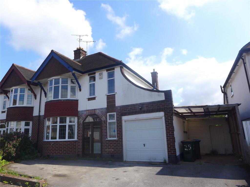
Humphrey Burton Road
Coventry, CV3
Last Sold - Jan, 2025

Description
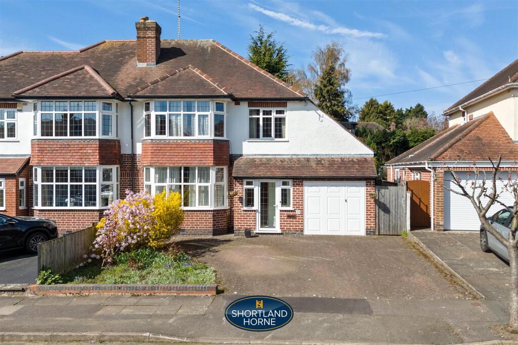
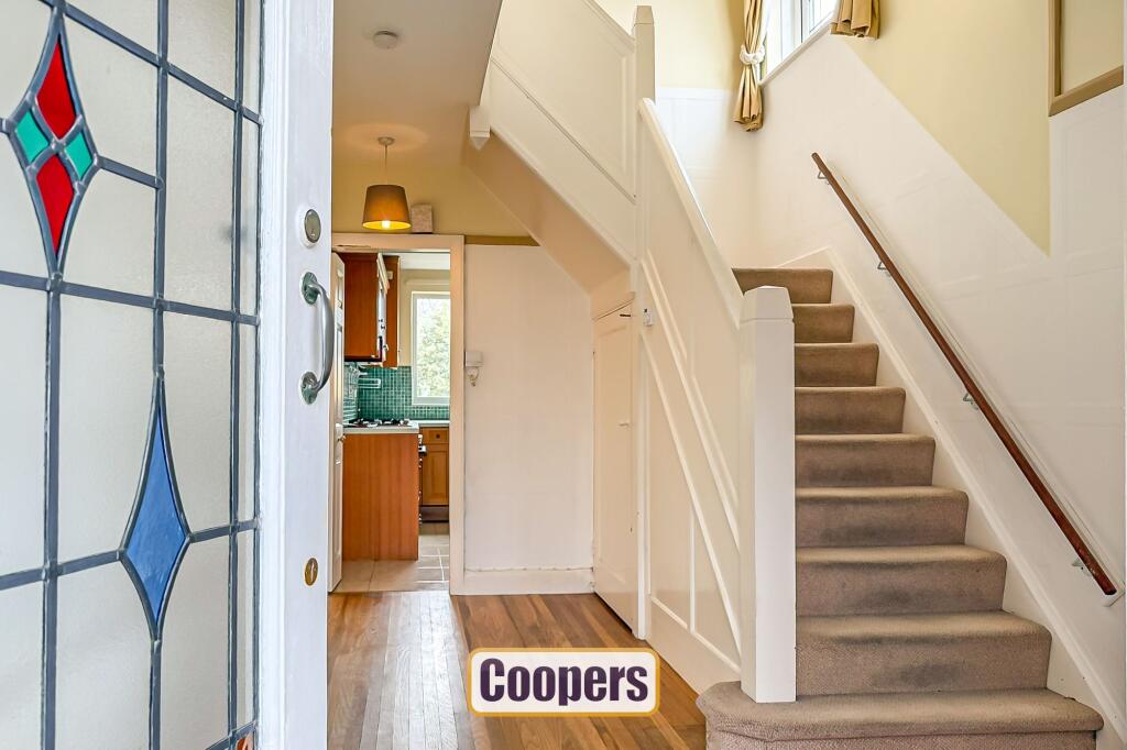
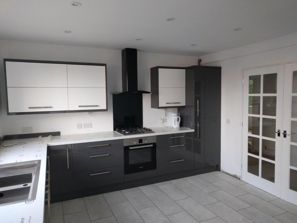
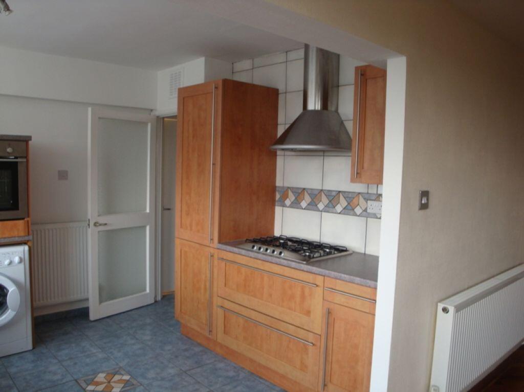
This superbly improved and extended semi detached family home is in truly immaculate condition and of professional Show home standard. Modern rear extension off the rear living room and kitchen creates an extremely impressive family dining kitchen. The whole specification of the property is very high and internal inspection is essential. The superb location is allows a very easy walk to the War Memorial Park, Coventry Railway Station and City Centre and this home is set in lovely private good sized gardens.
Key Facts
Title Plan
 Contains OS data © Crown copyright 2025
Title Information
Details provided by the Land Registry
- Title Number
- WM623390
- Plot Size
- 0.09 acres (363 sq metres)
Street View
House Prices in Coventry
Last 12 months
-
Average Price Change
£13,178
Increased by 6%
-
Semi-Detached Price Change
£17,130
Increased by 7%
Average House Prices
Last 12 months for all property types.
Since Last Sale - 29th January 2025
-
Average Price Change
£45,827
Increased by 25%
-
Semi-Detached Price Change
£54,917
Increased by 26%
Average House Prices
Since 2020 for all property types
EPC

EPC Information
Details taken from the EPC register
- Date
- 2021-07-01
- Valid Until
- 2031-06-30
- Energy Efficiency - Current
- 59
- Energy Efficiency - Potential
- 81
- Environmental Impact - Current
- 50
- Environmental Impact - Potential
- 77
Properties For Sale in the Area
Orchard Crescent
0.13 km away
The Hiron
0.14 km away
Asthill Grove
0.15 km away
The Hiron
0.16 km away
Kenilworth Court
0.23 km away
Kenilworth Court
0.23 km away
Properties To Let in the Area
Humphrey Burton Road
39 metres away
Orchard Crescent
71 metres away
Orchard Crescent
71 metres away
Kenilworth Court
0.19 km away
Kenilworth Court
0.23 km away
Kenilworth Court
0.23 km away
Schools
| Name | Type | Postcode | Distance | Rating |
|---|---|---|---|---|
| King Henry VIII School | Independent, Nursery, Primary, Post 16 | CV3 6AQ | 0.49 km | Not rated |
| Manor Park Primary School | Nursery, Primary | CV3 5EZ | 0.64 km | Good |
| Frederick Bird Primary School | Nursery, Primary | CV2 4QQ | 0.93 km | Not rated |
| Coventry Youth Offending Service | Primary | CV1 2GY | 1.06 km | Not rated |
| All Saints Church of England Primary School | Nursery, Primary | CV1 2AF | 1.16 km | Good |
Transport
Train Stations
Details provided by Department for Transport
| Name | Distance |
|---|---|
| Coventry Rail Station | 0.46 km |
| Canley Rail Station | 2.40 km |
Nearest Motorway
Details provided by Department for Transport
| Name | Distance |
|---|---|
| M6 | 7.40 km |
Airports
Details provided by Department for Transport
| Name | Distance |
|---|---|
| Coventry Airport | 4.10 km |
| Birmingham International Airport | 16.11 km |
| East Midlands Airport | 49.35 km |
| London Oxford Airport | 64.30 km |
| Gloucestershire Airport | 71.60 km |
Coverage
- Average Broadband Speed:
-
15mb Basic
-
78mb Superfast
-
1800mb Ultrafast
-
1800mb Overall
- Mobile Coverage:
-
EEOkay
-
O2Good
-
ThreeGood
-
VodafoneOkay
Recently Sold Properties in the Area
| Address | Property Type | Distance | Price | Completed |
|---|---|---|---|---|
|
33 Humphrey Burton Road Coventry, CV3 6HW |
Terraced | away | £415,000 | 3 months ago |
|
38 Orchard Crescent Coventry, CV3 6HJ |
Detached | 99 metres away | £550,000 | 7 months ago |
|
88 Kenilworth Court Coventry, CV3 6JB |
Flats/Maisonettes | 0.18 km away | £165,000 | 10 months ago |
|
44 Asthill Grove Coventry, CV3 6HP |
Semi-Detached | 0.21 km away | £615,000 | 8 months ago |
|
34 Benedictine Road Coventry, CV3 6GY |
Semi-Detached | 0.24 km away | £318,000 | 2 months ago |
|
130 Kenilworth Court Coventry, CV3 6JD |
Flats/Maisonettes | 0.24 km away | £192,000 | 8 months ago |
|
43 Benedictine Road Coventry, CV3 6GZ |
Terraced | 0.26 km away | £235,000 | 10 months ago |
|
10 Asthill Grove Coventry, CV3 6HP |
Semi-Detached | 0.26 km away | £615,000 | 3 months ago |
|
9 Carthusian Road Coventry, CV3 6HA |
Terraced | 0.31 km away | £267,000 | 3 months ago |
|
19 Leamington Road Coventry, CV3 6GF |
Detached | 0.36 km away | £708,300 | 10 months ago |
Important Notice - This report is intended for general informational purposes only and should act only as a guide. The report is produced automatically on behalf of Coopers Estate Agents - Coventry by Street Insights, a product of Street Systems Ltd. Street Systems maintains and aggregates data from multiple public data sources and whilst every effort is made to keep information up to date and accurate, we make no representations or warranties of any kind about the accuracy, reliability or completeness of the information contained within this report for any purpose. Any reliance you place on the data contained within this report is strictly at your own risk. In no event will Coopers Estate Agents - Coventry or Street Systems Ltd be liable for any loss or damage including without limitation, indirect or consequential loss or damage, or any loss or damage whatsoever arising from loss of data or profits arising out of, or in connection with, the use of this report.
This report contains public sector information licensed under the Open Government License v3.0
Transaction data and HPI data is produced by HM Land Registry. Crown copyright and database rights 2025