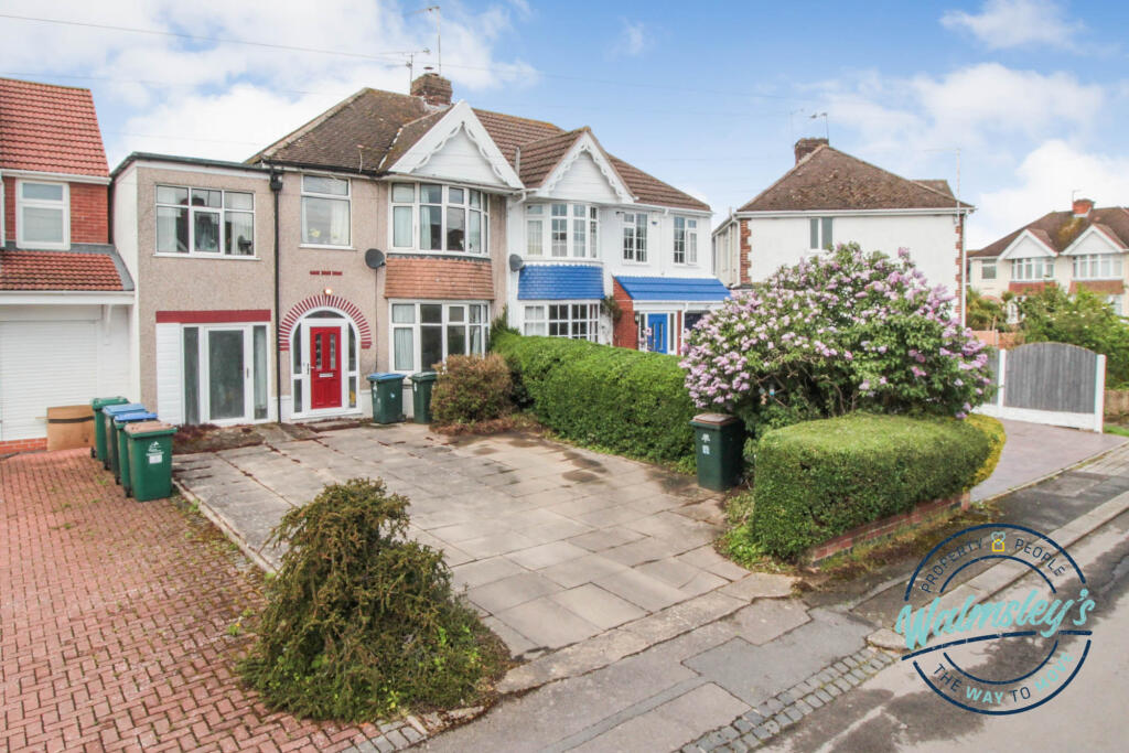
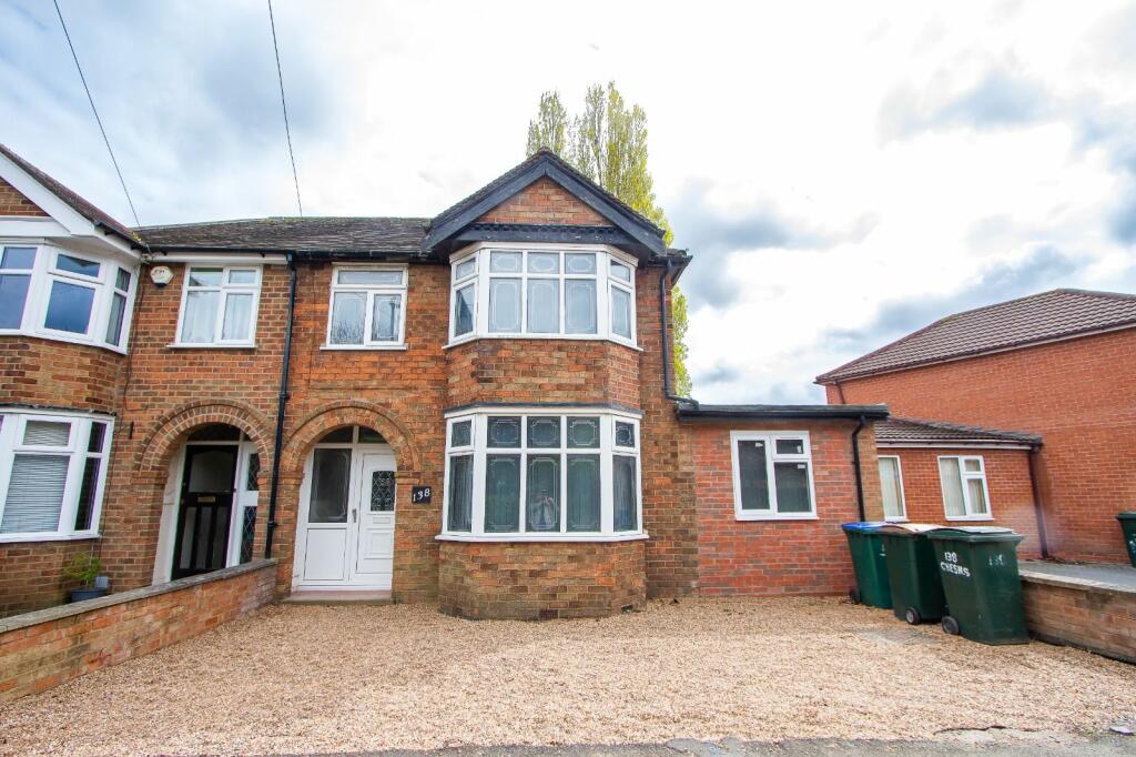
Property Information Report
Ulverscroft Road
Coventry, CV3

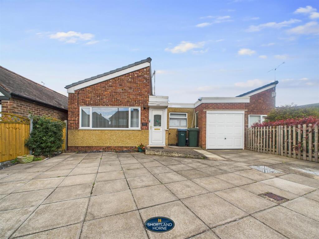
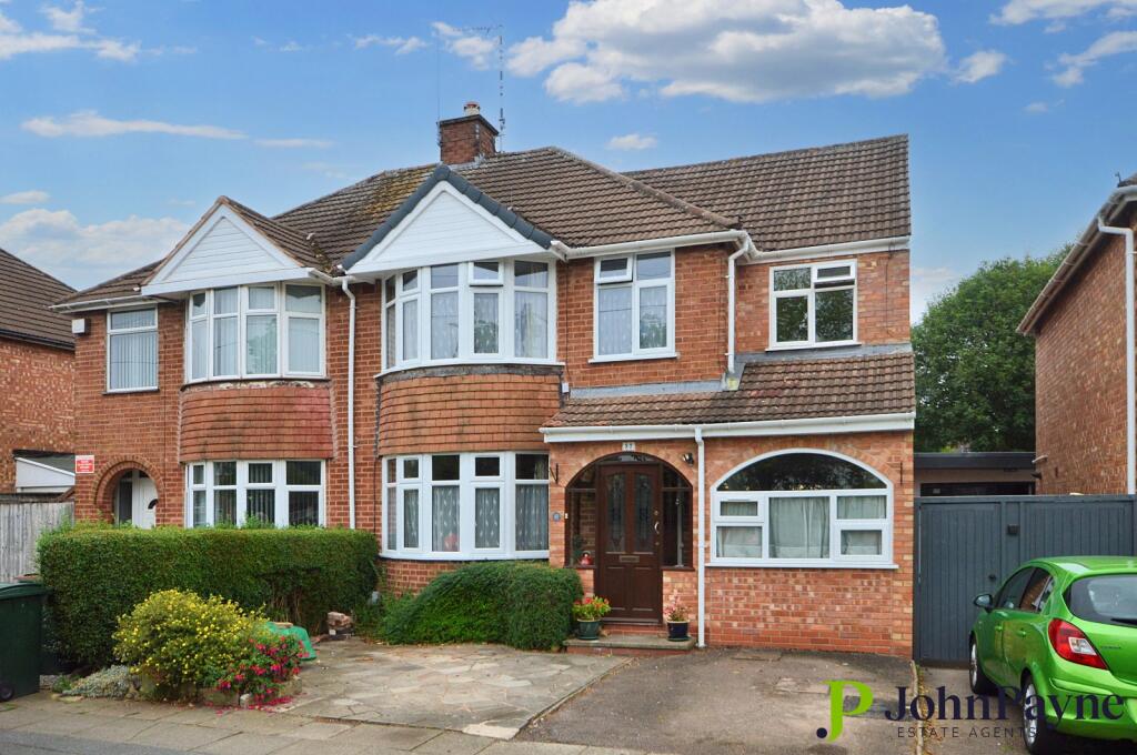
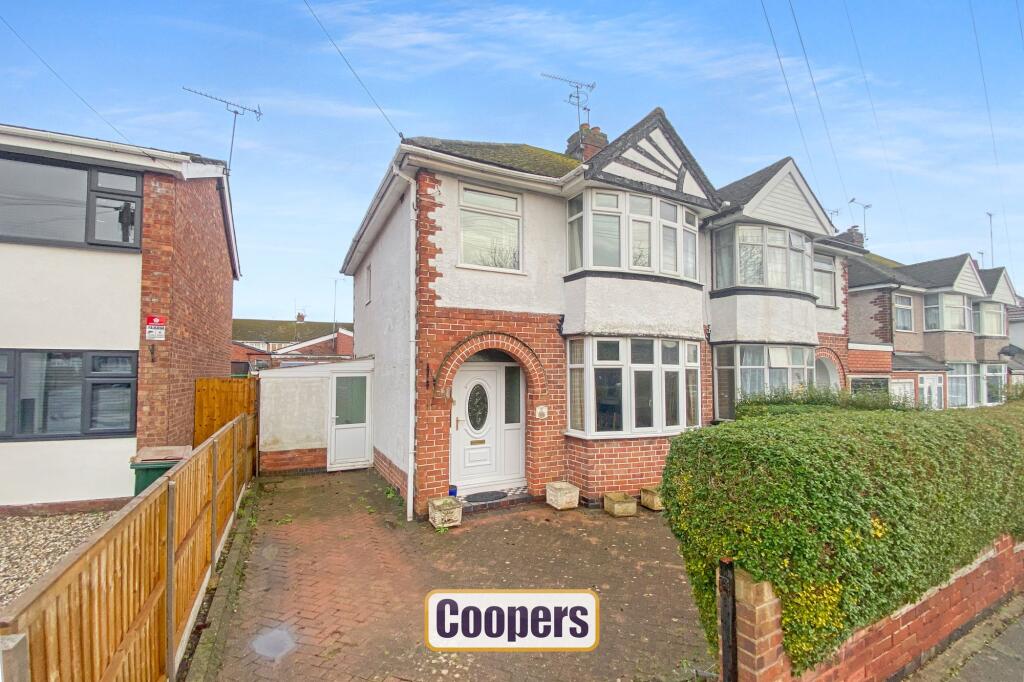
Description
Traditional double bayed semi detached home in prime residential area, convenient for Daventry Road, Memorial Park, excellent schools and bus routes.
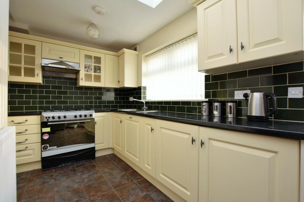
Priced very realistically to reflect the need for some general updating. Through lounge with archway, smaller kitchen, three bedrooms and bathroom. There is a direct driveway and the house enjoys gas central heating and double glazing.
Key Facts
Title Plan
 Contains OS data © Crown copyright 2025
Title Information
Details provided by the Land Registry
- Title Number
- WK155687
- Plot Size
- 0.04 acres (176 sq metres)
Street View
House Prices in Coventry
Last 12 months
-
Average Price Change
£13,178
Increased by 6%
-
Terraced Price Change
£11,916
Increased by 6%
Average House Prices
Last 12 months for all property types.
Since - February 2020
-
Average Price Change
£45,827
Increased by 25%
-
Terraced Price Change
£43,605
Increased by 26%
Average House Prices
Since 2020 for all property types
EPC

EPC Information
Details taken from the EPC register
- Date
- 2025-02-01
- Valid Until
- 2035-01-31
- Energy Efficiency - Current
- 67
- Energy Efficiency - Potential
- 81
- Environmental Impact - Current
- 63
- Environmental Impact - Potential
- 78
Properties For Sale in the Area
The Chesils
65 metres away
Mary Herbert Street
0.15 km away
Ulverscroft Road
0.15 km away
Ulverscroft Road
0.15 km away
The Countess Croft
0.19 km away
Mary Herbert Street
0.22 km away
Properties To Let in the Area
Mary Herbert Street
56 metres away
Mary Herbert Street
64 metres away
The Chesils
0.15 km away
Ulverscroft Road
0.15 km away
Poitiers Road
0.19 km away
Mary Herbert Street
0.23 km away
Schools
| Name | Type | Postcode | Distance | Rating |
|---|---|---|---|---|
| Manor Park Primary School | Nursery, Primary | CV3 5EZ | 0.20 km | Good |
| St Thomas More Catholic Primary School | Nursery, Primary | CV3 5DE | 0.52 km | Good |
| Howes Community Primary School | Nursery, Primary | CV3 5EH | 0.62 km | Not rated |
| Grange Farm Primary School | Primary | CV3 6NF | 1.05 km | Good |
| Stivichall Primary School | Primary | CV3 6PY | 1.24 km | Good |
Transport
Train Stations
Details provided by Department for Transport
| Name | Distance |
|---|---|
| Coventry Rail Station | 1.26 km |
| Canley Rail Station | 2.95 km |
Nearest Motorway
Details provided by Department for Transport
| Name | Distance |
|---|---|
| M6 | 7.57 km |
Airports
Details provided by Department for Transport
| Name | Distance |
|---|---|
| Coventry Airport | 3.30 km |
| Birmingham International Airport | 16.76 km |
| East Midlands Airport | 49.95 km |
| London Oxford Airport | 63.52 km |
| Gloucestershire Airport | 71.30 km |
Coverage
- Average Broadband Speed:
-
15mb Basic
-
41mb Superfast
-
1800mb Ultrafast
-
1800mb Overall
- Mobile Coverage:
-
EEOkay
-
O2Good
-
ThreeGood
-
VodafoneOkay
Recently Sold Properties in the Area
| Address | Property Type | Distance | Price | Completed |
|---|---|---|---|---|
|
81 Mary Herbert Street Coventry, CV3 5EW |
Terraced | 58 metres away | £160,000 | 10 months ago |
|
8 Lymesy Street Coventry, CV3 5DX |
Terraced | 85 metres away | £210,000 | 8 months ago |
|
102 Quinton Park Coventry, CV3 5HY |
Flats/Maisonettes | 0.10 km away | £115,000 | 6 months ago |
|
142 The Chesils Coventry, CV3 5BJ |
Detached | 0.13 km away | £560,000 | 8 months ago |
|
12a, Meschines Street Coventry, CV3 5DW |
Terraced | 0.13 km away | £121,000 | 5 months ago |
|
103 Dillotford Avenue Coventry, CV3 5DT |
Semi-Detached | 0.19 km away | £360,000 | 11 months ago |
|
18 Castle Close Coventry, CV3 5JA |
Detached | 0.24 km away | £336,000 | 8 months ago |
|
8 Salisbury Avenue Coventry, CV3 5DB |
Semi-Detached | 0.25 km away | £395,000 | 3 months ago |
|
65 Dillotford Avenue Coventry, CV3 5DS |
Semi-Detached | 0.27 km away | £450,000 | 9 months ago |
|
52 Poitiers Road Coventry, CV3 5JX |
Terraced | 0.27 km away | £185,000 | 2 months ago |
Important Notice - This report is intended for general informational purposes only and should act only as a guide. The report is produced automatically on behalf of Coopers Estate Agents - Coventry by Street Insights, a product of Street Systems Ltd. Street Systems maintains and aggregates data from multiple public data sources and whilst every effort is made to keep information up to date and accurate, we make no representations or warranties of any kind about the accuracy, reliability or completeness of the information contained within this report for any purpose. Any reliance you place on the data contained within this report is strictly at your own risk. In no event will Coopers Estate Agents - Coventry or Street Systems Ltd be liable for any loss or damage including without limitation, indirect or consequential loss or damage, or any loss or damage whatsoever arising from loss of data or profits arising out of, or in connection with, the use of this report.
This report contains public sector information licensed under the Open Government License v3.0
Transaction data and HPI data is produced by HM Land Registry. Crown copyright and database rights 2025