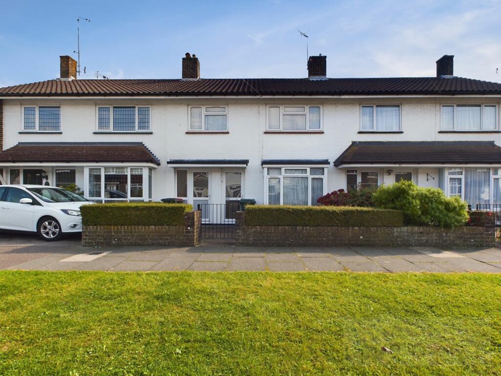
Property Information Report

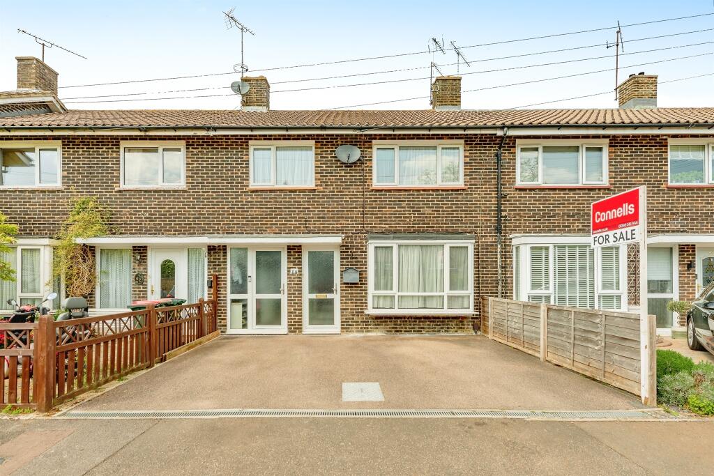
45 Boswell Road
Crawley, RH10 5BA

Key Facts
No lease data available
About Us

Let us Inspire you
Are you considering selling or letting in Crawley or the surrounding areas? Would you like to deal with property professionals, who have lived and worked in the area for many years?
If you are, we guarantee you will be impressed with our service. We are so confident that you will love our honest and pro-active approach that we don't need to tie you into restrictive sole agency agreements!
Find out more at our website
Title Plan
 Contains OS data © Crown copyright 2025
Title Information
Details provided by the Land Registry
- Title Number
- WSX404701
- Plot Size
- 0.05 acres (197 sq metres)
Street View

House Prices in Crawley
Last 12 months
-
Average Price Change
£28,026
Increased by 9%
-
Terraced Price Change
£30,588
Increased by 10%
Average House Prices
Last 12 months for all property types.
Since - March 2020
-
Average Price Change
£60,292
Increased by 22%
-
Terraced Price Change
£68,998
Increased by 25%
Average House Prices
Since 2020 for all property types
EPC

EPC Information
Details taken from the EPC register
- Date
- 2018-12-17
- Valid Until
- 2028-12-16
- Energy Efficiency - Current
- 69
- Energy Efficiency - Potential
- 85
- Environmental Impact - Current
- 65
- Environmental Impact - Potential
- 83
Properties For Sale in the Area
Boswell Road
6 metres away
Boswell Road
32 metres away
Boswell Road
33 metres away
Boswell Road
35 metres away
Boswell Road
92 metres away
Tilgate Way
0.13 km away
Boswell Road
6 metres away
Boswell Road
32 metres away
Boswell Road
33 metres away
Boswell Road
35 metres away
Boswell Road
92 metres away
Tilgate Way
0.13 km away
Recently Sold Properties in the Area
| Address | Property Type | Distance | Price | Completed |
|---|---|---|---|---|
|
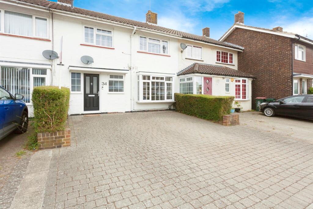
34 Boswell Road Crawley, RH10 5AZ |
Terraced | 33 metres away | £380,000 | 7 months ago |
|
10 Nash Road Crawley, RH10 5BG |
Terraced | 0.13 km away | £330,000 | 3 months ago |
|
13 Johnson Walk Crawley, RH10 5AY |
Terraced | 0.13 km away | £362,500 | 3 months ago |
|
6 Johnson Walk Crawley, RH10 5AX |
Terraced | 0.14 km away | £200,000 | 1 year ago |
|
18 Evelyn Walk Crawley, RH10 5AT |
Terraced | 0.14 km away | £390,000 | 10 months ago |
|
37 Dickens Road Crawley, RH10 5AS |
Terraced | 0.16 km away | £338,000 | 7 months ago |
|
23 Whittington Road Crawley, RH10 5AN |
Terraced | 0.18 km away | £457,051 | 9 months ago |
|
8 Drake Road Crawley, RH10 5NF |
Terraced | 0.18 km away | £345,000 | 2 months ago |
|
30 Johnson Walk Crawley, RH10 5AU |
Terraced | 0.19 km away | £308,000 | 7 months ago |
|
4 Tilgate Way Crawley, RH10 5BW |
Terraced | 0.19 km away | £385,000 | 10 months ago |
| Address | Property Type | Distance | Price | Completed |
|---|---|---|---|---|
|
34 Boswell Road Crawley, RH10 5AZ |
Terraced | 33 metres away | £380,000 | 7 months ago |
|
10 Nash Road Crawley, RH10 5BG |
Terraced | 0.13 km away | £330,000 | 3 months ago |
|
13 Johnson Walk Crawley, RH10 5AY |
Terraced | 0.13 km away | £362,500 | 3 months ago |
|
6 Johnson Walk Crawley, RH10 5AX |
Terraced | 0.14 km away | £200,000 | 1 year ago |
|
18 Evelyn Walk Crawley, RH10 5AT |
Terraced | 0.14 km away | £390,000 | 10 months ago |
|
37 Dickens Road Crawley, RH10 5AS |
Terraced | 0.16 km away | £338,000 | 7 months ago |
|
23 Whittington Road Crawley, RH10 5AN |
Terraced | 0.18 km away | £457,051 | 9 months ago |
|
8 Drake Road Crawley, RH10 5NF |
Terraced | 0.18 km away | £345,000 | 2 months ago |
|
30 Johnson Walk Crawley, RH10 5AU |
Terraced | 0.19 km away | £308,000 | 7 months ago |
|
4 Tilgate Way Crawley, RH10 5BW |
Terraced | 0.19 km away | £385,000 | 10 months ago |
Schools
| Name | Type | Postcode | Distance | Rating |
|---|---|---|---|---|
| Desmond Anderson Primary Academy | Special, Nursery | RH10 5EA | 0.43 km | Good |
| Thomas Bennett Community College | Secondary, Post 16 | RH10 5AD | 0.52 km | Good |
| Southgate Primary | Primary | RH10 6DG | 0.54 km | Good |
| The Oaks Primary School & Nursery | Primary | RH10 5DP | 0.61 km | Good |
| St Francis of Assisi Catholic Primary School, Crawley | Primary | RH10 6HD | 0.65 km | Good |
Transport
Bus Stops & Stations
Details provided by Department for Transport
| Name | Distance |
|---|---|
| Southgate Avenue Central, Southgate Avenue | 0.22 km |
| Nash Road | 0.25 km |
| Canterbury Road | 0.29 km |
| Thomas Bennett School, Ashdown Drive | 0.34 km |
| Southgate Avenue South, Southgate Avenue | 0.45 km |
Train Stations
Details provided by Department for Transport
| Name | Distance |
|---|---|
| Crawley Rail Station | 1.12 km |
| Three Bridges Rail Station | 2.39 km |
| Ifield Rail Station | 2.56 km |
Nearest Motorway
Details provided by Department for Transport
| Name | Distance |
|---|---|
| M23 | 1.89 km |
Coverage
- Average Broadband Speed:
-
8mb Basic
-
80mb Superfast
-
1000mb Ultrafast
-
1000mb Overall
- Mobile Coverage:
-
EEOkay
-
O2Good
-
ThreePoor
-
VodafoneOkay
Important Notice - This report is intended for general informational purposes only and should act only as a guide. The report is produced automatically on behalf of Inspire Estate Agents - Crawley by Street Insights, a product of Street Systems Ltd. Street Systems maintains and aggregates data from multiple public data sources and whilst every effort is made to keep information up to date and accurate, we make no representations or warranties of any kind about the accuracy, reliability or completeness of the information contained within this report for any purpose. Any reliance you place on the data contained within this report is strictly at your own risk. In no event will Inspire Estate Agents - Crawley or Street Systems Ltd be liable for any loss or damage including without limitation, indirect or consequential loss or damage, or any loss or damage whatsoever arising from loss of data or profits arising out of, or in connection with, the use of this report.
This report contains public sector information licensed under the Open Government License v3.0
Transaction data and HPI data is produced by HM Land Registry. Crown copyright and database rights 2025